Annandale, Dumfries and Galloway facts for kids
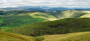
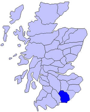
Annandale (in Gaelic: Srath Anann) is a long valley in Dumfries and Galloway, Scotland. It gets its name from the River Annan that flows through it. This valley stretches from Annanhead, north of Moffat, all the way south to the town of Annan on the Solway Firth.
In its northern parts, Annandale separates the Moffat Hills to the east from the Lowther Hills to the west. There's a long walking path called the Annandale Way. It's about 53 miles (85 km) long and follows the River Annan from its start to the sea. This path opened in September 2009.
History of Annandale
Annandale was once an important historical area in Scotland. It shared borders with other districts like Liddesdale to the east and Nithsdale to the west. To the north were Clydesdale and Tweeddale, and to the south was the Solway Firth.
This area was part of the Sheriffdom of Dumfries. Later, it became part of the County of Dumfries. Annandale is one of three main parts of Dumfriesshire. The other two are Eskdale and Nithsdale.
Annandale and Robert the Bruce
Annandale is famous for its connection to Robert the Bruce. His family, the de Brus family, was given this land in 1124. This happened when David I became the Prince of the Cumbrians.
Annandale was one of the border areas given to the de Brus family. Along with Carrick, these lands helped protect David's areas. They acted as a barrier between the independent Lordship of Galloway and David's lands of Strathclyde and Cumbria.

See also
 In Spanish: Annandale (Escocia) para niños
- Annandale distillery
- Annadale, Shimla


