Apiary, Oregon facts for kids
Quick facts for kids
Apiary, Oregon
|
|
|---|---|

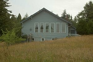
Apiary School Building in 2007
|
|
| Country | United States |
| State | Oregon |
| County | Columbia |
| Time zone | UTC-8 (Pacific (PST)) |
| • Summer (DST) | UTC-7 (PDT) |
| ZIP codes |
97048
|
| Area codes | 458 and 541 |
Apiary is a small, unincorporated community in Columbia County, Oregon, United States. An "unincorporated community" means it's a place where people live, but it doesn't have its own local government like a city or town. Apiary got its name from a post office that opened there in 1889. The person who started the post office, David M. Dorsey, was a beekeeper. An "apiary" is a place where bees are kept, so that's how the community got its unique name! The post office operated from August 28, 1889, until March 24, 1924.
Contents
What Was the Apiary School Like?
Apiary used to have its own school, called Apiary School District #38. This school had two rooms and taught students from first to eighth grade. After finishing eighth grade, students would go to Rainier Union High School.
How Did Schools Change in the Area?
The Rainier Union High School District also served several other smaller schools nearby. These included schools in Delena, Hudson, Fern Hill, Rainier, Goble, Shiloh Basin, and Neer City. In the 1960s, all these school districts joined together to form one big district. Because of this change, many of the smaller rural schools, including Apiary School, closed down over the next 10 to 15 years.
Where Was the School Located?
The Apiary community and its school were located along a road now known as Apiary Road. This road is near the beginning of the North Fork of the Clatskanie River. The old school building still stands today, but it has been changed into a private home. The community also has a pioneer cemetery. However, Apiary has never had a central community building like a church, a Grange hall, or even a fire station.
Apiary Road: A Busy Route
Today, Apiary Road is an important route for trucks carrying forest products. These products come from the Northern Oregon Coast Range, especially areas near the Nehalem River. They are transported to markets in Longview, Washington.
How Does Apiary Road Connect?
Apiary Road connects the Nehalem Highway (also known as Oregon Route 47) north of Pittsburg with U.S. Route 30 west of Rainier. However, when you reach U.S. Route 30, the intersection is signed as Larson Road. This is because Apiary Road technically ends at Old Rainier Road, which was an earlier version of U.S. Route 30, just south of the current highway.
Images for kids
 | Tommie Smith |
 | Simone Manuel |
 | Shani Davis |
 | Simone Biles |
 | Alice Coachman |


