Aracaju facts for kids
Quick facts for kids
Aracaju
|
|||
|---|---|---|---|
|
Municipality
|
|||
| Municipality of Aracaju | |||
|
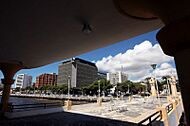
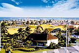
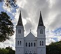
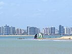
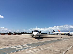
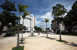
From the top; clockwise: Aracaju seen from Imperador Bridge; Brazilian Navy Lighthouse; Aracaju Metropolitan Cathedral; Aracaju skyline and Sergipe River; Aracaju-Barra dos Coqueiros Bridge at night and Coast of Atalaia.
|
|||
|
|||
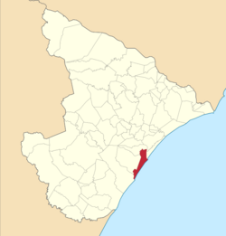
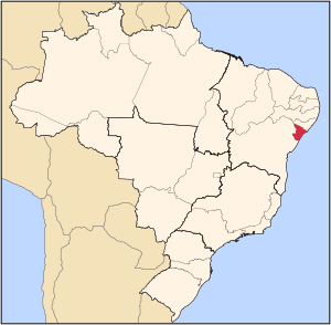
Location of Aracaju in the Sergipe
|
|||
 |
|||
| Country | |||
| Region | Northeast | ||
| State | |||
| Founded | 1592 | ||
| Incorporated (as capital) | March 17, 1855 | ||
| Area | |||
| • Total | 181.857 km2 (70.215 sq mi) | ||
| Elevation | 4 m (13 ft) | ||
| Population
(2022)
|
|||
| • Total | 602,757 | ||
| • Density | 3,314.456/km2 (8,584.401/sq mi) | ||
| Time zone | UTC−3 (BRT) | ||
| Postal code |
49000-001 a 49099-999
|
||
| Area code | +55 79 | ||
| HDI (2010) | 0.770 – high | ||
Aracaju is the capital city of the state of Sergipe in Brazil. It's located on the northeastern coast of the country. The city is about 350 km (217 mi) north of Salvador. In 2020, Aracaju had about 664,908 people. This is about one-third of Sergipe's total population. The larger metropolitan area includes nearby cities like Barra dos Coqueiros, Nossa Senhora do Socorro, and São Cristóvão. The main church in the city is the Metropolitan Cathedral Nossa Senhora da Conceiçao.
Contents
Discovering Aracaju's Past
The area where Aracaju now stands was once home to indigenous people. They spoke a language called Boime. Around 1602, the Portuguese crown gave this land to Pero Gonçalves. It was a long stretch of coastline with small fishing villages.
How Aracaju Became a City
In 1699, a village named Santo Antônio de Aracaju was recorded. It was located where the Sergipe River meets the Atlantic Ocean. An indigenous Brazilian named João Mulato founded this settlement. For a long time, the village did not grow much.
The old capital of Sergipe, São Cristóvão, was hard to reach. It was inland and only had a small river port. Large ships could not get there. So, in the 1850s, government officials looked for a new capital city. They found a good spot on the beach near the Sergipe River. This area is now part of Aracaju.
The state government moved important offices to this new location. They built a post office and a police station. A port was also built on the beach, called Atalaia. On March 17, 1855, Aracaju officially became the capital of Sergipe.
Aracaju's Economy and Fun Activities
Aracaju's economy mainly relies on services and industry. The city's total economic output, known as GDP, was about R$13,918,124 in 2013.
Fun for Visitors: Tourism and Recreation
Aracaju is becoming a popular spot for travelers who want to save money. It is known as one of the safest capital cities in Brazil's Northeast. It also has some of the lowest living costs in the country.
The city has been working to improve places for visitors to stay. This includes building good hostels. Public transportation has also been improved to make it easier for tourists to get around. You can even check bus routes in real time here.
Sports in Aracaju
Aracaju has hosted many athletes for big events. During the 2016 Summer Olympics, teams from seven countries trained here. Football players from Japan, and gymnasts and swimmers from countries like Poland, Austria, Belarus, and Ukraine used Aracaju as their training base.
For the 2016 Summer Paralympics Games, Aracaju also welcomed athletes. This included the Kazakhstani and Belarus paralympic teams. Famous paralympic swimmer Ihar Boki was among them.
Getting Around Aracaju
By Air: Santa Maria Airport
Aracaju has a domestic airport called Santa Maria Airport. It started in 1952 and became fully operational in 1958. The airport is about 12 km (7.5 mi) from downtown Aracaju.
By Road: Major Highways
Aracaju is located on BR-101. This is a very important highway that runs north and south across Brazil. The city is also the eastern end of BR-235. This highway is still being built and will eventually connect Aracaju to Novo Progresso in Pará.
Learning in Aracaju
Aracaju is home to several educational institutions, including:
- Federal University of Sergipe
- Universidade Norte do Paraná (Unopar)
Aracaju's Geography and Climate
Aracaju is located in a unique geographical spot. Its exact opposite point on Earth is near the famous Mariana Trench.
Weather in Aracaju
Aracaju has a hot and humid climate. It experiences a tropical monsoon climate. The average temperature throughout the year is about 26 °C (79 °F). The city gets about 1695.3 mm (66.74 in) of rain each year.
The warmest months are January, February, and March. During these months, temperatures average around 27 °C (81 °F). Highs can reach 30 °C (86 °F), and lows are around 24 °C (75 °F). The coolest months are July and August, with temperatures averaging 24 °C (75 °F). Highs usually do not go above 28 °C (82 °F), and nights drop to about 22 °C (72 °F).
Aracaju gets most of its rain between March and July. May is the rainiest month, with about 334 mm (13.1 in) of rain. The driest months are from September to February. November is the driest, with only about 52 mm (2.0 in) of rain.
| Climate data for Aracaju (1991–2020 normals, extremes 1960–1990) | |||||||||||||
|---|---|---|---|---|---|---|---|---|---|---|---|---|---|
| Month | Jan | Feb | Mar | Apr | May | Jun | Jul | Aug | Sep | Oct | Nov | Dec | Year |
| Mean daily maximum °C (°F) | 30.6 (87.1) |
30.8 (87.4) |
30.9 (87.6) |
30.4 (86.7) |
29.6 (85.3) |
28.6 (83.5) |
27.9 (82.2) |
27.9 (82.2) |
28.4 (83.1) |
29.2 (84.6) |
29.8 (85.6) |
30.2 (86.4) |
29.5 (85.1) |
| Daily mean °C (°F) | 27.3 (81.1) |
27.5 (81.5) |
27.7 (81.9) |
27.3 (81.1) |
26.5 (79.7) |
25.6 (78.1) |
24.9 (76.8) |
24.9 (76.8) |
25.4 (77.7) |
26.2 (79.2) |
26.7 (80.1) |
27.1 (80.8) |
26.4 (79.6) |
| Mean daily minimum °C (°F) | 23.9 (75.0) |
24.1 (75.4) |
24.0 (75.2) |
23.7 (74.7) |
23.0 (73.4) |
22.3 (72.1) |
21.9 (71.4) |
21.8 (71.2) |
22.5 (72.5) |
23.1 (73.6) |
23.5 (74.3) |
23.8 (74.8) |
23.1 (73.6) |
| Record low °C (°F) | 20.5 (68.9) |
19.7 (67.5) |
19.8 (67.6) |
20.0 (68.0) |
19.0 (66.2) |
17.8 (64.0) |
17.6 (63.7) |
14.6 (58.3) |
18.0 (64.4) |
19.0 (66.2) |
18.0 (64.4) |
16.0 (60.8) |
14.6 (58.3) |
| Average precipitation mm (inches) | 43.0 (1.69) |
66.7 (2.63) |
73.3 (2.89) |
153.9 (6.06) |
226.9 (8.93) |
198.4 (7.81) |
149.5 (5.89) |
97.4 (3.83) |
61.9 (2.44) |
56.0 (2.20) |
38.3 (1.51) |
24.0 (0.94) |
1,189.3 (46.82) |
| Average precipitation days (≥ 1 mm) | 5.7 | 6.9 | 8.4 | 12.8 | 16.4 | 17.2 | 17.7 | 15.3 | 9.3 | 6.2 | 5.3 | 3.5 | 124.7 |
| Average relative humidity (%) | 74.0 | 74.2 | 74.3 | 75.3 | 77.7 | 77.9 | 77.7 | 76.8 | 76.2 | 75.9 | 75.7 | 74.7 | 75.9 |
| Average dew point °C (°F) | 22.8 (73.0) |
23.0 (73.4) |
23.2 (73.8) |
23.0 (73.4) |
22.7 (72.9) |
21.8 (71.2) |
21.1 (70.0) |
20.9 (69.6) |
21.3 (70.3) |
21.9 (71.4) |
22.3 (72.1) |
22.5 (72.5) |
22.2 (72.0) |
| Mean monthly sunshine hours | 275.5 | 243.1 | 255.3 | 224.2 | 205.5 | 179.6 | 189.7 | 212.5 | 238.8 | 274.1 | 275.5 | 287.4 | 2,861.2 |
| Mean daily daylight hours | 12.7 | 12.4 | 12.2 | 11.9 | 11.6 | 11.5 | 11.5 | 11.8 | 12.1 | 12.4 | 12.6 | 12.8 | 12.1 |
| Average ultraviolet index | 7 | 7 | 7 | 7 | 7 | 6 | 6 | 6 | 7 | 7 | 7 | 7 | 7 |
| Source 1: INMET(Temperatures), (Precipitation), (Humidity), (Dew Point), (Sun | |||||||||||||
| Source 2: NOAA Weather atlas(Daylight-UV)
Brazilian National Institute of Meteorology (INMET). |
|||||||||||||
See also
 In Spanish: Aracaju para niños
 | George Robert Carruthers |
 | Patricia Bath |
 | Jan Ernst Matzeliger |
 | Alexander Miles |


