Arcola, Virginia facts for kids
Quick facts for kids
Arcola, Virginia
|
|
|---|---|
| Country | |
| State | |
| County | Loudoun |
| Area | |
| • Total | 2.31 sq mi (5.98 km2) |
| • Land | 2.29 sq mi (5.92 km2) |
| • Water | 0.02 sq mi (0.06 km2) |
| Elevation | 285 ft (87 m) |
| Population
(2010)
|
|
| • Total | 233 |
| • Density | 102/sq mi (39.4/km2) |
| Time zone | UTC−5 (Eastern (EST)) |
| • Summer (DST) | UTC−4 (EDT) |
| ZIP code |
20166
|
| FIPS code | 51-02248 |
| GNIS feature ID | 1492481 |
Arcola is a small community in Loudoun County, Virginia, United States. It's a place where the U.S. Census Bureau counts people, and in 2010, about 233 people lived there.
Contents
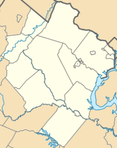
Where is Arcola Located?
Arcola is in the southeastern part of Loudoun County. It's right next to U.S. Route 50, a major road. This road goes east about 31 miles (50 km) to Washington, D.C.. It also goes northwest about 42 miles (68 km) to Winchester.
Nearby Cities and Landmarks
Leesburg, the main town of Loudoun County, is about 14 miles (23 km) north of Arcola. The southwest part of Washington Dulles International Airport is less than 3 miles (5 km) to the east.
Land and Water Around Arcola
Arcola covers about 2.3 square miles (6.0 square kilometers). Most of this area is land. A small part, about 0.02 square miles (0.06 square kilometers), is water. The village of Arcola is near the South Fork of Broad Run. This stream flows north into the Potomac River.
Arcola's Past: A Brief History
Arcola started as a small settlement around a spring called "Gum Springs." This spring flowed into Broad Run. Long ago, during the colonial period, people built a distillery (where drinks are made), a kiln (for baking bricks or pottery), and a small church near the spring.
Early Post Office and Name Changes
In 1801, the United States Post Office opened a branch here, calling it "Springfield." This branch closed in 1819. Later, in 1832, another post office opened nearby on the Little River Turnpike (now U.S. Route 50). This new post office was named "Arcola" after a local farm. The village itself was still known as "Gum Spring" for most of the 1800s.
Railroad and Civil War Times
In the 1850s, a railroad called the Loudoun Branch of the Manassas Gap Railroad was built near Arcola. However, due to money problems in 1857 and the American Civil War, the railroad was never used. During the Gettysburg Campaign in 1863, Union soldiers marched and camped near "Gum Spring" (which is now Arcola) as they moved north.
Arcola's Growth Over Time
Unlike some other villages in Loudoun County, Arcola continued to grow. In 1876, about 30 people lived there. By 1911, the population grew to 90. In 1976, it reached 135 people.
Important People and Places
John Franklin Ryan (1848–1936), who was once a representative in the Virginia House of Delegates (like a state lawmaker), is buried in the Darnes Cemetery in Arcola.
Several important places in Arcola are listed on the National Register of Historic Places. These include the Arcola Elementary School, the Arcola Slave Quarters, and Fleetwood Farm.
See also
 In Spanish: Arcola (Virginia) para niños
 | Georgia Louise Harris Brown |
 | Julian Abele |
 | Norma Merrick Sklarek |
 | William Sidney Pittman |


