Argostoli facts for kids
Quick facts for kids
Argostoli
Αργοστόλι
|
||
|---|---|---|
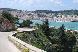
View of Argostoli
|
||
|
||
| Country | Greece | |
| Administrative region | Ionian Islands | |
| Regional unit | Kefalonia | |
| Area | ||
| • Municipality | 377.0 km2 (145.6 sq mi) | |
| • Municipal unit | 151.670 km2 (58.560 sq mi) | |
| Elevation | 23 m (75 ft) | |
| Population
(2021)
|
||
| • Municipality | 23,574 | |
| • Municipality density | 62.531/km2 (161.953/sq mi) | |
| • Municipal unit | 13,666 | |
| • Municipal unit density | 90.104/km2 (233.367/sq mi) | |
| Community | ||
| • Population | 10,982 (2021) | |
| Time zone | UTC+2 (EET) | |
| • Summer (DST) | UTC+3 (EEST) | |
| Postal code |
281 00
|
|
| Area code(s) | 26710 | |
| Vehicle registration | ΚΕ | |
| Website | www.argostoli.gr | |
Argostoli (Greek: Αργοστόλι, romanized: Argostóli) is a town and a municipality on the island of Kefalonia, which is part of the Ionian Islands in Greece. Since 2019, it has been one of the three main areas (municipalities) on the island. Argostoli became the capital and main center of Kefalonia in 1757. People moved here from the old capital, Agios Georgios (also known as Kastro), because Argostoli's sheltered bay was perfect for trading.
Over time, Argostoli grew into one of the busiest ports in Greece. This helped the town become very successful and grow a lot. The whole municipality covers an area of 377.0 square kilometers. In 2021, the population of the Argostoli municipal unit was 13,666 people. The larger municipality, including its newer parts, had a population of 23,574.
Contents
Exploring Argostoli's Landmarks
East of Argostoli, at the end of the bay, you'll find the Koutavos Lagoon. This lagoon is a special nature reserve. It is an important feeding ground for Loggerhead turtles. Long ago, this lagoon was a difficult swamp, full of mosquitoes and malaria.
During the time when the British ruled the Ionian Islands, a wooden bridge was built across the lagoon in 1813. This was done by Colonel Charles Philip de Bosset, a Swiss engineer working for the British army. Later, stone arches were added, and the whole bridge was rebuilt in stone. This bridge, known as the De-Bosset Bridge, was used until 2005. It is now being fixed up by the Greek Ministry of Culture. About halfway across the bridge, there is a stone column built by the British to celebrate their time there.
The road along the coast to the west of Argostoli is called the ‘Piccolo Gyro’. Along this road, in an area called Vlikha, you can see the ‘Swallow Holes’ of Katovothres. This is a cool natural event where seawater disappears underground. The water then travels under the island and comes out about two weeks later near Sami, after passing through the underground Melissani lake. In 1835, people even used the power of this flowing seawater to run a water mill!
Further along the Piccolo Gyro is the Agion Theodoron lighthouse. It is more commonly known as the Fanari lighthouse. It was also built when the British were in charge, in 1829. The original lighthouse was destroyed in a big earthquake in 1953. The lighthouse you see today was rebuilt using the original plans. It even has classic Doric-style columns.
Most buildings in Kefalonia, including Argostoli, were destroyed by a huge earthquake in 1953. Before that, some buildings were also damaged by German bombing in 1943. Only the Fiskardo area of the island was mostly untouched.
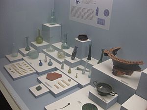
Across from the Archaeological Museum of Argostoli are the law courts. These were first built by the British using stone from an ancient site nearby. Along Lithostroto street, next to the Catholic Church, there is a small museum. It is dedicated to the soldiers of the Acqui Division. A little further along, you can see the Bell Tower. It was rebuilt in 1985 and holds the original clock.
Southwest of the town center, on the coast, is the holiday town of Lassi. It has several small beaches that are popular with visitors.
How Argostoli is Organized
The municipality of Argostoli is made up of several smaller areas, or municipal units. These include:
- Argostoli
- Eleios-Pronnoi
- Leivatho
- Omala
The Argostoli municipal unit itself is divided into smaller communities. Some of the main villages in these communities are:
- Agkonas
- Argostoli (which includes Argostoli town, Kokolata, Kompothekrata, Minia)
- Davgata
- Dilinata
- Faraklata (which includes Faraklata, Drapano, Prokopata, Razata)
- Farsa
- Thinaia (which includes Kardakata)
- Kourouklata
- Nyfi
- Troianata (which includes Troianata, Demoutsantata, Mitakata)
- Zola
Getting Around Argostoli
Between the Koutavos Lagoon and the De-Bosset Bridge is the new bus station. From here, you can travel to other towns and villages on the island. You can also catch buses to Athens and Patras on the mainland. The main ferry port is next to the bus station. Ferries from here connect Argostoli with the mainland (via Kyllini) and Zakynthos (also known as Zante). The ferry to Lixouri docks a bit further along and runs very often.
Here are some ways to get around:
- Car ferry service to Kyllini (mainland) and Zakynthos (Zante).
- Car ferry to Lixouri.
- KTEL Bus service to Athens, going through Kyllini, Patras, and past the Corinth Canal bridge.
- Buses that run less often to places like Poros, Sami, Skala, Fiskardo, and other villages.
- During summer, there are frequent buses to popular spots like Lassi, Kefalonia Airport, Ai Chelis, Lourdas, Ammes, Myrtos, and Antisamos.
- There is a bus service between the Airport and Argostoli city, but only during the summer. You can buy tickets from the bus driver.
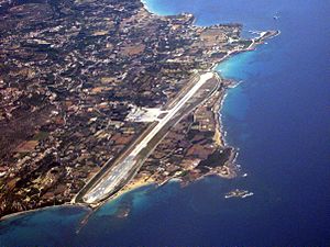
- Scheduled flights to Zakynthos and Athens, and charter flights in summer, are available from Kefalonia Airport.
- You can find taxis at Plateia Valianos and along the seafront. You can also rent cars, motorcycles, or scooters.
Argostoli's Climate
Argostoli has a hot-summer Mediterranean climate. This means it has hot, dry summers and cool, rainy winters.
| Climate data for Argostoli (1970–2010) | |||||||||||||
|---|---|---|---|---|---|---|---|---|---|---|---|---|---|
| Month | Jan | Feb | Mar | Apr | May | Jun | Jul | Aug | Sep | Oct | Nov | Dec | Year |
| Mean daily maximum °C (°F) | 14.5 (58.1) |
14.3 (57.7) |
16.0 (60.8) |
18.6 (65.5) |
23.0 (73.4) |
26.9 (80.4) |
29.3 (84.7) |
29.9 (85.8) |
26.9 (80.4) |
23.2 (73.8) |
19.0 (66.2) |
15.7 (60.3) |
21.4 (70.5) |
| Daily mean °C (°F) | 11.4 (52.5) |
11.4 (52.5) |
12.9 (55.2) |
15.6 (60.1) |
19.7 (67.5) |
23.7 (74.7) |
25.9 (78.6) |
26.3 (79.3) |
23.4 (74.1) |
19.8 (67.6) |
15.9 (60.6) |
12.8 (55.0) |
18.2 (64.8) |
| Mean daily minimum °C (°F) | 8.5 (47.3) |
8.3 (46.9) |
9.3 (48.7) |
11.3 (52.3) |
14.6 (58.3) |
18.3 (64.9) |
20.8 (69.4) |
21.4 (70.5) |
19.0 (66.2) |
16.1 (61.0) |
12.7 (54.9) |
9.8 (49.6) |
14.2 (57.6) |
| Average precipitation mm (inches) | 113.3 (4.46) |
101.3 (3.99) |
69.4 (2.73) |
51.6 (2.03) |
17.2 (0.68) |
8.6 (0.34) |
6.0 (0.24) |
9.4 (0.37) |
46.5 (1.83) |
94.7 (3.73) |
147.3 (5.80) |
147.0 (5.79) |
812.3 (31.98) |
| Average precipitation days | 14.1 | 13.4 | 10.7 | 9.0 | 4.7 | 1.8 | 0.8 | 1.6 | 5.4 | 10.0 | 12.9 | 15.4 | 99.8 |
| Source: Hellenic National Meteorological Service | |||||||||||||
Population Over Time
The population of Argostoli has changed over the years:
- In 1981, the community had 7,164 people.
- By 2001, the community grew to 9,593 people, and the municipal unit had 12,503.
- In 2021, the community reached 10,982 people, and the municipal unit had 13,666.
Famous People from Argostoli
Many notable people have come from Argostoli, including:
- Gerasimos Arsenis (1931–2016), a politician.
- Aris Maliagros (1895–1984), a well-known actor.
- Andreas Metaxas (1786–1860), a politician.
- Ioannis Metaxas (1871–1941), a general and politician.
- Constantine Phaulkon (1647–1688), a merchant and adventurer.
- Antonis Tritsis (1937–1992), who became the mayor of Athens.
- Christian Zervos (1889–1970), an art collector and writer.
- Ioannis Karantinos (1784–1834), a Greek mathematician.
- Athanassios S. Fokas (born 1952), another Greek mathematician.
Sister Cities
Argostoli has special connections with other cities around the world, called "sister cities" or "twin towns":
See also
 In Spanish: Argostoli para niños
 | James Van Der Zee |
 | Alma Thomas |
 | Ellis Wilson |
 | Margaret Taylor-Burroughs |


