Arroyo Grande Creek facts for kids
Quick facts for kids Arroyo Grande Creek |
|
|---|---|

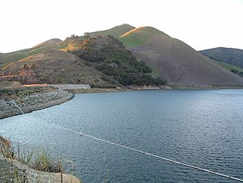
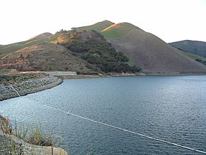
Lopez Lake and Dam on Arroyo Grande Creek
|
|
|
Location of Arroyo Grande Creek in California
|
|
| Country | United States |
| State | California |
| Physical characteristics | |
| Main source | Santa Lucia Range North of Huasna 1,307 ft (398 m) 35°11′55″N 120°23′00″W / 35.19861°N 120.38333°W |
| River mouth | Pacific Ocean Pismo State Beach 0 ft (0 m) 35°06′03″N 120°37′52″W / 35.10083°N 120.63111°W |
| Length | 22 mi (35 km) |
| Basin features | |
| Basin size | 153 sq mi (400 km2) |
Arroyo Grande Creek is an important stream in San Luis Obispo County, located on the Central Coast of California. This creek flows for about 22 miles (35 kilometers). It starts in the Santa Lucia Range mountains and travels southwest all the way to the Pacific Ocean.
The creek is a very important source of water for the southern part of San Luis Obispo County. Its name comes from the Spanish words for "large watercourse." In the 1800s, people sometimes called it the "Roaring Grande" because it could flood quite a bit. The city of Arroyo Grande, which was founded in 1867, was named after this very stream.
Contents
Where Does Arroyo Grande Creek Flow?
Arroyo Grande Creek begins its journey in the southern hills of the Santa Lucia Range. This area is just outside the Los Padres National Forest. As it flows west, the creek passes through many ranches and farms. Along the way, it is joined by smaller streams like Saucelito Creek and Phoenix Creek.
The creek then flows into Lopez Lake. This lake was created by Lopez Dam, which is about 13 miles (21 kilometers) upstream from where the creek meets the ocean. Other creeks, like Wittenberg and Lopez Canyon Creeks, also flow into Lopez Lake from the north. These creeks also start in the Los Padres National Forest.
Below Lopez Dam, the creek turns southwest and enters the Arroyo Grande Valley. It flows through Biddle Regional Park. Tar Springs Creek joins it just before the city of Arroyo Grande. Further downstream, Los Berros Creek also adds its water. After passing through Arroyo Grande and Oceano, Arroyo Grande Creek finally empties into the Pacific Ocean at Pismo State Beach. This spot is just north of the Pismo Dunes.
The Creek's Watershed
The area that drains water into Arroyo Grande Creek is called its watershed. This watershed covers about 153 square miles (396 square kilometers). It is entirely located within San Luis Obispo County. Most of this area is made up of hills or mountains. However, closer to the coast, there are wider valleys that are used for farming.
The land in the watershed ranges from sea level up to about 3,100 feet (945 meters) high in the upper parts of Lopez Canyon. The main types of plants you'll find here are grasslands, buckbrush, and chamise shrubs. There are also oak trees growing along the streams and in the valleys. On average, this area gets about 15 to 28 inches (380 to 710 millimeters) of rain each year.
How People Have Changed the Creek
People have made some big changes to Arroyo Grande Creek over the years.
Lopez Dam and Lake
Lopez Dam was built in 1968. It was constructed by the San Luis Obispo County Flood Control and Water Conservation District. The main reason for building it was to provide drinking water for communities in the "Five Cities" area, including the city of Arroyo Grande. The lake behind the dam, Lopez Lake, can hold a huge amount of water.
Each year, the dam provides about 8,730 acre-feet of water. About 52 percent of this water goes to local water agencies for people to use. The other 48 percent is released downstream to keep the creek flowing. Lopez Dam acts as a complete barrier for fish. This means fish like steelhead cannot swim upstream past the dam. This has caused a decrease in their numbers in the creek.
Controlling Floods
Because Arroyo Grande Creek used to flood often, the lower 3 miles (5 kilometers) of the creek were changed in 1959. This process is called "channelization," which means making the creek flow in a straighter, more controlled path. Parts of other streams that flow into Arroyo Grande Creek, like Tar Springs and Los Berros Creeks, have also been channelized.
Special gates were also put in place to control how water flows between Arroyo Grande Creek and Meadow Creek. Meadow Creek is what's left of a large marshy area that used to be along the coast. These gates help protect homes nearby from flooding.
 | Jewel Prestage |
 | Ella Baker |
 | Fannie Lou Hamer |


