Arthur's Pike facts for kids
Quick facts for kids Arthur's Pike |
|
|---|---|

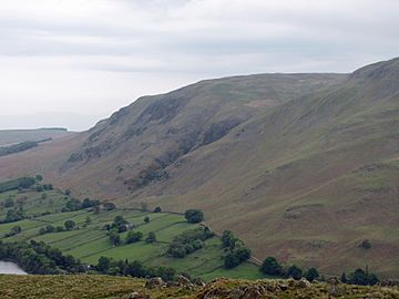
Seen from Hallin Fell, three km to the SW.
|
|
| Highest point | |
| Elevation | 533 m (1,749 ft) |
| Prominence | < 10 m |
| Parent peak | Loadpot Hill |
| Listing | Wainwright |
| Geography | |
| Location | Cumbria, England |
| Parent range | Lake District, Far Eastern Fells |
| OS grid | NY461206 |
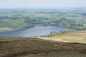
Arthur's Pike is a cool hill, or "fell," in the amazing Lake District in England. It's close to a beautiful lake called Ullswater. This fell is part of a longer ridge that stretches north from Loadpot Hill in the Far Eastern Fells. It has a big, rocky side that looks out over the lower part of Ullswater.
Contents
What is Arthur's Pike Like?
Arthur's Pike is separated from Loadpot Hill by a wide, flat area. This area is a bit marshy, meaning it can be wet and boggy. From Arthur's Pike, the ridge turns towards the northeast. It then goes over a smaller bump called White Knott. This ridge runs between a stream called Aik Beck and the lake, heading towards Pooley Bridge.
The famous fell-walker Alfred Wainwright described Arthur's Pike as being within these specific boundaries. This means the wider slopes around an area called Moor Divock are considered part of Loadpot Hill.
Looking West from Arthur's Pike
To the west of Arthur's Pike, the land drops steeply down to a stream called Swarthbeck. This stream creates a natural border between Arthur's Pike and its nearby twin fell, Bonscale Pike. Swarthbeck then flows into Ullswater. The northwest side of Arthur's Pike has several layers of rocky cliffs, or "crags." Below these crags, there's an area of farmland and then the road that runs along the lakeside to Howtown.
Reaching the Top of Arthur's Pike
The very top of Arthur's Pike is a small area on a grassy, flat plateau. It's set back a little from the steep crags. You'll find the remains of a beacon here. A beacon is like a tall stone pillar, also called a "cairn," that marks the edge of the rocky face.
How to Climb Arthur's Pike
There isn't one super clear path directly to the summit. However, a little to the southeast, an old Roman road called High Street runs nearby. One good way to climb Arthur's Pike is from Swarthbeck, which is on the Howtown road. From there, you can go around the crags to the north and follow a good path towards White Knott. You can also reach the top from the Roman road itself. You can walk north from Loadpot Hill or south from places like Pooley Bridge or Helton.
 | DeHart Hubbard |
 | Wilma Rudolph |
 | Jesse Owens |
 | Jackie Joyner-Kersee |
 | Major Taylor |


