Loadpot Hill facts for kids
Quick facts for kids Loadpot Hill |
|
|---|---|

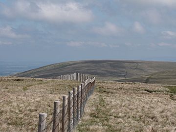
Seen from the summit of Wether Hill, 2 km to the south.
|
|
| Highest point | |
| Elevation | 672 m (2,205 ft) |
| Prominence | c. 50 m |
| Parent peak | High Raise |
| Listing | Hewitt, Wainwright, Nuttall |
| Geography | |
| Location | Cumbria, England |
| Parent range | Lake District, Far Eastern Fells |
| OS grid | NY457181 |
| Topo map | OS Explorer OL5 |
Loadpot Hill is a fell (a type of mountain or hill) located in the English Lake District. It sits between two large lakes, Haweswater and Ullswater.
Contents
Exploring Loadpot Hill's Landscape
Loadpot Hill might not be the tallest, but it covers a large area, about 12 square miles (31 square kilometers). It's the last major peak on the main ridge of the Far Eastern Fells before the land slopes down towards Penrith and the River Eamont.
Western Slopes and Valleys
The western side of Loadpot Hill drops quickly into a valley called Fusedale. Fusedale Beck, a small stream, flows north from here towards Ullswater. To the north and northwest, two smaller hills, Bonscale Pike and Arthur's Pike, branch off. Both of these hills have rocky cliffs that look out over Ullswater, and they are separated by another stream called Swarthbeck Gill.
Northeastern Ridge and Moor Divock
The main ridge to the northeast of Loadpot Hill is wide and gently slopes down. This area is between the River Eamont and the River Lowther. These rivers eventually meet about 8 miles (13 km) from the summit, just south of Penrith. For walkers, the northern edge of Loadpot Hill is generally considered to be the road connecting Pooley Bridge to Askham. This area is covered in heather and grass, with a dip called Moor Divock.
Moor Divock's Ancient History
Moor Divock is a very interesting place with a lot of history. You can find ancient burial mounds (tumuli), standing stones, old boundary markers, and stone circles there. It also has natural sinkholes and old quarries.
Eastern Ridges and Valleys
To the south of the northeastern ridge, Heltondale Beck flows, which feeds into the River Lowther. Further east, another ridge descends from Loadpot Hill between two deeply cut valleys, Heltondale and Cawdale. This ridge has a smaller peak called The Pen, which has a beacon (a tall stone pile called a cairn). The Lowther valley and the road from Askham to Bampton form the eastern boundary of Loadpot Hill.
Southern Connection to Wether Hill
South of Loadpot Hill, a short ridge connects it to Wether Hill. This path crosses areas of peat, which are wet, boggy sections of land.
Summit Views and Features
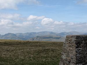
The top of Loadpot Hill is wide and flat, marked by a trig point. A trig point is a concrete pillar used by surveyors to measure distances and map the land. A little south of the summit, there used to be an old hunting lodge called Lowther House, but now only a pile of stones from its chimney remains.
An ancient Roman road, known as the High Street, runs along the main ridge. It takes a slight detour around the summit of Loadpot Hill before continuing northeast through Moor Divock towards Penrith. From the summit, you can enjoy wide views of the Lake District to the west and the Pennine hills further away to the east. If you move a little to the west, you can also see Ullswater lake.
Popular Walking Routes
Many people enjoy hiking up Loadpot Hill. Some of the main routes start from Bampton or Helton, following the east ridge. Other popular starting points include Pooley Bridge or Askham, using the northeast ridge. You can also start from Howtown and walk through Fusedale. Climbing via Arthur's Pike is another popular option. There is a good path running north and south, sometimes using parts of the old Roman road, and fainter paths follow the other branching ridges.
 | Mary Eliza Mahoney |
 | Susie King Taylor |
 | Ida Gray |
 | Eliza Ann Grier |


