High Raise (High Street) facts for kids
Quick facts for kids High Raise (High Street) |
|
|---|---|

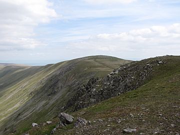
Seen from Rampsgill Head, one km. to the south.
|
|
| Highest point | |
| Elevation | 802 m (2,631 ft) |
| Prominence | c. 90 m |
| Parent peak | High Street |
| Listing | Hewitt, Wainwright, Nuttall |
| Geography | |
| Location | Cumbria, England |
| Parent range | Lake District, Far Eastern Fells |
| OS grid | NY448135 |
| Topo map | OS Explorer OL5 |
High Raise is a tall hill, also called a fell, located in the beautiful Lake District in England. It stands west of the Haweswater Reservoir in an area known as the Far Eastern Fells. It's important to know there's another fell called High Raise in the Central Fells, which is the highest point there.
Contents
What Does High Raise Look Like?
High Raise is part of a long line of fells that runs from north to south in the Far Eastern Fells. It sits between two other fells, Wether Hill and Rampsgill Head. The eastern side of High Raise slopes down towards Haweswater, a large lake. Its western side is a very steep, rocky slope that leads into a valley called Rampsgill.
The Northern Ridge
If you head north from High Raise, you'll walk along a ridge towards Wether Hill. This path goes over two smaller tops called Raven Howe (which is 2,345 feet high) and Red Crag (2,332 feet high). After these, the ridge dips down to an area called Keasgill Head. This path is mostly covered in grass, but it's quite narrow. An ancient Roman road, known as the High Street, runs along this ridge. You can also find a small tarn, which is a mountain lake, just south of Red Crag.
The Southern Ridge
Going in the other direction, the ridge from High Raise turns a bit west. It crosses a small dip in the land before reaching Rampsgill Head.
Low Raise and Whelter Crags
About half a mile east of High Raise, there's another broad top called Low Raise, which is 2,473 feet high. On Low Raise, you can see an ancient tumulus, which is a mound of stones. Some of these stones have been used to build a cairn (a pile of stones used as a marker) and a shelter from the wind. These stones don't seem to be from the local area.
East of Low Raise, there's a rocky, bowl-shaped area called Whelter Crags. This area is carved out of the hillside above the reservoir. Two ridges stretch out from here towards the lake shore. The longer one, Long Grain, curves around between two streams called Measand Beck and Whelter Bottom. This ridge starts as a wide, flat area before becoming rocky cliffs above Haweswater. The other ridge, to the southeast, gets narrower and rockier. It ends with a steep drop over Castle Crag. This spot was once an ancient hillfort, and you can still see some old earthworks there. South of this ridge, a valley called Randale separates it from Kidsty Pike.
Reaching the Summit
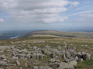
The very top of High Raise is quite rocky, especially compared to the grassy fells nearby. There's a large cairn built a few yards east of the old Roman road. From the summit, you get amazing views of the Lake District landscape stretching out to the west. It's a great spot to see many other fells!
How to Climb High Raise
You can start your climb to High Raise from different places. Some people begin from Martindale in the north. Others start from Mardale, using the ridges to the southeast or northeast. High Raise can also be part of a longer hike if you start from places like Patterdale, Hartsop, or Bampton. However, if you choose these routes, you'll need to climb other fells first to reach High Raise.
There aren't many clear paths on High Raise itself, apart from the old Roman road, the High Street. This is partly because the village of Mardale Green was flooded when the lake was made bigger in the 1930s.
 | William Lucy |
 | Charles Hayes |
 | Cleveland Robinson |


