Central Fells facts for kids
The Central Fells are a group of hills in the beautiful Lake District in England. Their highest point is High Raise, which stands at about 762 metres (2,500 feet) tall. These fells are found in a wide area to the east of Borrowdale. It might seem surprising, but the Central Fells are often lower than the hills around them. This is because the Lake District's overall shape is like a big dome, but with a small dip in the middle where these fells are. This range stretches from a wet, boggy ridge between Derwentwater and Thirlmere in the north, all the way to the famous rocky peaks of the Langdale Pikes in the south.
Contents
What are the Lakeland Fells?
The Lake District is a special National Park in northwest England. It's famous for its many lakes and a complex group of hills. These hills are known locally as fells. They can be small hills or some of the highest land in England. There are hundreds of these hilltops! Many writers have tried to make clear lists of them. To help describe them, these writers often divide the fells into smaller areas.
One of the most famous writers about the fells was Alfred Wainwright. His book series, Pictorial Guide to the Lakeland Fells, has sold over 2 million copies! It has been printed continuously since the first book came out in 1952. Wainwright split the fells into seven different areas. Each area was surrounded by valleys and low passes. While other writers have made their own divisions, Wainwright's seven areas are still the best known. The Central Fells are one of these areas, and they are covered in volume 3 of Wainwright's books.
Where are the Central Fells?

The Central Fells are surrounded by other parts of the Lake District. To the north, the Vale of Keswick separates them from Skiddaw and the Northern Fells. To the west, the long valley of Borrowdale runs from Stake Pass down to Keswick.
On the eastern side, Thirlmere and the Vale of St John form a parallel boundary. All these valleys eventually join the River Derwent. At the top of Thirlmere is a pass called Dunmail Raise, where the A591 road crosses. South of Dunmail Raise, the Vale of Grasmere goes down to Windermere, making up the rest of the eastern boundary. In the west, Stake Pass goes down into Great Langdale. This also leads to Windermere via the River Brathay.
The Central Fells are the only group completely surrounded by other Lakeland ranges. They connect to the Southern Fells across Stake Pass and to the Eastern Fells at Dunmail Raise.
What do the Central Fells look like?
If you look at a map, the Central Fells look a bit like a boot. A wide ridge runs south for about 16 kilometres (10 miles). The valleys on either side are about 5 kilometres (3 miles) apart. The range then gets narrower and turns southeast. The Langdale Pikes form the 'heel' of the boot, and Loughrigg Fell is the 'toe'.
Starting with Walla Crag and Bleaberry Fell in the north, the fells slowly get higher. They reach their highest point at High Raise, which is like the 'ankle' of the boot. This part is often called the 'Central Ridge'. It has flat-topped hills covered in peat. Some of the boggiest areas in the Lake District are found here.
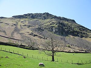
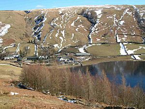
South of Bleaberry Fell are High Seat, High Tove (which has a very boggy area called The Peewits), and Ullscarf. The land finally gets drier as you reach High Raise. To the west of the Central Ridge, a lower ridge surrounds the quiet valley of Watendlath. In this area, you'll find Great Crag and Grange Fell. These are lower hills with more exposed rock, popular for shorter climbs. On the eastern side, another low ridge surrounds Shoulthwaite, topped by the impressive Raven Crag and the family-friendly High Rigg.

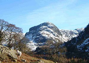
High Raise itself is mostly grassy, except for the very top. A wide, flat area stretches southwest over Thunacar Knott. Beyond this are several low tops that look flat from this direction. But from the south, you can see the amazing Langdale Pikes. They drop straight down from their rocky tops to the valley floor of Great Langdale, nearly 600 metres (2,000 feet) below! Pike of Stickle is at the western end, followed by Loft Crag, Harrison Stickle, and the huge cliff of Pavey Ark above Stickle Tarn.
East of High Raise, many smaller ridges spread out from a peak called Sergeant Man. Between the valleys of Wythburn, Easedale, and Greenburn, you'll find Calf Crag, Helm Crag, Gibson Knott, Steel Fell, and Tarn Crag. Along with Eagle Crag and Sergeant's Crag on the Borrowdale side, these fells have steep sides and lots of rock on their summits.
The main ridge goes southeast from High Raise. The land between the Rivers Brathay and Rothay gradually gets narrower, ending at Ambleside. In this section are the many tops of Blea Rigg, Silver How (which has great views of Grasmere), and finally Loughrigg Fell. Loughrigg Fell is easy to reach from the White Moss car park and is often combined with a walk along the path above Rydal Water.

Exploring the Central Fells
Many parts of the Central Fells are great for walking. In the north, Walla Crag and Bleaberry Fell are an easy walk from Keswick. The road through Borrowdale gives access as far south as Eagle Crag. The A591 road runs along the eastern side of the fells, and a smaller road around Thirlmere also provides many access points. Grasmere village is a good starting point for walks around Easedale.
The Langdale Pikes are usually climbed from Great Langdale. You can start from either of the Dungeon Ghyll Hotels. Loughrigg is surrounded by smaller roads, including Red Bank, which is the only road that crosses the Central Fells. Near the summit of Loughrigg is the youth hostel of High Close.
Generally, you can find quieter walks in the middle of the range, from High Seat to Ullscarf. However, you'll likely meet many other walkers on Walla Crag or the Langdale Pikes, as these are very popular spots!
 | Lonnie Johnson |
 | Granville Woods |
 | Lewis Howard Latimer |
 | James West |


