Tarn Crag (Easedale) facts for kids
Quick facts for kids Tarn Crag |
|
|---|---|

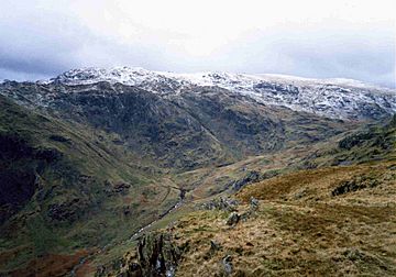
Tarn Crag from Gibson Knott
across Far Easedale |
|
| Highest point | |
| Elevation | 551 m (1,808 ft) |
| Prominence | c. 5 m (16 ft) |
| Parent peak | Codale Head |
| Listing | Wainwright |
| Geography | |
| Location | Cumbria, England |
| Parent range | Lake District, Central Fells |
| OS grid | NY301093 |
| Topo map | OS Landranger 90 |
Tarn Crag is a type of hill called a fell in the Central Fells area of the English Lake District. There is actually another hill with the same name, Tarn Crag, located in the Far Eastern Fells. The name "Tarn Crag" originally referred only to the rocky cliff that looks down on Easedale Tarn. However, a famous fell walker and writer named Alfred Wainwright used the name for the whole ridge. This ridge sits between the Easedale and Far Easedale valleys, as described in his book Pictorial Guide to the Lakeland Fells.
Contents
Exploring Tarn Crag's Landscape
The main line of hills in the Central Fells runs north from High Raise. This line creates a natural border between the Thirlmere and Borrowdale valleys. Several smaller ridges branch out east from High Raise. These ridges are centered around a smaller peak called Sergeant Man. One of these ridges is Tarn Crag, which lies between the Far Easedale and Easedale valleys. It ends where these two valleys meet, just above Grasmere village.
The Ridge and Its Features
The eastern part of the Tarn Crag ridge is quite narrow. It rises over several small bumps as the valleys on either side slowly spread further apart. To the west, the ridge becomes much wider. It curves south around the top of Codale Tarn before blending into the higher ground towards Sergeant Man and the High Raise area.
Codale Tarn is a shallow lake. Its original water exit was blocked by a natural pile of rock and dirt called a moraine. Now, its water flows out over a rocky edge.
Lakes and Cliffs Around Tarn Crag
The southern side of Tarn Crag includes Tarn Crags and Greathead Crags. These cliffs form the background for the popular picnic spot at Easedale Tarn. This lake is much larger than Codale Tarn and is about 70 feet deep. It is home to fish like perch, eel, and trout. Across Easedale Tarn, you can see the cliffs of Blea Rigg. On the northern side of the Tarn Crag ridge, Deer Bields Crag stands over Far Easedale, with Calf Crag beyond it.
What Tarn Crag is Made Of: Geology
The very top of Tarn Crag is made of a type of volcanic rock called dacitic welded lapilli-tuff. It also contains volcaniclastic sandstone from the Lincomb Tarns Formation. The cliffs on the southern side show layers of andesite (another volcanic rock) and pebbly sandstone. They also contain breccia, which is rock made of broken pieces cemented together. These rocks are part of the Pavey Ark Member.
Reaching the Top: The Summit
The highest point of Tarn Crag is a rocky peak. It has a small pile of stones, called a cairn, at its very top. From here, you can see far out to the east. If you go to a slightly lower peak to the south, you can get a good view of Easedale Tarn.
How to Climb Tarn Crag
Most people climb Tarn Crag starting from Grasmere. They follow a path that winds among the rocks on its eastern ridge. You can reach this path from Easedale Tarn, from the top of the Sour Milk Gill waterfalls, or from Stythwaite Steps in Far Easedale. It is also possible to climb Tarn Crag from the base of Deer Bield Crag or by going past Codale Tarn. However, these routes do not have clear paths.
 | Sharif Bey |
 | Hale Woodruff |
 | Richmond Barthé |
 | Purvis Young |


