Far Eastern Fells facts for kids
The Far Eastern Fells are a group of hills in the beautiful Lake District in England. These hills are found to the east of Ullswater lake and Kirkstone Pass. The highest point in this area is a hill called High Street, which is 828 metres (2,718 feet) tall.
Compared to the busy central parts of the Lake District, the Far Eastern Fells are much quieter. They often offer easier walks because many of the hills blend into the surrounding moorlands. However, some parts, like Harter Fell, Mardale Ill Bell, and High Street near Haweswater, have amazing rocky views.
Contents
What are the Lake District Fells?
The Lake District is a special National Park in northwest England. It's famous for its many lakes and a complex range of hills. These hills are known locally as fells. They can be small hills or some of the tallest mountains in England.
There are hundreds of fells! To make them easier to understand, people often divide the Lake District into smaller areas. One very famous person who did this was Alfred Wainwright. He wrote a series of guidebooks called Pictorial Guide to the Lakeland Fells. These books have been very popular since the first one came out in 1952.
Wainwright divided the fells into seven main areas. Each area is usually surrounded by valleys or low passes. The Far Eastern Fells are one of these seven areas.
Where are the Far Eastern Fells?
The Far Eastern Fells are located to the east of the A592 road, which goes over Kirkstone Pass. This road runs north from Ambleside to Patterdale, which is at the top of Ullswater lake. The western edge of these fells then continues along Ullswater to Pooley Bridge.
The eastern boundary of these fells goes out towards Longsleddale. This area includes hills like Tarn Crag and Grey Crag. These are some of the most easterly fells that are over 2,000 feet (610 metres) high.
Exploring the Far Eastern Fells
The higher parts of the Far Eastern Fells are like a big horseshoe shape. They connect to the Eastern Fells across Kirkstone Pass. The main ridge starts with Stony Cove Pike (also called Caudale Moor). It then gradually goes north over Thornthwaite Crag, High Street, Rampsgill Head, and High Raise.
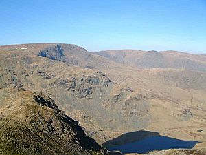
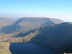
On the western side of this ridge, facing Ullswater, you'll find steep, U-shaped valleys like those in Martindale. This area is mostly covered in rough grass, heather, and bracken. On the eastern side, looking down towards Haweswater Reservoir, there are deep, bowl-shaped valleys (called corries) and lots of exposed rock.
North of High Raise, the ridge slowly gets lower. It becomes more like moorland as it passes over Wether Hill and Loadpot Hill. It eventually flattens out near Pooley Bridge. Only near Ullswater do you still see steep hills like Arthur's Pike and Bonscale Pike.
Valleys and Hills
The Martindale area on the western side has many valleys. These valleys are separated by ridges that spread out from Rampsgill Head. Here, you can find hills like The Knott and Rest Dodd. Further on are The Nab, Brock Crags, and Beda Fell. Near Patterdale, you'll find Angletarn Pikes with its beautiful, curvy tarn (a small mountain lake) and Place Fell. Steel Knotts and Hallin Fell are also in this area, close to Wether Hill.
South of High Street is the long valley of Kentmere. This valley has great ridges on both sides, perfect for a horseshoe-shaped walk. On the western side, coming down from Thornthwaite Crag, are Ill Bell, Froswick, and Yoke. On the eastern side, you'll see Mardale Ill Bell, Harter Fell, Kentmere Pike, and Shipman Knotts. Even further east are the parallel valley of Longsleddale and another ridge from Branstree to Grey Crag.
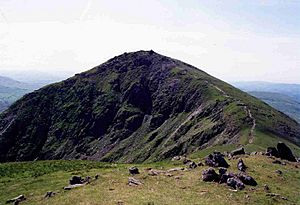
Harter Fell looks smoother from the Kentmere side. But its most impressive side faces the head of Mardale, the valley where Haweswater is. Before the lake was made bigger by a dam in the 1930s, a small village called Mardale Green stood here. You can only see its remains when the water levels are very low during dry spells. Two beautiful tarns, Small Water and Blea Water, feed into the lake from either side of Mardale Ill Bell. Blea Water is actually the deepest tarn in the entire Lake District!
Getting Around the Fells
There are several good starting points for walks in the Far Eastern Fells.
- North West: Patterdale and Glenridding are good bases. You can walk along the ridges all the way to High Street from here, often going through Boredale Hause.
- South West: From Ambleside, the lower hills around Troutbeck are easy to reach.
- Martindale: You can get to Martindale by taking the Ullswater steamer boat or by driving around the lake. Place Fell and Hallin Fell are popular hills to climb from this direction.
To the east, there are fewer places to start from, especially since the village of Mardale Green disappeared. However, there is a car park at the head of Haweswater lake. This car park makes it easier to reach the big arc of fells from Branstree to High Raise.
Mardale Head is also the start of two important walking paths: Nan Bield (which goes to Kentmere) and Gatesgarth (which goes to Longsleddale). These quiet valleys allow cars part of the way. In the summer, there's even a bus service for walkers. If you explore the fells from the far eastern valleys, expect long walks over quiet moorland. You might consider the ridges around Bannisdale, Crookdale, Wet Sleddale, or Naddle Beck. You probably won't see many other people all day!
 | Calvin Brent |
 | Walter T. Bailey |
 | Martha Cassell Thompson |
 | Alberta Jeannette Cassell |


