Brock Crags facts for kids
Quick facts for kids Brock Crags |
|
|---|---|

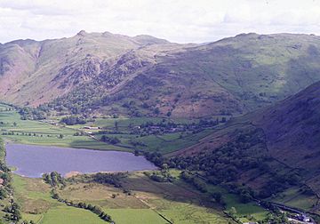
Brock Crags (right) and Angletarn Crags (left) seen above Brotherswater from High Hartsop Dodd
|
|
| Highest point | |
| Elevation | 562 m (1,844 ft) |
| Prominence | c. 25 m |
| Parent peak | Rest Dodd |
| Listing | Wainwright |
| Geography | |
| Location | Cumbria, England |
| Parent range | Lake District, Far Eastern Fells |
| OS grid | NY419137 |
| Topo map | OS Explorer OL5 |
Brock Crags is a mountain, or fell, located in the beautiful Lake District in England. It stands tall above the village of Hartsop and is part of the Far Eastern Fells. This mountain helps form the edge of the Martindale valley and is found on a long ridge that stretches from Rampsgill Head to Place Fell.
Contents
What is Brock Crags?
A Special Mountain for Walkers
The famous fell-walker, Alfred Wainwright, gave the name Brock Crags to a specific part of the mountain ridge. This section lies between two other peaks, Rest Dodd and Angletarn Pikes. Even though the highest point of Brock Crags is a bit off the main ridge, Wainwright chose to include it in his popular guidebooks.
This is why some mountains listed by Wainwright are different from other official mountain lists. Wainwright's choices were based on his personal exploration and what he found interesting.
Exploring Brock Crags
The Shape of the Mountain
Brock Crags has a narrow ridge that climbs eastwards towards Rest Dodd. Both sides of this ridge are quite steep. On the northern side, you'll find Satura Crag, which looks down into the Bannerdale valley. On the southern side, Prison Crag sits above Hayeswater Gill. This stream eventually flows into Goldrill Beck, near Hartsop village, and then heads north towards Ullswater.
From the true highest point of Brock Crags, the ridge turns north towards Angletarn Pikes. Near here, you'll find the lovely Angle Tarn. A tarn is a small mountain lake. It sits just west of the dip between these two fells.
Rocky Knolls and Views
The main part of Brock Crags spreads out like a wide, circular area. It's about half a mile across and has several rocky bumps, called knolls. Brock Crags itself has two main tops. The lower one is marked on maps by the OS.
North of this is Cat Crag, another smaller peak that overlooks Angle Tarn. Other smaller hills stand above Hartsop, near Lingy Crag.
Streams and Valleys
Below Lingy Crag, on the western side, there's a wooded area with broadleaf trees above Goldrill Beck. The slopes here are very steep. Angletarn Beck forms the northern edge of Brock Crags. It cuts through the land between Cat Crag and the main mountain, flowing through a gully down to Goldrill Beck. The deeply carved Bannerdale valley, including Buck Crags, forms the northeastern side of the mountain.
The Top of Brock Crags
Summit Features and Views
At the very top of Brock Crags, you'll find a small tarn nestled between the two highest knolls. From here, you can enjoy amazing views all around! It's a great spot to see the surrounding Lake District landscape.
How to Climb Brock Crags
You can climb Brock Crags from Hartsop. It's a relatively short and easy climb, though the very top section doesn't have a clear path.
A popular walking route from Patterdale to High Street also runs along the ridge of Brock Crags. This path passes just below the true summit.
 | John T. Biggers |
 | Thomas Blackshear |
 | Mark Bradford |
 | Beverly Buchanan |


