Rest Dodd facts for kids
Quick facts for kids Rest Dodd |
|
|---|---|

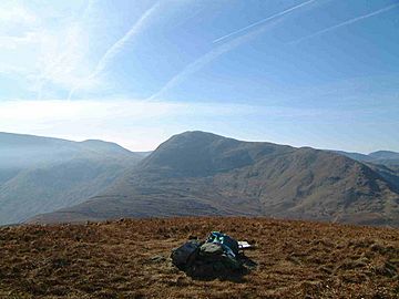
Rest Dodd seen from The Nab
|
|
| Highest point | |
| Elevation | 696 m (2,283 ft) |
| Prominence | 111 m (364 ft) |
| Parent peak | High Street |
| Listing | Hewitt, Wainwright, Nuttall |
| Geography | |
| Location | Cumbria, England |
| Parent range | Lake District, Far Eastern Fells |
| OS grid | NY432137 |
| Topo map | OS Explorer OL5 |
Rest Dodd is a mountain, also known as a fell, located in the beautiful Lake District in England. It stands tall at 696 metres (2,283 feet) and is found in the quieter eastern part of this national park.
Many hikers walk past Rest Dodd without climbing it. They often use the path between Ullswater and Haweswater to reach the taller High Street. Some are even trying to finish Alfred Wainwright’s famous Coast to Coast Walk. Wainwright himself said Rest Dodd was "a fell of little interest." However, he did note that its eastern side has cool, colourful rocky slopes. People usually climb Rest Dodd along with other nearby "Wainwright" fells like The Nab, Brock Crags, and Angletarn Pikes.
Contents
About Rest Dodd's Shape
Rest Dodd is part of a long ridge that forms the edge of the Martindale valley system. This valley empties north into Ullswater. To the southeast of Rest Dodd is The Knott, and to the other side is Brock Crags.
Ridges and Valleys
A smaller ridge extends north from Rest Dodd, ending at The Nab. This ridge helps separate two parts of the Martindale valleys: Bannerdale and Rampsgill. Another shorter, rocky ridge goes northwest from Rest Dodd, separated from The Nab by a stream called Yewgrove Gill. The southern side of the fell is shaped by Hayeswater Gill.
How Rest Dodd Looks
From most directions, Rest Dodd looks like a high, rounded hill. Its upper parts are covered in rough grass. Below about 450 metres (1,500 feet), all sides are steep and rugged, with some rocks sticking out on the Martindale slopes. The ridge connecting to The Knott is wide and marshy. The path to Brock Crags crosses rocky areas as it gets narrower above Satura Crag. The way to The Nab involves crossing many deep peat bogs, which can make the walk take much longer.
How to Climb Rest Dodd
Most people start their climb of Rest Dodd from the Patterdale valley. There are two main starting points:
- From Hartsop: This village is only about two miles from the top of Rest Dodd. It's a tough climb from Hayeswater Gill to reach the main path that goes from Patterdale village to Haweswater.
- From Patterdale Village: This route is longer, about 3.5 miles. It uses the main path over Boardale Hause and past Angle Tarn. From there, an old stone wall leads directly to the summit of Rest Dodd.
Views from the Top
The very top of Rest Dodd has a large pile of stones, called a cairn. This is because there are many old stone walls nearby. From the summit, you can see amazing views. To the west, you can see the entire Helvellyn mountain range. To the north, you get a great view of the Ramps Gill valley.
 | Georgia Louise Harris Brown |
 | Julian Abele |
 | Norma Merrick Sklarek |
 | William Sidney Pittman |


