
Kentmere facts for kids
Quick facts for kids Kentmere |
|
|---|---|
 Looking north up Kentmere from High Knott |
|

Kentmere
|
|
| Population | 159 (2011) |
| OS grid reference | NY4504 |
| Civil parish |
|
| Unitary authority |
|
| Shire county | |
| Region | |
| Country | England |
| Sovereign state | United Kingdom |
| Post town | KENDAL |
| Postcode district | LA8 |
| Dialling code | 01539 |
| Police | Cumbria |
| Fire | Cumbria |
| Ambulance | North West |
| EU Parliament | North West England |
| UK Parliament |
|
Kentmere is a beautiful valley, a small village, and a civil parish located in the amazing Lake District National Park in England. It's just a few miles from the town of Kendal in the Westmorland and Furness area of Cumbria. Long ago, it was part of Westmorland. In 2011, about 159 people lived in Kentmere.
Contents
Exploring Kentmere's Landscape
This narrow valley stretches about 3 miles (5 km) long. It starts with a group of hills called the Kentmere Round. These hills form a horseshoe shape around the Kentmere Reservoir. The River Kent, which gives Kendal its name, begins here. It flows from a bowl-shaped area called Hall Cove, then through the reservoir.
You can reach this part of the valley by old paths. These include the Roman High Street, or by crossing Nan Bield Pass or Garburn Pass. The valley sits between Troutbeck to the west and Longsleddale to the east. The only road access is through the village of Staveley. A popular walk, known as the Kentmere Round, is a 12-mile (19 km) trip around the fells.

The River Kent starts high up at Bleathwaite Crag. Its waters gather in the Kentmere Reservoir, built in 1848. This reservoir helps control the water flow to farms lower down the valley. A smaller stream, Lingmell Gill, also feeds into the reservoir.
Further down, the river flows into a lake called Kentmere Tarn. This lake has sometimes turned into marshland. In 1840, it was even drained to create farmland. But over the last 100 years, the "mere" (old word for lake) has reappeared. It is now about 1 mile (1.6 km) long. An old wooden boat, from around 1300 AD, was found here during an archaeological excavation.
Other streams in the valley include Ullstone Gill and Hall Beck. There's a waterfall called Force Jump just north of the village. Two bridges cross the River Kent near Staveley. Barley Bridge has a dramatic weir, and Scrogg's Bridge is further up the valley.
The village of Kentmere is home to Kentmere Hall and St Cuthbert's Church. The Kentmere area is divided into four parts:
- Kentmere Common
- Green Quarter
- Hallow Bank
- Crag Quarter
Rocks and Climbing in Kentmere
The main rocks found here are green slate and granite. People have used this local stone for centuries to build dry stone walls, which are walls built without mortar.
Near Kentmere Hall, you can find the "Brock Stone," a huge rhyolite boulder. It's a popular spot for climbers. Kentmere valley is known for having many climbing challenges.
Just below the reservoir is Jumb Quarry, a special Geological Conservation Review site. It has unique volcanic rock with "bird's-eye tuffs." These contain lapilli, which are small pieces of lava that erupted from a volcano. They were probably round but got squashed into oval shapes by huge pressure when the Caledonian Mountains formed.
Kentmere's Ancient Past
People have lived in the Kentmere valley for a very long time, since about 4000 BC. Back then, the valley and hills were mostly covered in forests. Between 1983 and 1999, archaeologists studied the valley. They found hundreds of old features and dug up two sites. One was a settlement from before and during the Viking Age. The other was part of a medieval farm near Kentmere Hall.
The valley has many ancient remains. These include at least five large prehistoric sites with round houses and animal pens. One of these sites is on a public path at Tongue House in the northern part of the valley.
Important Historic Buildings

Kentmere Hall is famous for its tower house. This strong building was built in the 13th or early 14th century. It was meant to show off wealth and protect against raiding parties from Scotland. The tower has very thick walls (5 feet or 1.5 meters), arched ceilings, and a crenellated (notched) roof with small towers. It's all built from local stone. The farm next to it shows how buildings were changed and added to over many years.
The Gilpin family, who owned the manor, passed it down to their eldest son. The rest of the valley was divided among younger sons for generations. Today, what's left of the original estate is a farm owned privately.

St Cuthbert's Church, Kentmere was built east of Kentmere Hall. Like many old churches, it has an ancient yew tree nearby. This tree might be as old as the time of William I, suggesting people worshipped here very early on. Written records for the chapel only start in 1692. The church was updated in the 19th century and again in the 1950s.
Kentmere's Industries
In the past, Kentmere was known for its bobbin mills, which made wooden spools for thread. There was also the Waterfoot factory, which dug up diatomite from the bottom of Kentmere Tarn in the 1950s.
A water mill was built in 1272 by the first Lord of the Manor. This mill was later used to cut wood for the Kendal and Windermere Railway in 1860. The mill was fixed up in the 1970s and is now a pottery studio.
At the Staveley end of the valley, there's a factory called Kentmere Ltd. that makes photographic paper. A fishery near the reservoir releases trout and salmon into the River Kent for people who enjoy fishing.
Mining in Kentmere
Kentmere has a history of mining, mostly for the green slate found in the valley. Official mining records go back to at least 1898. Before that, people probably took stone from the hillsides to build dry stone walls and houses.
There were two main open-air mines in the valley. Jumb Quarry was close to an early settlement, but people could have gotten building stone from anywhere. The second mine was at Steelrigg near Staveley. Both produced green slate.
There were also at least six underground mines. In 1914, Steelrigg employed five men underground and nine above. Mining stopped there for a while but restarted in 1927 and continued until at least 1938. Jumb Quarry was used continuously, employing 10 men underground and five above in 1934.
Famous Kentmere Families
For a small valley, Kentmere has produced some famous families. The most well-known are the Gilpin family, who were the main landowners. Another important family was the Airy family, first recorded in the 14th century. Some say an Airay built St. Cuthbert's Church.
Many Airey descendants still live in the valley today. Some moved away during the English Civil War. Famous Airey descendants include George Biddell Airy, a famous astronomer, and Henry Airay, who became the head of Queen's College, Oxford, in 1599. He left money for a monthly sermon at St. Cuthbert's.
Did you know that Greendale, the village where Postman Pat lives in the cartoon, is said by his creator to be based on Kentmere and the nearby valley of Longsleddale?
The Gilpin Family Story
The Gilpin family is famous in Kentmere. The story goes that around the time of the Magna Carta, Richard de Gilpin, also known as "Richard the Rider," helped the Baron of Kendal. After they returned, Richard became famous for killing the Wild Boar of Westmorland. This was a fierce animal that was scaring local villages.
As a reward for his bravery, the Baron gave Richard land in and around Kentmere. This was about 4,000 acres (16 km²). From then on, the Gilpin family's crest included a black boar on a gold background. Many places near Kentmere are still named after the Gilpin family.
Richard's bravery was even sung about by minstrels in a song called "the Minstrels of Winandermere." The Gilpin estate grew even larger under King Henry III.
The family later became friends with the de Bruce family, who were ancestors of the Kings of Scotland.
Bernard Gilpin, the "Apostle of the North"
Bernard Gilpin was a younger son of the Gilpins of Kentmere Hall, born in the 16th century. He grew up there and sometimes preached at the church. He was known as the "Apostle of the North" because he traveled widely to preach the Gospel. He was also called "The common Father of the Poor" because he gave so much to charity. He died in 1582.
Bernard's oldest brother was George Gilpin. Queen Elizabeth I sent him to the Dutch States to form an alliance against the Spanish Armada. He was a minister in The Hague during her reign.
The second brother, William Gilpin, lived in the mill from 1578. He married Elizabeth Washington, who was a distant relative of George Washington.
The Gilpin family owned Kentmere Hall for 12 generations. They lost it during the English Civil War. Cromwell's troops destroyed the hall, leaving only the strong tower standing. The family lost ownership in 1660, and the Philipson family took over the hall.
Gilpin Coat of Arms
The Gilpin family's coat of arms is: a black boar standing on a gold background, with a red tongue and tusks. The crest is an arm in armor holding a green pine branch. Their motto is: Dictis Factisque Simplex (which means "Honest in Word and Deed" in Latin).
Images for kids
-
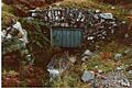
Entrance to an old underground mine near Browfoot

