Kentmere Pike facts for kids
Quick facts for kids Kentmere Pike |
|
|---|---|

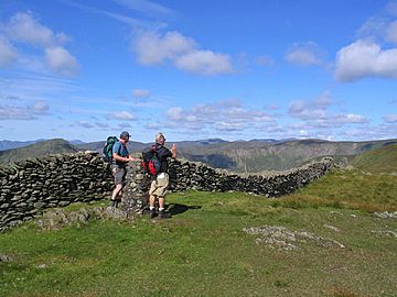
The summit wall and trig point
|
|
| Highest point | |
| Elevation | 730 m (2,400 ft) |
| Prominence | c. 35 m |
| Parent peak | Harter Fell |
| Listing | Wainwright, Hewitt, Nuttall |
| Geography | |
| Location | Cumbria, England |
| Parent range | Lake District, Far Eastern Fells |
| OS grid | NY465078 |
| Topo map | OS Explorer OL7 |
Kentmere Pike is a cool fell (that's a type of mountain or hill) in the beautiful Lake District in England. It stands tall between two valleys called Kentmere and Longsleddale. It's the highest point on a ridge that connects Harter Fell and Shipman Knotts.
Contents
What is Kentmere Pike Like?
The Slopes of Kentmere Pike
The western side of Kentmere Pike slopes down towards the Kentmere valley. This area has rough ground and leads to a stream called Ullstone Gill. This stream flows into the River Kent.
Further along, a smaller hill called Smallthwaite Knott helps separate Kentmere Pike from the main valley. You can also see lots of signs that people used to dig for stone here, which is called quarrying.
The Longsleddale Side
On the other side, facing the Longsleddale valley, Kentmere Pike has a rim of steep cliffs. These cliffs are above the narrow upper part of the River Sprint. Some of the main rocky faces here are Goat Scar, Raven Crag, and Brown Crags.
From the valley path, a rocky peak called Steel Pike looks like it's standing on its own. Near here, you can find the remains of a big old quarry called Wrengill Quarry. There's also an old mine entrance a bit higher up the slope.
The Ridge Walks
If you walk north from Kentmere Pike, the ridge goes down into a wet area. Then, it climbs up a grassy ridge towards Harter Fell. You'll follow a stone wall and then a broken fence along the way.
If you head south-east, the ridge continues to a top called Goat Scar. This spot has a small pile of stones (a cairn) and offers a great view of the rocky entrance to Longsleddale. From Goat Scar, the high ground turns directly south towards Shipman Knotts.
The Top of Kentmere Pike
The very top of Kentmere Pike is a grassy, rounded area. A stone wall runs right along the ridge. You'll see an Ordnance Survey column (a stone pillar used for mapping) just to the east of the wall. There's also a small cairn (a pile of stones) built to the west. Both are about the same height.
The views from the top are pretty good, even though other hills sometimes block parts of the scenery. You might catch glimpses of the Ill Bell ridge, the Coniston fells, and some of the Scafell group. Looking south, you get an open view of Windermere (a famous lake) and Morecambe Bay.
How to Climb Kentmere Pike
Most people climb Kentmere Pike as part of a longer walk called the Kentmere Horseshoe. This walk takes you along the beautiful ridges on both sides of the valley. It also includes some of the higher fells at the head of the valley.
You can also climb Kentmere Pike directly from either side. From Kentmere, an old path goes up the hillside from the end of High Lane. This path meets the ridge wall just south of the summit.
From Longsleddale, you can follow a walled track that leads to Gatesgarth Pass. You can leave this track just north of Steel Pike. Then, you follow the line of an old fence up to the ridge.
 | Janet Taylor Pickett |
 | Synthia Saint James |
 | Howardena Pindell |
 | Faith Ringgold |


