Grey Crag facts for kids
Quick facts for kids Grey Crag |
|
|---|---|

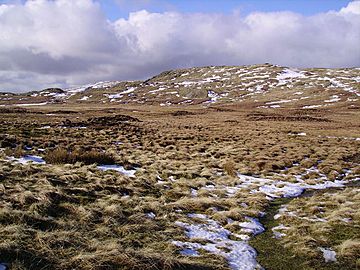
Grey Crag from Greycrag Tarn to the north-west
|
|
| Highest point | |
| Elevation | 638 m (2,093 ft) |
| Prominence | c. 45 m |
| Parent peak | Tarn Crag |
| Listing | Wainwright, Nuttall, Hewitt |
| Geography | |
| Location | Cumbria, England |
| Parent range | Lake District, Far Eastern Fells |
| OS grid | NY497072 |
| Topo map | OS Explorer OL7 |
| Listed summits of Grey Crag | ||||
| Name | Grid ref | Height | Status | |
|---|---|---|---|---|
| Harrop Pike | NY500078 | 637 m | Nuttall | |
Grey Crag is a mountain, also known as a fell, located in the Lake District in England. It stands to the east of a valley called Longsleddale, within the Far Eastern Fells. There is another mountain named Gray Crag in the Lake District, so make sure not to confuse them!
Contents
Exploring Grey Crag's Landscape
When you head north from a place called Sadgill, the Longsleddale valley gets much narrower. It has steep rock walls on both sides. Grey Crag is the first mountain you'll find on the eastern side. You can't see its very top from below.
What you can see is a flat-topped part called Great Howe. This section sticks out southwards from the main mountain. Great Howe's steep sides form the eastern wall of Longsleddale.
The Crags and Ridges
The name "Grey Crag" comes from a second set of rocky cliffs. These cliffs are set back from Great Howe, just below the mountain's top.
Grey Crag is part of a huge system of ridges that stretch far to the east. These ridges reach towards the distant Lune and Eden Valleys. Grey Crag also sits on the main dividing line for water in the Cumbrian hills. This means water flowing from it can end up in two different places: the Solway Firth or Morecambe Bay.
The long eastern ridges are mostly open moorland. They offer easy walks in quiet areas. Some of the important tops on these ridges include:
- Ancrow Brow (about 555 meters high)
- White Howe (about 530 meters high)
- Lords Seat (about 524 meters high)
- Great Yarlside (about 594 meters high)
These ridges surround several valleys. These include Bannisdale, Crookdale, Wet Sleddale, Borrowdale, and Wasdale. Don't mix up the last two with the more famous Borrowdale and Wasdale in the Lake District!
Greycrag Tarn
North of the summit, there's a wet, marshy area. Here you'll find Greycrag Tarn. A tarn is a small mountain lake. This tarn is actually a few small pools within what used to be a much larger body of water. Just beyond this tarn is Grey Crag's nearby mountain, Tarn Crag.
Reaching the Top of Grey Crag
The very top of Grey Crag is a short ridge. The highest point is at the southwest end. About half a mile to the northeast is another high point called Harrop Pike. It's only a little bit lower than Grey Crag's summit, at 637 meters (2,089 feet).
A fence runs along the summit ridge. It starts from the direction of Tarn Crag and then goes towards Harrop Pike. The true top of Grey Crag has a small pile of stones, called a cairn. Harrop Pike has a more impressive tall stone marker.
Views from the Summit
From the top of Grey Crag, you can see far to the east and south. Looking west, you can spot the Coniston and Scafell mountain groups. These are some of the Lake District's most famous peaks!
How to Climb Grey Crag
You can climb Grey Crag from Longsleddale. One way is to go up via Great Howe. Another option is to start from near the A6 road (Shap). From there, you can use any of the long eastern ridges mentioned earlier to reach the top.
The Haweswater Aqueduct Story
On the eastern side of Great Howe, you can still see parts of an old surveying pillar. This unusual structure is made of stone and concrete. It has a split at the top, which was used as a sight line for measurements. It used to have a wooden frame around it, but that has fallen apart over time.
This pillar is one of four similar structures. They were built when the Haweswater aqueduct was being constructed. An aqueduct is like a giant pipeline that carries water.
Water for Manchester
Below the mountains of Branstree, Tarn Crag, and Great Howe, is the first part of this huge pipeline. It carries water from the Haweswater reservoir all the way to the city of Manchester. The tunnel for this pipeline runs about 300 meters (1,000 feet) below Great Howe.
Building this tunnel was a massive job! It required 250 tons of gelignite, a type of explosive, for blasting through the rock. When it was built in the 1930s, it was the longest pipeline of its kind in Britain. The tunnel comes out into Longsleddale valley below the southern end of Great Howe. You can still see the leftover rock and soil from the digging there.
 | Bayard Rustin |
 | Jeannette Carter |
 | Jeremiah A. Brown |


