Gray Crag facts for kids
Quick facts for kids Gray Crag |
|
|---|---|

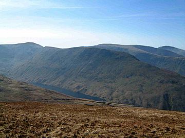
Gray Crag seen from the slopes of Rest Dodd 1.5 km to the north, Hayeswater is visible in the valley.
|
|
| Highest point | |
| Elevation | 699 m (2,293 ft) |
| Prominence | c. 15 m |
| Parent peak | Thornthwaite Crag |
| Listing | Wainwright, Nuttall |
| Geography | |
| Location | Cumbria, England |
| Parent range | Lake District, Far Eastern Fells |
| OS grid | NY427117 |
| Topo map | Landranger 90, OS Explorer OL5 |
Gray Crag is a cool mountain, or "fell," found in the amazing Lake District in Cumbria, England. It's a popular spot for hikers and offers some fantastic views!
Contents
Exploring Gray Crag's Unique Shape
Gray Crag is a special kind of mountain called a "fell" in the Lake District. It stands tall at 699 metres (about 2,293 feet) at its northern end. This spot is usually seen as the highest point and gives the best views.
Discovering the Summit Views
Even though the northern end is popular, there's another point a bit higher. This spot is 710 metres (about 2,329 feet) tall, less than a kilometre to the south. Both of these high points have small piles of stones called "cairns." These cairns are like markers on the grassy tops.
Where is Gray Crag Located?
Gray Crag is in the eastern part of the Lake District National Park. It's about five kilometres southeast of a village called Patterdale. Think of Gray Crag as a long, grassy ridge that stretches north from a bigger mountain called Thornthwaite Crag.
The Steep Sides of Gray Crag
This fell has very steep sides with rocky areas and deep channels. These steep parts drop down towards Hayeswater on its eastern side. On the western side, the land falls into a valley with a stream called Pasture Beck. It's important not to mix up Gray Crag with another fell named Grey Crag! That one is also in the eastern Lake District, but it's above Longsleddale.
How to Climb Gray Crag
Most people start their hike up Gray Crag from a small village called Hartsop. There's a car park there, which is a good starting point for your adventure.
Following Hayeswater Gill
From Hartsop, you can follow a stream called Hayeswater Gill for about 1.5 kilometres. You'll walk until you reach a building called a filter house, which is just below Hayeswater lake. From there, you can climb the steep, grassy northern ridge of Gray Crag. You'll pass a rocky area before reaching the flatter top and then the summit.
Alfred Wainwright's Favorite Path
Another way to climb Gray Crag from Hartsop is to follow Pasture Beck. This stream leads you up to the end of the valley at a spot called Threshthwaite Mouth. From there, you can walk around to Gray Crag. A famous fell walker named Alfred Wainwright actually preferred this route!
Continuing Your Adventure
Many hikers don't stop at Gray Crag. They often continue their walk along the ridge south to Thornthwaite Crag, which is about two kilometres away. After that, they might return to Hartsop by walking over Caudale Moor and Hartsop Dodd.
Amazing Views from the Top
When you reach the top of Gray Crag, you get a fantastic view of the Helvellyn range. This is a long line of mountains that looks really impressive. You can also get other great views by walking to the edges of the ridge. From there, you can look down into the valleys on both sides of the fell. It's a perfect spot to see the beauty of the Lake District!
 | Janet Taylor Pickett |
 | Synthia Saint James |
 | Howardena Pindell |
 | Faith Ringgold |


