
Ashley (Bristol ward) facts for kids
Quick facts for kids Ashley, Bristol |
|
|---|---|
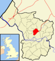
 Boundaries of the council ward, shown within Bristol |
|
| Population | 16,225 (2011.Ward) |
| OS grid reference | ST598755 |
| Unitary authority | |
| Ceremonial county | |
| Region | |
| Country | England |
| Sovereign state | United Kingdom |
| Post town | BRISTOL |
| Postcode district | BS6 |
| Dialling code | 0117 |
| Police | Avon and Somerset |
| Fire | Avon |
| Ambulance | Great Western |
| EU Parliament | South West England |
| UK Parliament |
|
| Councillors | 3 |
| Councillors |
|
Ashley is one of 35 special areas, called council wards, in the city of Bristol in the United Kingdom. This ward includes several interesting neighborhoods like Baptist Mills, Montpelier, St Andrew's, St Paul's, and St Werburgh's. More than 16,000 people live in Ashley. The community even has its own magazine and a group called 'Vocalise' that helps residents.
Contents
Discovering Ashley's Neighborhoods
Ashley is made up of unique areas, each with its own history and feel. Let's explore them!
Baptist Mills: A Historic Spot


Baptist Mills is a small part of Bristol, located between St Werburgh's and Easton. A long time ago, from 1700 to 1840, it was home to a factory that made brass. After that, from 1840 to 1891, a pottery factory operated there. Today, many people think of Baptist Mills as part of St Werburgh's. In the 1800s, a section of Baptist Mills was known as Botany Bay.
Montpelier: A Creative Corner
Montpelier is an area in North Bristol. It's bordered by Cheltenham Road to the west, St Paul's to the south, St Werburgh's to the east, and St Andrew's to the north. It has its own train station. Montpelier is known for being a bit artistic and free-spirited. Picton Street is especially popular for those who enjoy organic and vegetarian food.
Interestingly, Montpelier was developed by French prisoners of war (POWs) during the Napoleonic Wars. Many streets are named after famous generals or have military connections, like Wellington, York, and Banner Roads. Stories say these POWs helped build the foundations for the houses. You can still see some original cobblestones laid by the POWs in the gutters and hidden alleys.
Picton Street was named after Sir Thomas Picton. In 1783, he was a captain who bravely faced a rebellious army group in Bristol, helping to prevent a mutiny. There's even a house on the street, Picton Lodge, named after him.
St Andrew's: A Victorian Suburb
St Andrew's is a suburb of Bristol, about 3 kilometers (1.8 miles) north of the city center. It was built in the late 1800s as the St Andrew's Park Estate. Most of the houses are large Victorian villas. Some newer homes were built between World War I and II, and a few areas were rebuilt after damage during World War II.
The area is generally surrounded by the Severn Beach Railway Line, Gloucester Road, Somerville Road, and Cromwell Road. The exact border can be a bit confusing! The church that gave the area its name, St Andrew's Church, was actually in St Andrew's Road, Montpelier, but it was taken down in 1969.
In the mid-1900s, St Andrew's became less popular, and many large houses were split into several smaller apartments. However, in the 1990s, the area became popular again. Many houses are now being turned back into single family homes.
St Andrew's has good public transport. There are frequent buses from Gloucester Road to different parts of the city. You can also catch buses to the University of West England's Frenchay Campus. A local train service runs from Montpelier to Bristol Temple Meads, Clifton, and Avonmouth on the Severn Beach Line.
St Andrew's Park: Green Space Fun
St Andrew's Park is a central part of the area. The park was created in 1895. It hosts fun events like 'Music in the Park' in summer and 'Carols in the Park' at Christmas. The park has a good-sized play area for children and a paddling pool that's open in the summer. Even though it's on a hill, people use the park for football and frisbee all year. On April 30, 1941, a Wellington bomber plane crashed in the park during a training flight after hitting barrage balloon cables. There is now a memorial in the park to remember this event. You can find more information about the crash on a website.
St Paul's: A Historic Inner Suburb
St Paul's is an inner suburb of Bristol, England. It's located just northeast of the city center and west of the M32. In the early 1700s, it was one of Bristol's first planned suburbs.
St Werburgh's: A Green Village Feel
St. Werburgh's is an area in central north-east Bristol, England. It feels like a green village within the city because it's surrounded by the M32 motorway, railway tracks, and allotment gardens.
The area got its name when St Werburgh's Church was moved and rebuilt in Mina Road in 1879. This church was originally on Corn Street in Bristol. Today, the old church building is an Indoor Climbing Centre called Undercover Rock.
Images for kids
-
Boundaries of the council ward, shown within Bristol
