Atascadero Creek (Santa Barbara County, California) facts for kids
Quick facts for kids Atascadero Creek |
|
|---|---|

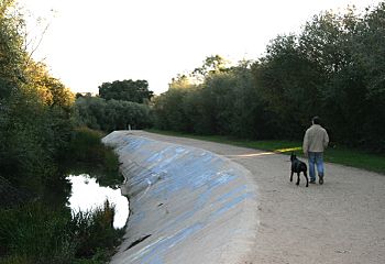
Along the north edge of More Mesa
|
|
|
Location of the mouth in California
|
|
| Country | United States |
| State | California |
| Region | Santa Barbara County |
| Physical characteristics | |
| Main source | Top of Atascadero Canyon, Santa Ynez Mountains 540 ft (160 m) 34°28′5″N 119°45′43″W / 34.46806°N 119.76194°W |
| River mouth | Goleta Slough 7 ft (2.1 m) 34°25′11″N 119°49′44″W / 34.41972°N 119.82889°W |
Atascadero Creek is a small river in Santa Barbara County, California. It flows towards the southwest. Eventually, it empties into the Goleta Slough.
Where Does Atascadero Creek Flow?
Atascadero Creek begins in a place called Atascadero Canyon. This spot is just east of California State Route 154 in Santa Barbara, California.
The creek flows south from its starting point. It then meets another creek called Cieneguitas Creek. Cieneguitas Creek joins Atascadero Creek from the east.
After that, Atascadero Creek turns west. It flows along the northern edge of an area known as More Mesa. As it heads west, other creeks from nearby canyons also flow into it. These include Hospital Creek and Maria Ygnacio Creek. Maria Ygnacio Creek even brings water from San Antonio Creek.
Finally, Atascadero Creek connects with the water from the Goleta Slough. This happens near Mescalitan Island. From there, the creek's water flows into the Pacific Ocean at Goleta Beach County Park.
A Look Back: History of Atascadero Creek
The land around Atascadero Creek has a long history. The area north of the creek, which is now part of Goleta, California and Noleta, was once home to the Chumash people. They used the land for farming.
Later, the land was used for grazing cattle. Over time, it became famous for growing citrus fruits like oranges and lemons. After World War II, many of these citrus farms were turned into neighborhoods with houses.
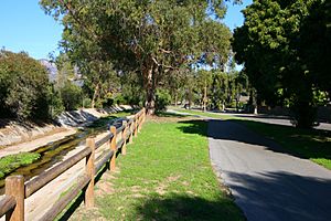
Today, a popular bike path runs next to the creek. This path follows most of the creek's western journey. It goes all the way to Goleta Beach and continues to the University of California, Santa Barbara (UCSB). It's a great spot for people to enjoy nature and get some exercise.
 | Bayard Rustin |
 | Jeannette Carter |
 | Jeremiah A. Brown |


