
Atglen, Pennsylvania facts for kids
Quick facts for kids
Atglen, Pennsylvania
|
|
|---|---|

Atglen Municipal Building in April 2015
|
|

Location of Atglen in Chester County, Pennsylvania (left) and of Atglen in Pennsylvania (right)
|
|

Atglen, Pennsylvania
Location in Pennsylvania

Atglen, Pennsylvania
Location in the United States
|
|
| Country | United States |
| State | Pennsylvania |
| County | Chester |
| Area | |
| • Total | 0.88 sq mi (2.28 km2) |
| • Land | 0.88 sq mi (2.27 km2) |
| • Water | 0.01 sq mi (0.02 km2) |
| Elevation | 489 ft (149 m) |
| Population
(2020)
|
|
| • Total | 1,313 |
| • Density | 1,500.57/sq mi (579.65/km2) |
| Time zone | UTC-5 (EST) |
| • Summer (DST) | UTC-4 (EDT) |
| ZIP Code |
19310
|
| Area code(s) | 610 |
| FIPS code | 42-03384 |
| Website | http://www.atglen.org |
Atglen is a small town, called a borough, located in Chester County, Pennsylvania, in the United States. In 2020, about 1,311 people lived there.
Contents
History of Atglen

The area where Atglen is now was once a wild place. Native Americans created paths through this land. They used these paths to travel and trade. For example, the Great Minquas Path was one of these important trails. They traded with the Swedes and later the English.
Early Settlements in the 1700s
In 1717, a large area called Sadsbury Township was formed. It included many of today's towns and parts of Lancaster County. Because it was so big, people asked to divide it. In 1728, Sadsbury was split into East and West Sadsbury.
More settlers came to Atglen in the mid-1700s because of its good farmland. The old Native American trails became paths for horses. Later, they became wagon tracks. Farmers used these tracks to send their goods to markets. They went to cities like Philadelphia, Newport, Delaware, and New Castle, Delaware. Important roads were built, like the old Provincial Highway in 1730. Newport Road, which led to mines, was built in 1796.
Religious groups also started forming. In 1720, Presbyterians created the Upper Octorara Presbyterian Church. Quakers followed them, building the Sadsbury Meeting House in 1724. A year later, English settlers started St. John's Church. Andrew Moore, who helped found the Sadsbury Meeting House, built a mill on his land around this time.
Atglen Becomes a Borough in the 1800s
The first settlement in this area was called Penningtonville. It even had a post office by that name in 1842. But by the 1870s, people commonly called the town Atglen. In 1876, the court officially changed the name. Penningtonville became the "Borough of Atglen."
Geography of Atglen
Atglen is located at 39°56′53″N 75°58′26″W / 39.94806°N 75.97389°W. The U.S. Census Bureau says the borough covers about 0.9 square miles (2.3 square kilometers). All of this area is land.
Transportation in Atglen
_just_south_of_Pennsylvania_State_Route_372_(Lower_Valley_Road)_in_Atglen,_Chester_County,_Pennsylvania.jpg)
As of 2020, Atglen has about 8.72 miles (14.03 kilometers) of public roads. The Pennsylvania Department of Transportation (PennDOT) takes care of 2.64 miles (4.25 kilometers) of these roads. The borough itself maintains the other 6.08 miles (9.78 kilometers).
Two main highways pass through Atglen. Pennsylvania Route 41 runs from northwest to southeast. It follows Gap Newport Pike through the northeastern part of town. Pennsylvania Route 372 goes east to west. It follows Valley Road, Main Street, and Lower Valley Road through the center of Atglen.
People of Atglen (Demographics)
| Historical population | |||
|---|---|---|---|
| Census | Pop. | %± | |
| 1880 | 347 | — | |
| 1890 | 397 | 14.4% | |
| 1900 | 404 | 1.8% | |
| 1910 | 546 | 35.1% | |
| 1920 | 650 | 19.0% | |
| 1930 | 620 | −4.6% | |
| 1940 | 588 | −5.2% | |
| 1950 | 668 | 13.6% | |
| 1960 | 721 | 7.9% | |
| 1970 | 740 | 2.6% | |
| 1980 | 669 | −9.6% | |
| 1990 | 825 | 23.3% | |
| 2000 | 1,217 | 47.5% | |
| 2010 | 1,406 | 15.5% | |
| 2020 | 1,311 | −6.8% | |
| 2021 (est.) | 1,306 | −7.1% | |
In 2010, most people in Atglen were White (85.6%). About 7.4% were Black or African American. A small number were Native American (0.1%) or Asian (0.2%). About 1.5% were of two or more races. Also, 5.8% of the people had Hispanic or Latino family backgrounds.
In 2000, there were 1,217 people living in Atglen. There were 413 households, which are groups of people living together. Out of these, 317 were families. The town had about 1,377 people per square mile.
Many households (46.2%) had children under 18 living there. Most households (55.9%) were married couples. Some households (16.7%) had a female head with no husband. About 23.2% were not families. The average household had 2.95 people. The average family had 3.33 people.
The population of Atglen included:
- 34.2% under 18 years old
- 9.0% from 18 to 24 years old
- 32.4% from 25 to 44 years old
- 16.6% from 45 to 64 years old
- 7.9% who were 65 years or older
The average age in Atglen was 30 years old. For every 100 females, there were about 94.7 males.
In 2016, the average income for a household in Atglen was about $59,167. About 11.9% of families and 16.8% of all people lived below the poverty line. This included 27.5% of those under 18. It also included 6.1% of those 65 or older.
Education
The schools in Atglen are part of the Octorara Area School District.
Gallery
-
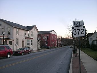
Route 372
-
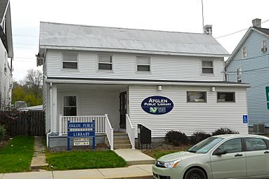
Atglen Library
-
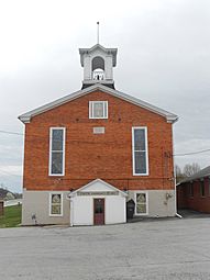
Methodist Episcopal Church
-
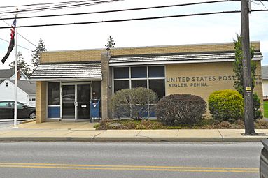
Post Office
-
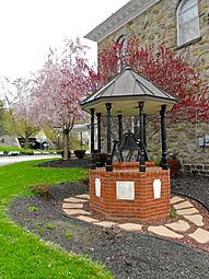
Bell from the original Municipal Building


Notable people
- Thomas J. Philips (1846–1939), a member of the Pennsylvania House of Representatives.
- John A. Reynolds (1820–1889), also a member of the Pennsylvania House of Representatives.
See also
 In Spanish: Atglen para niños
