Attica, Kansas facts for kids
Quick facts for kids
Attica, Kansas
|
|
|---|---|

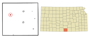
Location within Harper County and Kansas
|
|

|
|
| Country | United States |
| State | Kansas |
| County | Harper |
| Founded | 1884 |
| Incorporated | 1885 |
| Named for | Attica |
| Area | |
| • Total | 0.63 sq mi (1.64 km2) |
| • Land | 0.63 sq mi (1.64 km2) |
| • Water | 0.00 sq mi (0.00 km2) |
| Elevation | 1,453 ft (443 m) |
| Population
(2020)
|
|
| • Total | 516 |
| • Density | 819/sq mi (314.6/km2) |
| Time zone | UTC-6 (CST) |
| • Summer (DST) | UTC-5 (CDT) |
| ZIP code |
67009
|
| Area code | 620 |
| FIPS code | 20-03100 |
| GNIS ID | 2394019 |
Attica is a small city in Harper County, Kansas, United States. In 2020, about 516 people lived there. The city was named after a famous historical region called Attica in Greece.
Contents
History of Attica
Attica began in June 1884 when land was bought for a new community. It became the end point for the Atchison, Topeka, and Santa Fe Railway, which helped it grow. The town officially became a city on February 16, 1885. Back then, it had about 1,500 people!
However, many people moved away in 1893. This happened when a large area of land in northern Oklahoma, called the Cherokee Outlet, was opened up for settlement. People rushed to claim land there, which was known as a Land run.
Most of Attica is located on land that was once part of the Osage Land Trust. This land was held by the U.S. government for the Osage Native American tribe. Settlers could buy sections of land, usually 160 acres, for $1.25 per acre. The money from these sales went to the Osage tribe. For example, some of this land was sold for $12 per acre in 1909.
On May 12, 2004, a strong F2 tornado hit Attica. It caused damage and was shown on many local and national TV news channels.
Geography and Climate
Attica is a small city, covering about 0.64 square miles (1.64 square kilometers) of land. It has no water area.
What is Attica's Climate Like?
Attica has a climate with hot, humid summers. The winters are usually mild to cool. This type of weather is called a humid subtropical climate. On climate maps, it's often shown as "Cfa."
Population Changes Over Time
| Historical population | |||
|---|---|---|---|
| Census | Pop. | %± | |
| 1890 | 553 | — | |
| 1900 | 311 | −43.8% | |
| 1910 | 737 | 137.0% | |
| 1920 | 744 | 0.9% | |
| 1930 | 756 | 1.6% | |
| 1940 | 708 | −6.3% | |
| 1950 | 622 | −12.1% | |
| 1960 | 845 | 35.9% | |
| 1970 | 639 | −24.4% | |
| 1980 | 730 | 14.2% | |
| 1990 | 716 | −1.9% | |
| 2000 | 636 | −11.2% | |
| 2010 | 626 | −1.6% | |
| 2020 | 516 | −17.6% | |
| U.S. Decennial Census | |||
The city's population has changed quite a bit over the years. In 1890, there were 553 people. The population reached its highest point in 1960 with 845 residents. By the 2020 census, the population was 516 people.
In 2020, there were 218 households in Attica. About 31.7% of these households had children under 18 living there. The average age of people in Attica was 47.6 years.
Education in Attica
Students in Attica attend schools in the Attica USD 511 public school district. The sports teams at Attica High School are known as the Bulldogs!
External Links
- City of Attica
- Attica - Directory of Public Officials: https://www.lkm.org/members/?id=41260536
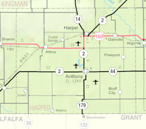
- Attica city map, KDOT
See also
 In Spanish: Attica (Kansas) para niños
 | Emma Amos |
 | Edward Mitchell Bannister |
 | Larry D. Alexander |
 | Ernie Barnes |

