Avon River (Nova Scotia) facts for kids
Quick facts for kids Avon River |
|
|---|---|

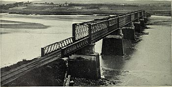
19th-century photograph of the Dominion Atlantic Railway bridge at Windsor
|
|
| Country | Canada |
| Province | Nova Scotia |
| Physical characteristics | |
| River mouth | Minas Basin sea level |
| Length | 64 km (40 mi) |
| Basin features | |
| Basin size | 1,306 km2 (504 sq mi) |
The Avon River is a smaller river located in the middle part of Nova Scotia, Canada. It flows towards the north and is an important natural feature of the region.
Where Does the Avon River Start and End?
The Avon River begins its journey high up on the South Mountain. It starts from Card and Bag Lakes, which are about 145 metres (475 feet) above sea level. This starting point is roughly 29 kilometres (18 miles) southwest of the town of Windsor.
How Long is the Avon River?
The river twists and turns a lot, making its total length about 64 kilometres (40 miles). This winding path is called its meander length.
What Rivers Join the Avon?
As the Avon River flows, other rivers join it, adding to its size. Near a place called Windsor Forks, two main branches come together: the West Branch Avon River and the Southwest Branch Avon. The West Branch Avon River itself starts even higher up, at Black River Lake, about 175 metres (574 feet) above sea level.
In the past, people built hydropower projects on both the Avon and West Branch rivers. These projects use the river's flow to create electricity.
The Avon River's Estuary
Near the community of Martock, the river enters a wide valley carved by glaciers. Here, the river becomes a ria, which is like a drowned river valley. This means the ocean's tides now affect the river's flow. It forms an estuary, which is a special area where fresh river water mixes with salty ocean water. This estuary continues all the way to the Minas Basin, which is part of the larger Bay of Fundy.
Another important river, the St. Croix River, joins the Avon just below Windsor. When you add up all the land that drains water into the Avon River and its branches, it covers a huge area of 1,306 square kilometres (504 square miles). This entire area is called its watershed.
Other Rivers Flowing Into the Avon
Several other rivers also contribute their water to the Avon River. These include:
- The Halfway River
- The Herbert River
- The Cogmagun River
- The Kennetcook River
- The St. Croix River
History of the Avon River on Maps
The Avon River has been known for a very long time. You can see it on many of the earliest maps of the region. For example, a detailed map from 1686 by Jean-Baptiste-Louis Franquelin clearly shows the Avon River and all the land that drains into it. This shows how important the river was even centuries ago.
 | James B. Knighten |
 | Azellia White |
 | Willa Brown |

