Back River (Kennebec River tributary) facts for kids
Quick facts for kids Back River |
|
|---|---|

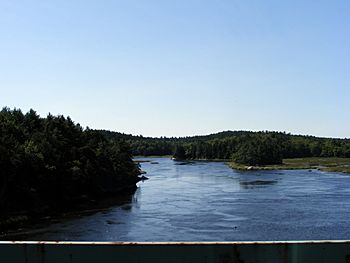
Back River as seen from the Route 127 bridge near Arrowsic
|
|
 |
|
| Physical characteristics | |
| Main source | Wiscasset, Maine 43°59′35″N 69°39′51″W / 43.99306°N 69.66417°W |
| River mouth | Georgetown, Maine 0 m (0 ft) 43°48′10″N 69°47′0″W / 43.80278°N 69.78333°W |
| Length | 16 miles (26 km) |
| Basin features | |
| River system | Kennebec - Sheepscot |
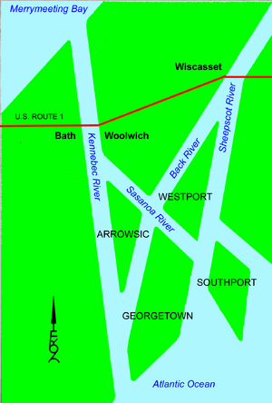
The Back River is a 16-mile (26 km) long waterway in the state of Maine, USA. It is part of a special area where the Sheepscot River and the Kennebec River meet the ocean. This meeting point is called an estuary.
The Back River connects the town of Wiscasset on the Sheepscot River to Georgetown on the Kennebec River. Along its path, it also crosses another channel called the Sasanoa River at a place known as Hockomock Bay.
Contents
Where the Back River Flows
The Back River is like a natural shortcut between two bigger rivers. It helps connect the Sheepscot River and the Kennebec River. This makes it an important waterway for boats and local wildlife.
Connecting Towns
The river starts near Wiscasset, which is on the Sheepscot River. It then flows south until it reaches Georgetown, which is on the Kennebec River. This connection helps link different parts of coastal Maine.
Meeting Other Waterways
The Back River doesn't just flow by itself. It meets up with the Sasanoa River at Hockomock Bay. This area is a network of channels and bays.
Another Back River?
About 4 miles (6.4 km) south of where the Back River begins, there is another waterway also called Back River. This second waterway connects directly to the Sheepscot River. It can be a bit confusing, but they are different channels.
Bridges Over the River
Several bridges cross the Back River, making it easier for people to travel between islands and the mainland.
Northern Bridges
Maine State Route 144 crosses the northern part of the Back River. This bridge connects Wiscasset to Westport Island.
Southern Bridges
Further south, Maine State Route 127 crosses a narrower part of the river. This bridge is near Arrowsic. It connects Arrowsic Island to Georgetown Island.
Nearby Landmarks
The Back River flows past some important places.
Former Power Plant Site
On the northern part of the Back River, you can find the site of the Maine Yankee Nuclear Power Plant. This power plant used to produce electricity, but it is no longer operating. It has been safely taken apart.
 | Bayard Rustin |
 | Jeannette Carter |
 | Jeremiah A. Brown |

