Back River (Powwow River tributary) facts for kids
Quick facts for kids Back River |
|
|---|---|
| Country | United States |
| States | New Hampshire, Massachusetts |
| Counties | Rockingham, NH, Essex, MA |
| Towns | Kensington, NH, South Hampton, NH, Amesbury, MA |
| Physical characteristics | |
| Main source | Kensington, Rockingham County, New Hampshire 150 ft (46 m) 42°54′26″N 70°57′57″W / 42.90722°N 70.96583°W |
| River mouth | Powwow River Amesbury, Essex County, Massachusetts 0 ft (0 m) 42°51′20″N 70°55′38″W / 42.85556°N 70.92722°W |
| Length | 6.5 mi (10.5 km) |
| Basin features | |
| Tributaries |
|
The Back River is a small but important river in the United States. It flows through parts of New Hampshire and Massachusetts. This river is about 6.5-mile-long (10.5 km). It is a smaller stream, also called a tributary, that flows into the Powwow River. The Powwow River then joins the larger Merrimack River. This means the Back River is part of the huge watershed of the Merrimack River.
Contents
Back River: A Small but Important Waterway
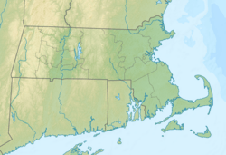
The Back River is a relatively short river. It starts in Kensington, New Hampshire. From there, it flows southeast. Almost immediately, it enters the town of South Hampton, New Hampshire.
Where Does the Back River Flow?
The river then turns south. It crosses the state line into Massachusetts. Here, it flows through the town of Amesbury, Massachusetts. The Back River finally joins the Powwow River in Amesbury. This meeting point is near the center of Amesbury. It is just downstream from the Powwow River's falls.
About 3.0 miles (4.8 km) of the Back River are in New Hampshire. The remaining 3.5 miles (5.6 km) are in Massachusetts.
A Look Back in Time: The River's History
Long ago, before European settlers arrived in the early 1600s, the Pennacook tribe of Native Americans lived in this area. They used both the Back River and the larger Powwow River. These rivers were important for travel and for catching fish. The native population in the area significantly decreased around 1617-1619.
Clarks Pond: A Modern Change
In the 1950s, a structure called the Clarks Pond Dam was built. This dam is located in Amesbury, Massachusetts. It created a body of water known as Clarks Pond.
Since the pond was created, it has faced some challenges. A report in 2013 said the pond was "threatened." This is mainly due to runoff from homes nearby. Runoff is water that flows over land and picks up things like dirt and pollutants. This can lead to silt deposits, which are layers of fine dirt and sand. These issues can affect the health of the pond and the river.
 | Sharif Bey |
 | Hale Woodruff |
 | Richmond Barthé |
 | Purvis Young |


