Powwow River facts for kids
Quick facts for kids Powwow River |
|
|---|---|

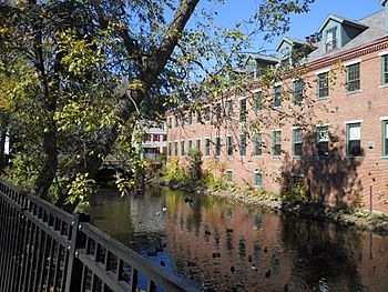
The Powwow River in downtown Amesbury, MA
|
|
| Country | United States |
| States | New Hampshire, Massachusetts |
| Counties | Rockingham, NH, Essex, MA |
| Towns and city | Danville, NH, Kingston, NH, East Kingston, NH, South Hampton, NH, Amesbury, MA |
| Physical characteristics | |
| Main source | Danville, NH 165 ft (50 m) 42°56′0″N 71°7′52″W / 42.93333°N 71.13111°W |
| River mouth | Merrimack River Amesbury, MA 0 ft (0 m) 42°50′26″N 70°55′28″W / 42.84056°N 70.92444°W |
| Length | 22.8 mi (36.7 km) |
| Basin features | |
| Tributaries |
|
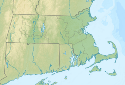
The Powwow River is a 22.8-mile (36.7 km) long river located in New Hampshire and Massachusetts in the United States. It is a tributary of the Merrimack River. This means it's a smaller river that flows into the larger Merrimack River. The Powwow River is part of the Gulf of Maine watershed, which is the area of land where all the water drains into the Gulf of Maine.
Contents
River Course
Where the River Starts
The Powwow River begins in the middle of Danville, New Hampshire. It then flows southeast through a pond called Long Pond.
Journey Through Ponds
Next, the river enters Kingston. Here, it flows into a large body of water called Great Pond, which is about 268 acres big. After leaving Great Pond, the river goes through many wet areas, like swamps. It also gets water from a major stream called the outlet of Country Pond. This pond is in Kingston and Newton.
The Powwow River continues east and enters Powwow Pond. It then passes into the southwest part of East Kingston. Here, the river flows over Trickling Falls Dam, near Route 107.
Flowing to the Merrimack
The river then turns southeast and enters South Hampton. It flows into Tuxbury Pond and crosses into Amesbury, Massachusetts. After leaving Tuxbury Pond, the river winds east along the state line. It then fully enters Massachusetts at Lake Gardner. Finally, the river flows through the center of Amesbury. It drops over several falls and rapids before joining the Merrimack River.
Falls in Amesbury
The river drops about 90 feet (27 m) as it flows through the center of Amesbury. This big drop created a lot of water power. This power was very important for the early factories and industries in the town.
The falls in Amesbury are quite interesting to see. You can spot old machinery, dams, and buildings all around them. The river even flows underneath a historic building in the middle of town! Sometimes, when there's a lot of rain, the Powwow River can flood. This has made national news because of the risk to these old, historic buildings in Amesbury.
Atlantic White Cedar Swamps
Between Country Pond and Powwow Pond, the Powwow River area is home to something very special. It has the largest group of Atlantic white cedar swamp forests in New Hampshire.
Why These Swamps Are Special
Atlantic white cedar swamps are a very rare type of natural area around the world. In New Hampshire, there are about 500,000 acres (200,000 ha) of wetlands. But only about 550 acres (220 ha) of these are Atlantic white cedar swamps. This shows how unique and important they are!
Protecting the Swamps
In 2004, an organization called The Nature Conservancy bought 50 acres (20 ha) of land here. This land included more than 3,000 feet (910 m) along the Powwow River. It also covered almost all of a large Atlantic white cedar swamp.
In 2006, The Nature Conservancy bought four more pieces of land. These added up to 41.8 acres (16.9 ha) and gave another 1,300 feet (400 m) of river access. This helped protect the swamp even more. The goal is to protect a large area of over 900 acres (360 ha) in total. This will keep the river and its special habitats safe. It will also create places for people to enjoy boating, hunting, fishing, and watching wildlife.
Other Unique Ecosystems
The area of the river between Country Pond and Powwow Pond is also a great example of a streamside fen ecosystem. A fen is a type of wetland that gets its water from groundwater. This area is also located over one of southeastern New Hampshire's largest and most productive aquifers. An aquifer is an underground layer of rock or sand that holds groundwater.
 | Sharif Bey |
 | Hale Woodruff |
 | Richmond Barthé |
 | Purvis Young |


