Bajo, Patillas, Puerto Rico facts for kids
Quick facts for kids
Bajo
Bajos
|
|
|---|---|
|
Barrio
|
|

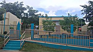
Elementary school in Bajos
|
|

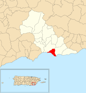
Location of Bajo within the municipality of Patillas shown in red
|
|
| Lua error in Module:Location_map at line 416: Malformed coordinates value. | |
| Commonwealth | |
| Municipality | |
| Area | |
| • Total | 2.66 sq mi (6.9 km2) |
| • Land | 1.21 sq mi (3.1 km2) |
| • Water | 1.45 sq mi (3.8 km2) |
| Elevation | 0 ft (0 m) |
| Population
(2010)
|
|
| • Total | 1,530 |
| • Density | 1,264.5/sq mi (488.2/km2) |
| Source: 2010 Census | |
| Time zone | UTC−4 (AST) |
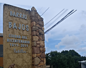
Bajo (also known as Barrio Bajo or Bajos) is a special part of Patillas, Puerto Rico. It's like a neighborhood or a small community within the larger area of Patillas. In 2010, about 1,530 people lived in Bajo.
Contents
History of Bajo
How Puerto Rico Became Part of the U.S.
The history of Bajo is connected to the history of Puerto Rico. After the Spanish–American War, Spain gave Puerto Rico to the United States. This happened in 1898 as part of a big agreement called the Treaty of Paris of 1898. Because of this, Puerto Rico became an unincorporated territory of the United States. This means it's a territory that belongs to the U.S. but isn't a state.
Early Population Counts
In 1899, the United States Department of War conducted a census in Puerto Rico. A census is like a big count of all the people living in an area. This first census found that Bajo and a nearby area called Jacaboa had a combined population of 1,198 people.
Bajo's Population Over Time
The number of people living in Bajo has changed over many years. Here's how the population has grown and shrunk according to different censuses:
| Historical population | |||
|---|---|---|---|
| Census | Pop. | %± | |
| 1910 | 691 | — | |
| 1920 | 741 | 7.2% | |
| 1930 | 800 | 8.0% | |
| 1940 | 835 | 4.4% | |
| 1950 | 1,328 | 59.0% | |
| 1980 | 1,686 | — | |
| 1990 | 1,716 | 1.8% | |
| 2000 | 1,722 | 0.3% | |
| 2010 | 1,530 | −11.1% | |
| U.S. Decennial Census 1899 (shown as 1900) 1910-1930 1930-1950 1980-2000 2010 |
|||
Sectors of Bajo
What are Barrios and Sectors?
In Puerto Rico, a "barrio" is like a major division of a municipality, similar to a township or a large neighborhood. These barrios are then divided into even smaller local areas. These smaller areas are called sectores (which means sectors in English).
Types of Sectors
The names for these sectors can be different. Some are just called "sector," while others might be named "urbanización" (a planned housing development), "reparto" (a land division), "barriada" (a neighborhood), or "residencial" (a housing project).
Sectors in Bajo
Here are some of the specific sectors you can find within the Bajo barrio:
- Calle El Fuego
- Carretera 3
- Sector Barro Blanco
- Sector Villa Marina
- Sector Villa Pesquera
- Urbanización Solimar
See also
 In Spanish: Bajo (Patillas) para niños
- List of communities in Puerto Rico
- List of barrios and sectors of Patillas, Puerto Rico
 | James B. Knighten |
 | Azellia White |
 | Willa Brown |


