Bangham Conservation Park facts for kids
Quick facts for kids Bangham Conservation ParkSouth Australia |
|
|---|---|
|
IUCN Category III (Natural Monument)
|
|
| Nearest town or city | Naracoorte |
| Established | 22 November 1973 |
| Area | 8.69 km2 (3.4 sq mi) |
| Visitation | 'low level' (in 1992) |
| Managing authorities | Department for Environment and Water |
| See also | Protected areas of South Australia |
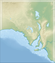
Bangham Conservation Park is a special protected area in South Australia. It's located in a region called the Limestone Coast. You can find it in the area known as Bangham, about 45 kilometers (around 28 miles) north-east of the town of Naracoorte. This park helps protect important natural environments.
About Bangham Conservation Park
Bangham Conservation Park covers a specific piece of land. It is bordered by a road called Bordertown-Frances Road on its west side. Another road runs along its southern edge. On the eastern side, you'll find the Bordertown – Naracoorte railway line.
In 1992, there were already tracks built along the northern and eastern parts of the park. An area for an electricity power line also passed through the western side. This shows how the park fits into the local landscape.
History of the Park
The land that makes up Bangham Conservation Park first became a protected area in 1973. At that time, it was officially named Bangham Conservation Park. Later, in 2010, more land was added to the northern part of the park. This made the park a bit bigger, allowing more nature to be protected.
Why the Park Was Created
The land was offered to the government of South Australia in 1971. The idea was to use it for conservation, which means protecting nature. Back then, most of the land was covered in "native scrub," which is natural bushland. A smaller part was cleared land.
Scientists studied the area and found something very important. Red-tailed black cockatoos were using this land. These birds were not found in many other places in South Australia. Because of these special birds, the land was considered perfect for conservation.
Landscape and Plants
The park's landscape is an undulating plain, which means it has gentle rolling hills. It's made of sand from a very old time period called the Tertiary period. There are also sand dunes and sheets of sand that have been moved by the wind.
Sometimes, you might see sinkholes or small dips in the ground. These are formed when the underlying limestone dissolves. The soils in the park are generally sandy and deep.
Types of Trees
In 1982, experts noted three main types of plant groups in the park:
- An "open forest - woodland" area with South Australian blue gum trees.
- Areas that sometimes flood have river red gum trees.
- Another "open forest - low open forest" area is home to brown stringybark trees.
Visiting the Park
In 1992, not many people visited Bangham Conservation Park. Most visitors were local people. Sometimes, field naturalists (people who study nature) and bird observers (people who watch birds) would come from further away. The park does not have any special facilities for visitors, like picnic areas or restrooms. It's mostly for quiet observation of nature.
Protection Status
Bangham Conservation Park is classified as an IUCN Category III protected area. This means it's recognized internationally for protecting a specific natural feature or monument. In this case, it helps protect the unique landscape and the wildlife, like the red-tailed black cockatoos.
 | James Van Der Zee |
 | Alma Thomas |
 | Ellis Wilson |
 | Margaret Taylor-Burroughs |


