Banjarmasin facts for kids
Quick facts for kids
Banjarmasin
|
|||
|---|---|---|---|
|
City
|
|||
| Other transcription(s) | |||
| • Jawi | بنجر ماسين | ||
| • Chinese | 马辰/馬辰 Mǎ chén (Pinyin) |
||
|
Clockwise from top:
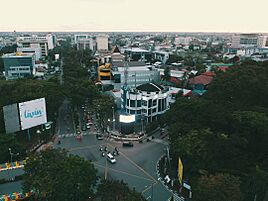
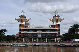
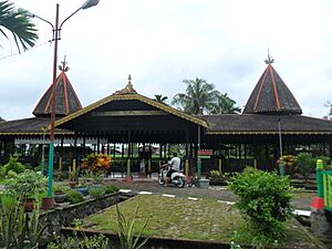
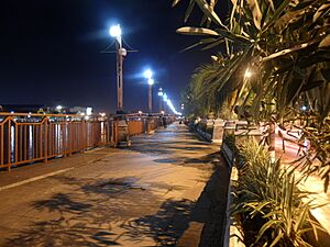
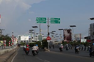
Banjarmasin seen from above, Soetji Nurani Chinese Temple, Banjarmasin watchtower, and Banjarmasin floating market. |
|||
|
|||
| Nicknames:
Kota Seribu Sungai (Indonesian: City of Thousand Rivers)
|
|||
| Motto(s):
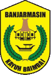
Kayuh Baimbai (Banjarese: 'Rowing Together')
|
|||
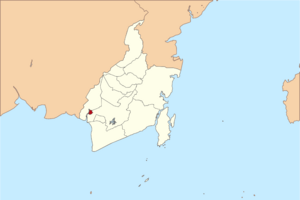
Location of Banjarmasin within South Kalimantan
|
|||
| Country | |||
| Region | Kalimantan | ||
| Province | |||
| Established | 24 September 1526 | ||
| Area | |||
| • City | 98.46 km2 (38.02 sq mi) | ||
| • Metro | 6,945.67 km2 (2,681.74 sq mi) | ||
| Elevation | 1 m (3 ft) | ||
| Population
(mid 2023 estimate)
|
|||
| • City | 675,915 | ||
| • Density | 6,864.9/km2 (17,779.9/sq mi) | ||
| • Metro | 2,041,014 | ||
| • Metro density | 293.85416/km2 (761.0788/sq mi) | ||
| Time zone | UTC+8 (WITA) | ||
| Area code(s) | +62 511 | ||
| HDI (2023) | |||
Banjarmasin is a big city in South Kalimantan, Indonesia. It used to be the capital of the province until 2022. The city is built on a delta island. It sits where the Barito and Martapura rivers meet.
Banjarmasin is the heart of Banjarese culture. It was once the capital of the Sultanate of Banjar. Today, it is the largest city in South Kalimantan. It is also one of the most important cities on the island of Kalimantan. The city covers about 98.46 square kilometers. In mid-2023, about 675,915 people lived there. This makes it the third most populated city on the island of Borneo.
The larger area around Banjarmasin is called Banjarbakula. This area includes Banjarmasin, Banjarbaru city, and parts of other nearby regions. Over two million people live in this wider area. It covers about 6,945 square kilometers.
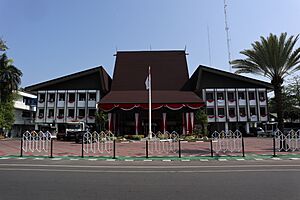
Banjarmasin was the official home for the South Kalimantan governor and the provincial parliament. However, some government buildings have moved to Banjarbaru. In February 2022, Banjarbaru officially became the new capital of South Kalimantan province.
Contents
Exploring Banjarmasin's Past
Negara Dipa (1380–1478)
Negara Daha (1478–1520)
![]() Banjar Sultanate (1520–1526)
Banjar Sultanate (1520–1526)
Demak Sultanate (1526–1546)
![]() Banjar Sultanate (1546–1635)
Banjar Sultanate (1546–1635)
![]() VOC (1635–1638)
VOC (1635–1638)
![]() Banjar Sultanate (1638–1701)
Banjar Sultanate (1638–1701)
![]() England (1701–1707)
England (1701–1707)
![]() Banjar Sultanate (1707–1787)
Banjar Sultanate (1707–1787)
![]() Dutch Republic (1787–1795)
Dutch Republic (1787–1795)
![]() Batavian Republic (1795–1806)
Batavian Republic (1795–1806)
![]() Dutch East Indies (1806–1809)
Dutch East Indies (1806–1809)
![]() Banjar Sultanate (1809–1815)
Banjar Sultanate (1809–1815)
![]() Kingdom of Great Britain and Ireland (1815–1816)
Kingdom of Great Britain and Ireland (1815–1816)
![]() Dutch East Indies (1817–1942)
Dutch East Indies (1817–1942)
![]() Empire of Japan (1942–1945)
Empire of Japan (1942–1945)
![]() Dutch East Indies (1945–1949)
Dutch East Indies (1945–1949)
![]() Indonesia (1949–today)
Indonesia (1949–today)
How Banjarmasin Got Its Name
The name "Banjarmasin" likely comes from "Bandar Masih." This means "Port Masih." It was named after Patih Masih, who was a local leader. His name, Masih, might have come from the Ngaju language. In that language, Oloh Masi means coastal people. These were the Malay people who lived near the coast. Dayaks from inland often visited the port to trade. Some Dayaks later settled there. They, along with Javanese and Malays, helped shape the Banjarese culture.
Ancient Times and Kingdoms
In 1939, an archeologist found old tools around Banjarmasin. These tools, like stone choppers, show that people lived here long ago. Many artifacts found suggest a Neolithic (New Stone Age) culture. People might have moved from mainland Asia to Borneo when the lands were connected.
Before the 15th century, not many written records were found. But other records show that kingdoms like Tanjungpuri, Negara Daha, and Dipa existed. These kingdoms were founded by Malay and Javanese people. Hinduism and Buddhism came to the region during this time. Two old temples, Candi Laras and Candi Agung, still remain.
The city's history really began with the founding of the Sultanate of Banjar. A folk story says that Raden Samudra, a prince, had to flee. He went to the area that became Banjarmasin. There, he met Patih Masih. Under Samudra, the port grew into Bandar Masih. When another prince tried to attack, Samudra got help from the Demak Sultanate. He promised to become Muslim if he won. After winning, he became Sultan Suriansyah I and founded the Banjar Sultanate.
Colonial Period and Conflicts
Europeans first traded with the Banjar people in the late 1500s. The Dutch East India Company later gained control of the spice trade. But they were kicked out in 1638 after a war with the Sultan. The English also tried to trade but were expelled.
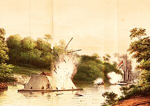
After the Napoleonic Wars, the British briefly controlled Banjarmasin. But soon, the Dutch took over again. A conflict over who would rule and control coal mines led to a war. This war, known as the Banjarmasin War, lasted many years. It ended the Sultanate in 1863. Many Banjar people moved to other places like Sumatra and Malaysia because of the war.
Modern History and Growth
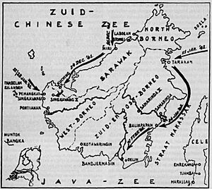
During World War II, the Japanese army occupied Banjarmasin. After the war, the Dutch tried to return. But Indonesian nationalists fought for independence in the Kalimantan Physical Revolution. Indonesia finally gained independence in 1949.
Banjarmasin became the capital of the new South Kalimantan province. Because of frequent flooding, the provincial capital eventually moved to Banjarbaru. Banjarmasin officially became a city in 1959.
In 1997, the city experienced a major event. It was a riot that caused damage and loss of life. Locals remember it as Jumat Kelabu, or Grey Friday. The city has since recovered and continued to grow.
Banjarmasin's Location and Weather
Banjarmasin is located in the Barito River area. The Martapura River also flows through it. The city is mostly flat and low-lying. It is built on clay and sand. Many smaller rivers connect to the main rivers, creating a network. The river system is affected by ocean tides. Because it's in a swampy area, the city can sometimes flood when tides are high.
The city covers about 98.46 square kilometers. To its north and west is the Barito Kuala Regency. To its east and south is the Banjar Regency.
Banjarmasin's Climate
Banjarmasin has a tropical savanna climate. This means it has a wet season and a dry season. Heavy rain falls from November to June. From July to October, there is moderate rainfall.
Temperatures usually range from 26°C to 38°C. The average high is about 33°C, and the average low is 22°C. Rainfall can be between 2,400 mm and 3,500 mm each year. The hottest months are from March to September. January is the wettest month, and September is the driest.
How Banjarmasin is Governed
Like other Indonesian cities, Banjarmasin is run by a mayor and a vice mayor. They work with the city parliament. The mayor, vice mayor, and parliament members are chosen by the people in elections.
City Districts
The city is divided into five main areas called districts (kecamatan).
- South Banjarmasin
- East Banjarmasin
- West Banjarmasin
- Central Banjarmasin
- North Banjarmasin
Central Banjarmasin is the most crowded district. South Banjarmasin has the fewest people per square kilometer. Each district has several smaller areas called villages (kelurahan).
City Politics
Banjarmasin is part of South Kalimantan's larger political system. At the city level, Banjarmasin has five electoral districts. These districts choose a total of 45 representatives for the city parliament.
Greater Banjarmasin Area
The Banjarmasin metropolitan area is much larger than the city itself. It's called Banjarbakula. This area includes Banjarmasin and Banjarbaru cities. It also includes large parts of three other regions:
- Banjar Regency
- Barito Kuala Regency
- Tanah Laut Regency
This entire area covers about 6,945 square kilometers. Over two million people live in Banjarbakula.
Banjarmasin's Economy
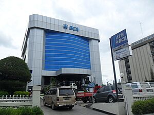
Banjarmasin's economy mainly relies on manufacturing. This includes making things like food and drinks. Trade is the second biggest part of the economy. The finance sector, like banks, is also very important. Farming is a smaller part of the city's economy. Unlike nearby areas, there is no mining within the city.
In 2020, the economy slowed down because of the COVID-19 pandemic. The city imports many goods through its main port, the Port of Trisakti. It also exports a lot of goods.
Industries in the City
Most of the industries in Banjarmasin focus on making food and drinks. This includes bread, flour, and soybean sauce. Other industries make rubber and plastic products. There are also companies that make machinery, medicines, paper, and electrical items.
In 2020, there were over 3,000 industrial companies in the city. They employed more than 22,000 people. There are also many smaller businesses that make wood furniture, clothes, and snacks.
Tourism and Finance
Banjarmasin has many hotels. In 2020, over 100,000 local tourists visited the city. There were also a few hundred foreign tourists. The city has many potential tourist spots. However, tourism is still a small part of the city's economy.
The finance sector, which includes banks and insurance, has been growing steadily. Banjarmasin is a major center for financial activities in the province.
People and Culture of Banjarmasin
Most people in Banjarmasin have lived there for at least six months. In 2020, about 657,663 people lived in the city. There were slightly more females than males overall. A large part of the population is young, with many people aged 15 and above.
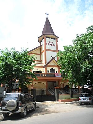
The main religion in Banjarmasin is Islam. About 95% of the people are Muslim. There are also smaller groups of Christians (Protestants and Catholics), Hindus, Buddhists, and Confucianists.
Most of the city's people are Banjarese. They make up about 79% of the population. Other groups include Javanese, Madurese, Chinese Indonesian, Dayak, and Bugis people. There is also a small Arabic community.
Banjarese Culture
The main culture in Banjarmasin is the Banjarese culture. It is known as a "river culture." It has been shaped by other groups like Dayak, Javanese, Malay, Arab, and even Persian people. Even though most Banjarese are Muslim, they still keep some traditions from their Hindu-Buddhist past. One example is the Malanuh ceremony, which is an offering.
A big annual event is Haul Guru Sekumpul. This event honors a respected religious leader named Zaini Abdul Ghani.
A famous cultural sight is the floating market on the Kuin River and Lok Baintan. People meet on the river in small boats to buy and sell things. They sell snacks, vegetables, fruits, and meat. However, this market is becoming less popular as people move away from river life. The city also has a cultural center. Traditional artists often perform there to help keep Banjarese culture alive.
City Parks and Fun Places
Banjarmasin has several parks and public spaces. One of the most famous is Siring Park. It's in the city center, along the Martapura River. It's sometimes called "0 Kilometer Park." The park has a watchtower, gazebos, walking paths, and a skateboard park. There's also a 6.5-meter statue of a bekantan (Proboscis monkey). This monkey is native to the region and is a city landmark. Siring Park is also a popular spot for street food in the evenings.
Other parks include Kamboja Park and Bungas Banjarmasin Park. Banua Anyar Public Space is designed for young children. It has a kids' park, soft artificial grass, and reading corners.
Shopping and Entertainment
Banjarmasin has several shopping malls. Duta Mall Banjarmasin is the biggest in the province. It has four stories and is connected to a hotel. Other entertainment spots include Trans Studio Mini Banjarmasin, an indoor theme park. There are also other malls like Mitra Plaza, Lotte Mart, and Giant. Mitra Plaza is one of the city's oldest malls. Besides modern malls, the city also has many traditional markets.
Getting Around Banjarmasin
The city has over 790 kilometers of roads, mostly paved. Banjarmasin is connected to the Trans-Kalimantan Highway Southern Route. This highway links it to other big cities like Palangka Raya and Samarinda.
The main bus terminal for long-distance buses used to be Kilometer 6 Bus Terminal. It has moved to a new, larger terminal outside the city. However, many bus operators still prefer the old terminal because it's closer to the city center.
Since the city is divided by a large river, speed boats are an important way to travel. Ride-hailing services like Gojek and Grab are also very popular. The city has urban bus services like BRT Banjarbakula and Trans Banjarmasin. These buses connect the city to the wider metropolitan area. There are also angkots (shared taxis), but their use is declining.
The city is served by the Port of Trisakti. This is one of Indonesia's main ports. It has a passenger terminal for ships going to other islands like Java and Sulawesi. The closest airport is Syamsudin Noor International Airport. It is located in Banjarbaru city, about 29 kilometers from Banjarmasin.
Media in Banjarmasin
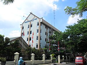
Banjarmasin is a hub for mass media in South Kalimantan. Many newspapers, television stations, and radio stations are based here. Well-known newspapers include Banjarmasin Post and Kalimantan Post. There are also many smaller online news outlets.
For television, besides national channels, there are local stations like Duta TV and Banjar TV. These channels focus on local news. The city also has a branch of Radio Republik Indonesia, which is a state-owned radio network. In total, there are many registered radio stations in Banjarmasin.
 | Janet Taylor Pickett |
 | Synthia Saint James |
 | Howardena Pindell |
 | Faith Ringgold |


