Banner Peak facts for kids
Quick facts for kids Banner Peak |
|
|---|---|

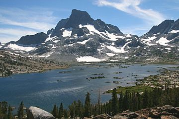
Banner Peak from Thousand Island Lake
|
|
| Highest point | |
| Elevation | 12,942 ft (3,945 m) NAVD 88 |
| Prominence | 856 ft (261 m) |
| Parent peak | Mount Ritter |
| Listing |
|
| Geography | |
| Location | Madera County, California, U.S. |
| Parent range | Ritter Range, Sierra Nevada |
| Topo map | USGS Mount Ritter |
| Geology | |
| Age of rock | Cretaceous |
| Mountain type | Metavolcanic rock |
| Climbing | |
| First ascent | 1883 by Willard D. Johnson and John Miller |
| Easiest route | Scramble, class 2 |
Banner Peak is a really tall mountain in California. It's the second highest peak in a mountain range called the Ritter Range, which is part of the bigger Sierra Nevada mountains. This amazing peak stands at 12,942 feet (about 3,945 meters) tall.
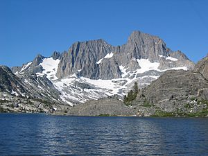
You can find Banner Peak inside the Ansel Adams Wilderness. This is a special protected area where nature is kept wild. Around the base of the mountain are beautiful lakes like Garnet Lake, Lake Ediza, and the famous Thousand Island Lake. Other nearby lakes include Lake Catherine and Shadow Lake.
Where is Banner Peak?
Banner Peak is located in Madera County, California, in the U.S.. It's part of the Ritter Range, which is a smaller mountain group within the larger Sierra Nevada mountain range.
The mountain is quite close to the town of Mammoth Lakes. From there, people who love to climb can start their journey. They hike to the base of the mountain to find different paths to the top.
How to Climb Banner Peak
Climbing Banner Peak is an exciting adventure. The easiest way to reach the top is a route called a "scramble." This means you might need to use your hands sometimes, but it's not like difficult rock climbing.
- The easiest path starts from the west end of Thousand Island Lake.
- From there, climbers head towards the saddle. A saddle is a low point between two mountain peaks.
- This saddle is located between Banner Peak and its slightly taller neighbor, Mount Ritter.
How Banner Peak Got Its Name
The name "Banner Peak" was given in 1883. A mapmaker named Willard D. Johnson from the USGS named it.
He noticed something cool happening at the top of the mountain. A special kind of cloud, called a "banner cloud," was streaming away from the summit. It looked like a flag or banner waving from the peak! This natural sight gave the mountain its unique name.
 | Valerie Thomas |
 | Frederick McKinley Jones |
 | George Edward Alcorn Jr. |
 | Thomas Mensah |


