Basra Governorate facts for kids
Quick facts for kids
Basra Governorate
محافظة البصرة
Basra Province
|
|||
|---|---|---|---|
|
|||
 |
|||
| Country | |||
| Capital | Basra | ||
| Area | |||
| • Total | 19,070 km2 (7,360 sq mi) | ||
| Population
(2018 Estimate)
|
|||
| • Total | 2,900,000 | ||
| ISO 3166 code | IQ-BA | ||
| HDI (2017) | 0.687 medium |
||
| Website | basrahgov.com | ||
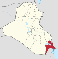
Basra Governorate (Arabic: محافظة البصرة Muḥāfaẓa al-Baṣra), also known as Basra Province, is a region in southern Iraq. It borders Kuwait to the south and Iran to the east. The main city and capital is Basra.
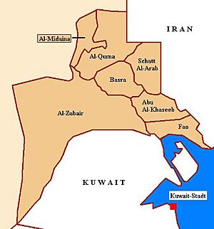
Basra Governorate is special because it's the only part of Iraq that has a coastline. This coast is along the Persian Gulf. Other important areas in Basra include Al-Qurna, Al-Zubair, Al-Midaina, Shatt Al-Arab, Abu Al-Khaseeb, and Al-Faw.
Contents
History of Basra Governorate
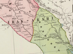
After World War I ended in 1918, the Ottoman Empire was defeated. In 1920, the United Kingdom took control of the Basra region. This area, along with Baghdad and Mosul, became known as the Mandate for Mesopotamia. This was a territory managed by Britain.
In 1932, the British Mandate ended. The area then became part of the new Kingdom of Iraq.
The city of Basra faced many challenges. It was greatly affected during the eight-year war with Iran. Later, during the Gulf War in 1991, the people in Basra started an uprising. They hoped for help from the United States.
The uprising began in Basra when soldiers protested. Many people joined in, removing symbols of Saddam Hussein. They expected support from American troops nearby. However, the Allied army was busy elsewhere.
The city did not fully fall to the rebels. About 6,000 loyal soldiers fought against 5,000 Iraqi army defectors. After a few days, the loyal forces took back control. They suppressed the uprising and many rebels were killed.
From 2003, Basra Governorate became a key area during the Iraq War. The Battle of Basra happened between March and April 2003. British forces fought against Iraqi forces. Much of the fighting in the war took place in this province.
Later, in 2006, there were some conflicts between different groups. In September 2007, British troops moved to Basra Airport. They left the city completely in December 2007.
Basra has considered joining with nearby provinces like Dhi Qar and Maysan. They want to form an autonomous region, similar to the Kurdistan Autonomous Region in northern Iraq. In 2005, a large number of people in Basra voted for the new constitution.
During the Gulf War, a part of Kuwait was briefly added to Basra Governorate. It was called Saddamiyat al-Mitla' District.
Population Changes
| Historical population | ||
|---|---|---|
| Year | Pop. | ±% p.a. |
| 1977 | 1,008,600 | — |
| 1987 | 872,176 | −1.44% |
| 1997 | 1,556,445 | +5.96% |
| 2009 | 2,405,434 | +3.69% |
| 2018 | 2,908,491 | +2.13% |
| Source: Citypopulation | ||
Government Leaders
The Basra Governorate has its own leaders:
- Governor: Asaad Al Eidani
- Deputy Governor: Mohammed Tahir
- Provincial Council Chairman (PCC): Sabah Al Bazooni
Areas within Basra
Basra Governorate is divided into several smaller areas called districts:
- Abu Al-Khaseeb
- Basra
- Al-Faw
- Al-Midaina
- Al-Qurna
- Shatt Al-Arab
- Al-Zubair
More to Explore
 In Spanish: Gobernación de Basora para niños
 | William M. Jackson |
 | Juan E. Gilbert |
 | Neil deGrasse Tyson |


