Bay, Arkansas facts for kids
Quick facts for kids
Bay, Arkansas
|
|
|---|---|

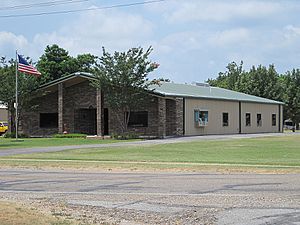
Bay City Hall, July 2011
|
|

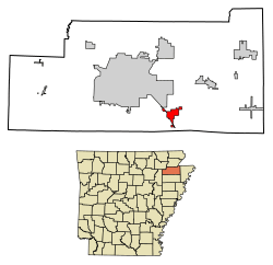
Location of Bay in Craighead County, Arkansas.
|
|
| Country | United States |
| State | Arkansas |
| County | Craighead |
| Area | |
| • Total | 3.10 sq mi (8.02 km2) |
| • Land | 3.09 sq mi (8.00 km2) |
| • Water | 0.01 sq mi (0.02 km2) |
| Elevation | 226 ft (69 m) |
| Population
(2020)
|
|
| • Total | 1,876 |
| • Density | 607.51/sq mi (234.59/km2) |
| Time zone | UTC-6 (Central (CST)) |
| • Summer (DST) | UTC-5 (CDT) |
| ZIP code |
72411
|
| Area code(s) | 870 |
| FIPS code | 05-04180 |
| GNIS feature ID | 2403823 |
Bay is a small city located in Craighead County, Arkansas, in the United States. In 2020, about 1,876 people lived there. Bay is part of the larger Jonesboro area.
Contents
Geography of Bay
Bay is found in a region known as the Arkansas Delta. This area is mostly flat. The city covers about 3.3 square miles (8.02 square kilometers) of land.
Bay's Natural Environment
Bay is part of an ecoregion called the St. Francis Lowlands. An ecoregion is a large area with similar ecosystems. This area used to have many forests. Today, much of it is used for farming.
You can still see some unique features here. These include sand blows and sunken lands. They were formed by big earthquakes in 1811 and 1812. Many rivers and streams in this area have been changed. This has affected the homes of many animals and plants.
East of Bay, you can find the St. Francis Sunken Lands Wildlife Management Area. This special place helps protect some of the original forests. These forests are important for local wildlife.
History of Bay
People have lived in the Bay area for a very long time. There are two ancient mounds still standing. These mounds were built by a society that lived here between 1200 and 1400 AD. This group of people is known as the Lawhorn Phase culture. They lived along the St. Francis River.
Major Tornado Event in Bay
On April 27, 2011, a strong tornado hit Bay. This tornado was part of a very large storm system. It had wind speeds of about 115 miles per hour (185 km/h). The tornado caused damage to buildings and carried light objects. It was about 200 yards (183 meters) wide. The tornado traveled for about 0.7 miles (1.1 kilometers) through the area.
Highways Near Bay
Several important roads pass through or near Bay. These highways help people travel to and from the city.
Population of Bay
The population of Bay has changed over the years. Here is how many people have lived in the city during different census years:
| Historical population | |||
|---|---|---|---|
| Census | Pop. | %± | |
| 1930 | 300 | — | |
| 1940 | 357 | 19.0% | |
| 1950 | 500 | 40.1% | |
| 1960 | 627 | 25.4% | |
| 1970 | 751 | 19.8% | |
| 1980 | 1,605 | 113.7% | |
| 1990 | 1,660 | 3.4% | |
| 2000 | 1,800 | 8.4% | |
| 2010 | 1,801 | 0.1% | |
| 2020 | 1,876 | 4.2% | |
| U.S. Decennial Census 2014 Estimate |
|||
Bay's Population in 2020
According to the 2020 United States census, Bay had 1,876 residents. There were 717 households in the city. About 532 of these households were families.
Famous Person from Bay
- Wally Moon, a well-known baseball player, was from Bay.
See also
 In Spanish: Bay (Arkansas) para niños
 | Lonnie Johnson |
 | Granville Woods |
 | Lewis Howard Latimer |
 | James West |


