Beargrass Creek (Kentucky) facts for kids
Quick facts for kids Beargrass Creek |
|
|---|---|

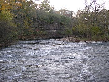
Middle fork of Beargrass Creek in Cherokee Park, near Big Rock
|
|
|
Location of the river mouth in Kentucky
|
|
| Country | United States |
| Physical characteristics | |
| River mouth | Ohio River at River Road in Louisville, Kentucky 412 ft (126 m) 38°16′01″N 85°43′17″W / 38.266944°N 85.721389°W |
| Basin features | |
| Basin size | 60 square miles (160 km2) |
Beargrass Creek is a name for several streams in Jefferson County, Kentucky. Its watershed, or the area of land that drains into it, is one of the biggest in the county. It covers over 60 square miles (155 km²). The creek is fairly small, with about 103 cubic feet of water flowing per second near River Road in Louisville.
The different parts of Beargrass Creek wind through what is now Louisville's East End. They have helped shape the land there. No one is completely sure where the name "Beargrass" came from. Old maps sometimes spelled it "Baregrass Creek" or "Bear Grass Creek." Some local stories say that bears used to come to the creek for water. They also came for salt from salt licks nearby.
Contents
Early History
The first European settlements in the area were forts. These forts were built right along the banks of Beargrass Creek. The three main parts of the creek drain about 70 square miles (181 km²) of land. Because of this, the creek can sometimes flood after heavy rains.
Around 1940, a U.S. Army base was built near Bowman Field. After this, people found that the limestone in the area was causing problems. It made the water systems in Seneca Gardens not work correctly. This caused dirty water to flow into the creek. It took a few years to fix this problem, partly because of wartime shortages.
The Three Forks
Beargrass Creek has three main branches or "forks." These are the South, Middle, and Muddy Forks. They split up just east of Downtown Louisville.
South Fork
The South Fork flows through areas like Butchertown and Germantown. It also goes west of Tyler Park. Then it runs through the Poplar Level area, where the Beargrass Creek State Nature Preserve is located. Finally, it reaches the Fern Creek neighborhood. A cave called Eleven Jones Cave is found along this fork.
The South Fork used to flow through downtown Louisville. But it was changed in the 1850s. Its old path was turned into a sewer. In the 1920s, the part near Germantown was put into a concrete channel. Today, the creek bed is often channelized, meaning it flows in a man-made path. Louisville also has issues with combined sewer overflows (CSOs). This means that after heavy rains, the water quality in the creek can be poor. It's best to avoid touching the water after big rainstorms.
Middle Fork
The Middle Fork has two smaller branches. These are called Weicher Creek and the Sinking Fork. Weicher Creek starts in the Hurstborne Area. The Sinking Fork begins near Anchorage, Kentucky. These two branches join together in St. Matthews. From there, they flow through Cherokee Park. The Middle Fork then meets the South Fork near the Bourbon Stockyards.
Muddy Fork
The Muddy Fork starts at a stone springhouse in Windy Hills. It flows next to the Ohio River. This fork was rerouted when Interstate 71 was built.
Creek Uses
Today, Beargrass Creek is mostly used for drainage. It also adds to the beauty of the area. But in the days of early pioneers, the creek was deep enough for boats. People used it to travel and move goods.
Protecting the Creek
The Beargrass Creek Alliance is a local group of volunteers. They are part of the Kentucky Waterways Alliance. This group works to teach people about the creek. They also do projects to help make the water in Beargrass Creek cleaner and healthier.
 | William Lucy |
 | Charles Hayes |
 | Cleveland Robinson |


