
Bechuanaland Protectorate facts for kids
Quick facts for kids
Bechuanaland Protectorate
|
|||||||||
|---|---|---|---|---|---|---|---|---|---|
| 1885–1966 | |||||||||
 Coat of arms
|
|||||||||

1885 map showing the Bechuanaland Protectorate prior to the creation of the crown colony of British Bechuanaland and the Heligoland–Zanzibar Treaty
|
|||||||||
| Status | Protectorate of the United Kingdom | ||||||||
| Capital | |||||||||
| Official languages | English | ||||||||
| Common languages | Setswana, IKalanga, widely spoken | ||||||||
| Religion | Congregationalism (Christian mission churches of the London Missionary Society/LMS); Anglicanism, Methodism, Badimo | ||||||||
| Government | Protectorate | ||||||||
| Monarch | |||||||||
|
• 1885–1901
|
Victoria | ||||||||
|
• 1901–1910
|
Edward VII | ||||||||
|
• 1910–1936
|
George V | ||||||||
| Resident Commissioner | |||||||||
|
• 1884–1885
|
John Mackenzie | ||||||||
|
• 1965–1966
|
Hugh Norman-Walker | ||||||||
| Prime Minister | |||||||||
|
• 1965–1966
|
Seretse Khama | ||||||||
| Historical era | New Imperialism | ||||||||
| 31 March 1885 | |||||||||
|
• Expanded
|
1890 | ||||||||
|
• General election
|
1 March 1965 | ||||||||
|
• Independence
|
30 September 1966 | ||||||||
| Area | |||||||||
| 1924 | 712,000 km2 (275,000 sq mi) | ||||||||
| Population | |||||||||
|
• 1924
|
152,980 | ||||||||
| Currency |
|
||||||||
|
|||||||||
| Today part of | Botswana South Africa |
||||||||

The Bechuanaland Protectorate was a special type of territory controlled by the United Kingdom in Southern Africa. It was set up on March 31, 1885. This protectorate later became the independent country of Botswana on September 30, 1966.
Contents
History of Bechuanaland Protectorate

A Scottish missionary named John Mackenzie lived in the area from 1862 to 1876. He worried that the local African people, especially the BamaNgwato, were in danger. People from the south, called Boers, were trying to take their land.
Mackenzie worked hard to convince the British government to protect this area. In January 1885, the British decided to send soldiers to South Africa. Their goal was to show that Britain was in charge of the land.
Sir Charles Warren led 4,000 British soldiers from Cape Town. He made agreements with several African chiefs. In March 1885, Warren announced that the Bechuanaland Protectorate was officially created.
Later that year, the southern part of the Tswana country became a British colony. This part was called British Bechuanaland. It was added to the Cape Colony in 1895 and is now part of South Africa.
What "Bechuanaland" Meant
The name "Bechuanaland" means "country of the Tswana people." The Tswana are a group of people who lived there.
The Bechuanaland Protectorate was the northern part of this region. It covered about 225,000 square miles (582,750 square kilometers). About 120,776 people lived there.
This area was home to three main Tswana groups: the Bamangwato, the Bakwena, and the Bangwaketse. There were also smaller tribes like the Bamalete and the Bakhatla. Other groups, like the Bushmen and Makalaka, also lived there.
The British government first thought about giving control of the protectorate to Rhodesia or South Africa. But the Tswana people did not want this. So, the protectorate stayed under British rule until it became independent in 1966.
How the Protectorate Was Run
A protectorate is different from a colony. In a protectorate, local rulers often keep some power. At first, the Tswana rulers stayed in charge. The British only had a police force to protect the borders.
But on May 9, 1891, the British government took more control. They gave the administration to the High Commissioner for South Africa. This person started appointing officials in Bechuanaland. This meant the protectorate was no longer truly independent.
The protectorate was managed from Mafeking. This was unusual because Mafeking was actually outside the protectorate's borders! The area of Mafeking was known as 'The Imperial Reserve'.
Expanding the Borders
In 1885, the northern border of Bechuanaland was at 22° south latitude. On June 30, 1890, the British officially extended the protectorate north. This included Ngamiland, which was controlled by the Tawana state.
The next day, Germany agreed to these new borders. This was part of the Heligoland-Zanzibar Treaty. This treaty also set the western border between British Bechuanaland and German South-West Africa (now Namibia). It also created the Caprivi strip, which gave Germany access to the Zambezi River.
British officials did not arrive in the Ngamiland region until 1894.
Later, on January 21, 1911, a new law added more land to the protectorate. This land was in the east, near the Shashe River. It was originally claimed by Matabeleland.
In 1895, a company tried to take over this eastern area. But three Tswana chiefs, Bathoen I, Khama III, and Sebele I, traveled to London. They protested against the company, and they won! This land is now the North-East District of Botswana.
Politics and Leaders
The British created the protectorate to stop other countries, like Germany or Portugal, from expanding their control in the region. It also aimed to prevent the Boers from taking more land.
Not all chiefs were happy about the protectorate. But King Khama III was a very powerful ruler. He had strong support from the British government. He worked closely with the British military. He managed to keep his large lands safe from outsiders from South Africa.
The Story of Seretse Khama
When King Khama III died in 1923, his oldest son, Sekgoma II, became chief. Sekgoma II's oldest son was named Seretse.
Sekgoma II ruled for only about a year. This meant Seretse, who was a baby, was the next in line to be chief. Following tradition, Seretse's uncle, Tshekedi, became the acting chief. He would rule until Seretse was old enough. The plan was for Seretse to take over after he finished his law studies in Britain.
Tshekedi was known for expanding schools and building grain silos and water systems. He also often argued with the British authorities about how justice was handled.
A big challenge for Tshekedi came when Seretse married a white woman, Ruth Williams, while studying in Britain. Tshekedi was against the marriage. He felt that a chief could not just marry anyone he pleased. He believed a chief served the people, and the chieftainship itself was at risk.
Seretse refused to change his mind and married Ruth in 1948. People in the tribe were divided. Older people often supported Tshekedi, while younger people supported Seretse. In the end, the British authorities sent both men away from the territory for a time.
Later, Seretse and Ruth were allowed to return. Seretse and Tshekedi were able to make peace. Seretse then saw his future not just as a tribal chief, but as a leader for the whole nation. He became the head of the Botswana Democratic Party.
In 1966, Seretse Khama became the first President of independent Botswana. He remained president until he passed away in 1980. The story of Seretse and Ruth is told in the 2016 film A United Kingdom.
British Representatives
The Bechuanaland Protectorate was one of three "High Commission Territories." The others were Basutoland (now Lesotho) and Swaziland (now Eswatini).
A High Commissioner had some duties like a governor. But the main tribes in Bechuanaland largely governed themselves. The protectorate was not a British possession where many white settlers could move.
In each of these three territories, a Resident Commissioner was in charge of Britain's responsibilities. This person had some of the functions of a Governor but with less power.
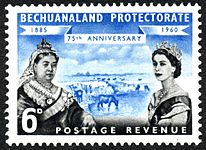
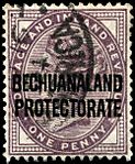
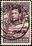
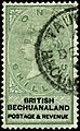
Postage Stamps

Bechuanaland issued its own postage stamps from 1888 to 1966. At first, they used stamps with words printed over them. In 1932, the first stamps that actually said "Bechuanaland Protectorate" were released.
In 1961, the South African rand currency was introduced. This meant the existing stamps had to have new values printed on them until new stamps were made.
Gallery of Postage Stamps
- Postage stamps pictures
-
-
-
-


Images for kids
-
Revenue stamp for British Bechuanaland, 1887.

See also
 In Spanish: Bechuanalandia para niños
- History of Botswana
- British Bechuanaland, the area south of the Molopo River, now part of South Africa.
