Bishopsworth facts for kids
Quick facts for kids Bishopsworth |
|
|---|---|
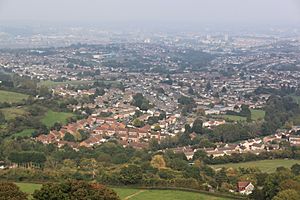 A view over Withywood, in the foreground, and Bishopsworth from the tower of the Church of St Michael, Dundry |
|
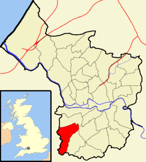 Boundaries of the city council ward |
|
| Population | 12,274 https://citypopulation.de/en/uk/southwestengland/wards/city_of_bristol/E05010889__bishopsworth/ |
| OS grid reference | ST569686 |
| Unitary authority | |
| Ceremonial county | |
| Region | |
| Country | England |
| Sovereign state | United Kingdom |
| Post town | BRISTOL |
| Postcode district | BS13 |
| Dialling code | 0117 |
| Police | Avon and Somerset |
| Fire | Avon |
| Ambulance | Great Western |
| EU Parliament | South West England |
| UK Parliament |
|
Bishopsworth is a part of the city of Bristol in the United Kingdom. It is both a local area and a larger "ward" or district. This ward includes Bishopsworth itself, plus other areas like Bedminster Down, Highridge, and Withywood. It's mostly a place where people live, with many homes built by the local council.
Contents
Discover Bishopsworth
Bishopsworth is a residential area in south Bristol, England. It used to be a separate village or 'civil parish'. Long ago, it was known as Bishport and was part of Bedminster. Over time, parts of it became a new parish called Bishopsworth. Later, in the 1930s and 1950s, much of Bishopsworth became part of Bristol city.
Today, Bishopsworth has about 11,444 people living there (based on the 2001 census). The local services, like roads and parks, are managed by Bristol City Council. Health services are looked after by the Bristol Clinical Commissioning Group.
You can find many useful places in Bishopsworth. There are shops and pubs, a public library, and a community arts center. There's even an indoor skate park called Campus Pool, which used to be a swimming pool!
St Peter's Church
The first church in Bishopsworth was a small chapel built way back in 1194. It was dedicated to St Peter and St Paul. A chaplain from Bedminster would visit to hold services. This chapel was later turned into cottages. These cottages were removed in 1961 to make way for a swimming pool. That pool is now the Campus Pool skate park.
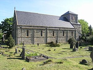
The current church, dedicated to St Peter, was built much later, between 1841 and 1843. It was designed by Samuel Charles Fripp in a style that looks like old Norman architecture. This church is considered a very important historical building.
Bishopsworth Manor
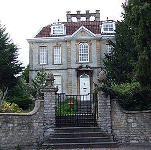
Bishopsworth Manor is a historic house built around 1720. It's also a very important listed building. In the 1970s and 1980s, it was owned by Denis Bristow, who worked hard to restore it to its beautiful condition.
Other Historic Buildings
Besides the church and manor, Bishopsworth has other old buildings. The School House and its attached school rooms were built around 1840. They have a Tudor Revival style, looking like buildings from the Tudor period. Chestnut Court is another old building, dating from the early 1700s.
Exploring Bedminster Down
Bedminster Down is another area within Bristol. It's a suburb that was mostly built in the 1930s. This area stretches from Bedminster towards Ashton, Bishopsworth, Highridge, and Uplands. It's mainly a place where people live.
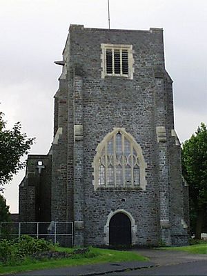
Bedminster Down is home to many middle-class families. Some parts of the area are built over old, unused coal mines. The main church here is dedicated to St Oswald and was built in 1927. There was also a Methodist church, which closed in 2008. Its main building is now used as a community arts center.
Discovering Withywood
Withywood is a district of Bristol, located on the city's southern edge. It sits between Hartcliffe and Bishopsworth, just north of Dundry Hill. Withywood is a large housing estate that started being built in the 1950s. The roads connecting to Withywood have improved over time, especially with the South Bristol Ring Road.
Withywood has several primary schools for younger students:
- Fair Furlong
- Four Acres
- Gay Elms
- Merchants Academy (Phase 1)
- St. Pius
There is also a newer secondary school called Merchants Academy. It opened in 2008 after the old Withywood Community School was taken down. All these schools have large sports fields and grounds. Merchants Academy even has two artificial turf pitches and a gym that the public can use. Withywood also has a private home that acts as a "University" where people can study and attend lectures.
Along Queen's Road, you'll find various shops and the Amelia Nutt Health Clinic. Four Acres road also has shops near the Sherrin Way bus stop. Withywood used to have several pubs, but many have been demolished to make way for new housing.
The Malago stream runs between Sherrin Way and The Coppice. This stream goes underground where it meets Four Acres. The area is currently undergoing a big regeneration program. New apartments are being built, and there are plans for a swimming pool and leisure complex near a cinema. All these new developments are within walking distance of Withywood.
The Dundry View Neighbourhood Partnership works with local residents. They help improve the areas of Bedminster Down, Bishopsworth, Hartcliffe, Headley Park, Highridge, Teyfant, Uplands, Whitchurch Park, and Withywood.


