Beemer, Nebraska facts for kids
Quick facts for kids
Beemer, Nebraska
|
|
|---|---|
|
Village
|
|

Downtown Beemer: West side of Main Street, looking north from U.S. Highway 275
|
|
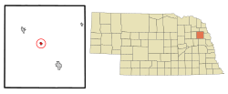
Location of Beemer, Nebraska
|
|
| Country | United States |
| State | Nebraska |
| County | Cuming |
| Area | |
| • Total | 0.42 sq mi (1.09 km2) |
| • Land | 0.42 sq mi (1.09 km2) |
| • Water | 0.00 sq mi (0.00 km2) |
| Elevation | 1,355 ft (413 m) |
| Population
(2020)
|
|
| • Total | 611 |
| • Density | 1,458.23/sq mi (562.66/km2) |
| Time zone | UTC-6 (Central (CST)) |
| • Summer (DST) | UTC-5 (CDT) |
| ZIP code |
68716
|
| Area code(s) | 402 |
| FIPS code | 31-03635 |
| GNIS feature ID | 2398068 |
| Website | ci.beemer.ne.us |
Beemer is a small village located in Cuming County, Nebraska, in the United States. In 2020, about 611 people lived there.
Contents
Where is Beemer Located?
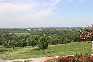
Beemer is found on flat land next to the Elkhorn River. It is about 84 miles from Omaha. The village is also nine miles northwest of West Point. It sits near the middle of Cuming County. Important roads like Nebraska Link 20A and U.S. Route 275 meet here.
The village covers about 0.42 square miles (1.09 square kilometers). All of this area is land.
What is the Weather Like in Beemer?
Beemer has a climate with warm summers and cold winters. It gets rain and snow throughout the year. The most rain usually falls in late spring and early summer.
| Climate data for Beemer, Nebraska (coordinates:41°55′48″N 96°48′28″W / 41.9301°N 96.8078°W, 1991-2020) | |||||||||||||
|---|---|---|---|---|---|---|---|---|---|---|---|---|---|
| Month | Jan | Feb | Mar | Apr | May | Jun | Jul | Aug | Sep | Oct | Nov | Dec | Year |
| Average precipitation inches (mm) | 0.99 (25) |
0.99 (25) |
1.67 (42) |
3.56 (90) |
4.11 (104) |
5.02 (128) |
3.35 (85) |
3.79 (96) |
3.15 (80) |
2.25 (57) |
1.47 (37) |
1.03 (26) |
31.38 (795) |
| Average precipitation days (≥ 0.01 in) | 5.4 | 6.7 | 7.5 | 10.8 | 13.9 | 13.1 | 9.3 | 11.7 | 9.8 | 10 | 4.9 | 6.2 | 109.3 |
| Source: NOAA | |||||||||||||
History of Beemer
How Beemer Started
The first European settlers came to the Beemer area in 1864. They traveled in covered wagons, looking for land under the Homestead Act. These new residents built simple homes like dugouts and sod houses. Later, they built log cabins.
Some of the very first families in the area included the Sharps, the Rabes, and the McNamaras. In 1867, the first school in the area was held. It was taught by Mrs. William Sharp in her log cabin.
West of Beemer, a small stream called Rock Creek flows into the Elkhorn River. In 1865, a man named August Lambrecht built a mill on this creek. The mill used water power to grind grain into flour. This mill, along with good farming land, attracted more settlers. This area became known as "Rock Creek."
In 1871, railroad tracks reached nearby Wisner. By 1879, they reached Norfolk. As the railroad grew, it needed stops for its steam locomotives to get water. These stops were also used for telegraphs. The telegraph station near where Beemer is today was called "Rock Creek." So, for about 15 years, two places were called "Rock Creek": the mill area and the railroad stop.
Becoming a Village
In 1885, Allen D. Beemer and two other men planned out a village. They called it Rock Creek and officially registered it. Mr. Beemer built the first train station. He also helped build a wooden bridge over the Elkhorn River.
Because of his hard work, the settlement got a post office in 1886. It was named the Beemer Post Office. On July 15, 1886, Beemer officially became a village. It was named after Allen D. Beemer. That same year, Mr. Beemer started a newspaper called the Beemer Times. The railroad also changed the station's name from Rock Creek to Beemer.
Beemer's First 100 Years (1886-1986)
The first century of Beemer was a time of growth and new projects. The Beemer Times newspaper reported on everything happening in the village. It talked about problems like muddy streets and too many taverns. It also shared good news about new schools, businesses, and modern changes. These changes included water systems, electricity, better roads, and telephone services.
Churches in Beemer
Five churches were built in Beemer during this time:
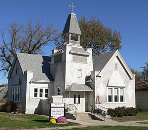
- The Methodist Episcopal Church was built in 1886.
- St. John's Lutheran Church was built in 1893.
- The Congregational Church was built in 1900.
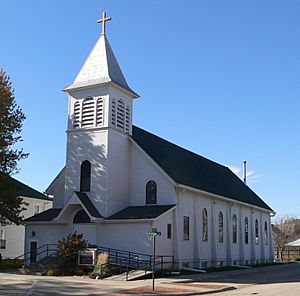
- The Holy Cross Roman Catholic Church was built in 1914.
- The Mennonite Church was built in 1959.
Schools in Beemer
The first public school in Beemer was in a small wooden building. By 1886, a two-room building was built for the 32 students. The newspaper even reported if students were absent or late!
In 1892, people voted to build a new, modern brick school. It had two stories and could hold 210 students. In 1917, another new school building was approved. This new building was used for graduations starting in 1918. The old building was then taken down. The 1918 building was used until 2008.
Railroad Service
The railroad tracks reached Beemer in 1871. This line was meant to go from Fremont to the Black Hills of South Dakota. The Chicago & North Western railroad took over the line in 1903.
By the mid-1970s, less freight was being shipped by train. In 1982, the railroad stopped service after floods damaged the tracks. The tracks were removed a few years later.
Population Changes in Beemer
| Historical population | |||
|---|---|---|---|
| Census | Pop. | %± | |
| 1890 | 350 | — | |
| 1900 | 455 | 30.0% | |
| 1910 | 494 | 8.6% | |
| 1920 | 548 | 10.9% | |
| 1930 | 571 | 4.2% | |
| 1940 | 585 | 2.5% | |
| 1950 | 613 | 4.8% | |
| 1960 | 667 | 8.8% | |
| 1970 | 699 | 4.8% | |
| 1980 | 853 | 22.0% | |
| 1990 | 672 | −21.2% | |
| 2000 | 773 | 15.0% | |
| 2010 | 678 | −12.3% | |
| 2020 | 611 | −9.9% | |
| U.S. Decennial Census | |||
Beemer's Population in 2010
In 2010, there were 678 people living in Beemer. There were 291 households, which are groups of people living in one home. About 172 of these were families.
Most people in Beemer were White (92.0%). A small number were Native American, Asian, or from other backgrounds. About 7.7% of the population was Hispanic or Latino.
The average age in Beemer was 52 years old. About 21.1% of residents were under 18. About 34.7% were 65 years old or older. Slightly more than half of the residents were female (52.8%).
Village Facilities and Services
What Beemer Offers
Almost all the streets in Beemer are paved. They also have systems to handle rainwater. The village has its own office building, a fire station, and a town park. There is also a dance hall and a library.
Beemer runs its own water system and a sewage treatment plant. Electricity and phone services are provided by larger companies in the region.
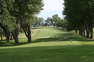
For fun and recreation, Beemer has a school gym. The Beemer park has tennis courts and picnic areas. Nearby is the Indian Trails Country Club, which has an 18-hole golf course. It is often called the 'Beemer Golf Course'. Older adults can gather at the Senior Citizen Center.
Schools in Beemer
The elementary school in Beemer is part of the West Point-Beemer Public School system. The high school for the district is located about 10 miles away from Beemer.
Famous People from Beemer
- William E. Galbraith – He was a national leader for the American Legion from 1967-1968.
- Mel Harder – A well-known baseball player and manager.
- Karl Hubenthal – A famous cartoonist.
See also
 In Spanish: Beemer (Nebraska) para niños
 | Bayard Rustin |
 | Jeannette Carter |
 | Jeremiah A. Brown |


