Beinn Spionnaidh facts for kids
Quick facts for kids Beinn Spionnaidh |
|
|---|---|
 |
|
| Highest point | |
| Elevation | 773 m (2,536 ft) |
| Listing | Corbett, Marilyn |
| Naming | |
| Language of name | Norse |
| Geography | |
| Location | Assynt, Scotland |
| Topo map | OS Landranger 9 |
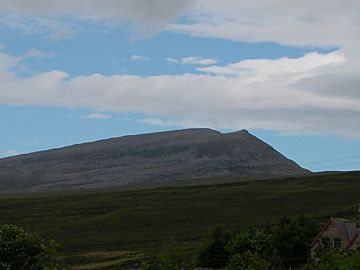
Beinn Spionnaidh is a mountain in the very north of Scotland. It stands tall at 773 meters (about 2,536 feet) high. You can find it in an area called Sutherland, which is part of the Scottish Highlands.
This mountain is west of a sea loch called Loch Eriboll. It's also near other mountains like Cranstackie and Foinaven.
Contents
What Kind of Mountain Is It?
Beinn Spionnaidh is known as a Corbett. A Corbett is a Scottish mountain that is between 762 meters (2,500 feet) and 914 meters (3,000 feet) high. It also has to have a drop of at least 152 meters (500 feet) on all sides.
It is also a Marilyn. A Marilyn is a hill or mountain in the British Isles that has a drop of at least 150 meters (492 feet) on all sides.
What Does Beinn Spionnaidh Look Like?
The top of Beinn Spionnaidh is about 1 kilometer (0.6 miles) long. It looks a bit like the back of a whale, running from the southwest to the northeast. This long top is covered in loose, broken quartzite. Quartzite is a very hard rock that used to be sandstone.
Routes to the Top
There are different ways to climb Beinn Spionnaidh.
The Cioch Mhor Spur
One way to reach the top is by a steep path on the northwest side. This path goes up a part of the mountain called Cioch Mhor. From here, you can get amazing views of the Kyle of Durness, which is a narrow sea inlet.
The Southeast Slope
Another path is on the gentler southeast side of the mountain. However, even though it's not as steep, it can be tiring. This is because the upper part of the slope also has a lot of loose, broken rocks.
 | Jewel Prestage |
 | Ella Baker |
 | Fannie Lou Hamer |

