Loch Eriboll facts for kids
Quick facts for kids Loch Eriboll |
|||||||||||||||||||||||||||||||||
|---|---|---|---|---|---|---|---|---|---|---|---|---|---|---|---|---|---|---|---|---|---|---|---|---|---|---|---|---|---|---|---|---|---|
 |
|||||||||||||||||||||||||||||||||
| Location | Scotland | ||||||||||||||||||||||||||||||||
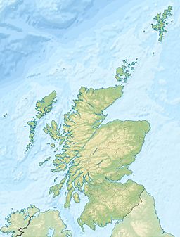
| Coordinates | 58°30′18″N 4°40′12″W / 58.505°N 4.670°W | ||||||||||||||||||||||||||||||||
| Type | Sea loch | ||||||||||||||||||||||||||||||||
| Basin countries | Scotland | ||||||||||||||||||||||||||||||||
|
|||||||||||||||||||||||||||||||||
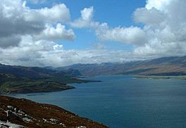
Loch Eriboll (which means "Loch Euraboil" in Scottish Gaelic) is a long, narrow arm of the sea. It stretches about 16 km (9.9 mi) inland on the northern coast of Scotland.
This loch has been a safe place for ships to anchor for hundreds of years. It offers protection from the rough seas often found near Cape Wrath and the Pentland Firth.
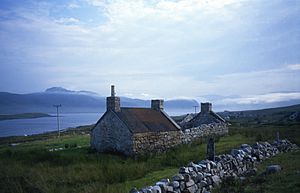
People have lived in the area around Loch Eriboll for a very long time. You can find remains from the Bronze Age here. These include an underground passage called a souterrain and a well-preserved ancient house known as a wheelhouse. This wheelhouse is on the hillside above the west side of the loch.
In the 1800s, a small industry grew here, making lime. Ard Neakie, a piece of land on the eastern shore, had four large lime kilns built around 1870. Before a road was built around the loch in 1890, a ferry called the Heilam ferry carried people and goods. It went from Portnancon on the west side to Ard Neakie. Both Ard Neakie and Portnancon were also places where people fished.
Around the shores of the loch, you'll find small villages called crofting townships. These include Eriboll, Laid, Heilam, Portnancon, and Rispond.
At the northern, seaward end of the loch is an island called Eilean Hoan. There are also several smaller islands nearby, such as A' Ghoil-sgeir and An Cruachan. Today, Loch Eriboll is a wild and natural place. It gets a lot of rain and has very few people living there.
Loch Eriboll's Role in History
Loch Eriboll has played an important part in history, especially for the Royal Navy.
World War II Activities
During World War II, the Royal Navy often visited the loch. Sailors would arrange stones on the hillside above the village of Laid to spell out the names of their warships. You can still see names like HMS Hood and Amethyst'.
British service members called the loch "Lock ’orrible" because of the bad weather. The largest island in the loch, Eilean Choraidh, was used for practice. Pilots from the Fleet Air Arm would pretend it was the German battleship Tirpitz. This helped them prepare for a successful attack on the real Tirpitz in April 1944.
End of the Battle of the Atlantic
A very important event happened here in 1945. The remaining 33 German U-boats, like U-532 and U-295, officially surrendered in Loch Eriboll. This marked the end of the Battle of the Atlantic, a long and difficult fight at sea during World War II.
Modern Military Training
Today, a part of the shore and loch is used by the Defence Training Estate. It is a "Minor training area." The military uses it for special training, like landing troops from the sea. This training happens for about two weeks, three times a year.
In 2011, Loch Eriboll was part of Exercise Joint Warrior. This was the largest war game held in the UK. The navy's new main ship, HMS Bulwark, took part in these exercises.
See also
 In Spanish: Fiordo de Eriboll para niños
 | Jewel Prestage |
 | Ella Baker |
 | Fannie Lou Hamer |


