Beinn a' Chòin facts for kids
Quick facts for kids Beinn a' Choin |
|
|---|---|

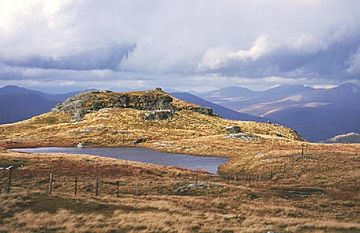
Beinn a' Choin summit
|
|
| Highest point | |
| Elevation | 769 m (2,523 ft) |
| Prominence | 345 m (1,132 ft) |
| Listing | Corbett, Marilyn |
| Geography | |
| Location | Stirling / Argyll and Bute, Scotland |
| Parent range | Grampian Mountains |
| OS grid | NN354130 |
| Topo map | OS Landranger 50, 56 |
Beinn a' Choin is a mountain in the beautiful Grampian Mountains of Scotland. It stands 769 meters (about 2,523 feet) high. This mountain is special because it sits right on the border between two Scottish regions: Stirling and Argyll and Bute. You can find it at the northern end of the famous Loch Lomond, which is a very large and popular loch (lake) in Scotland.
Contents
Exploring Beinn a' Choin
Beinn a' Choin is known for being a wild and rugged mountain. It's covered in rocks and moorland, which is a type of open, uncultivated land. It lies just north of Ben Lomond, another well-known Scottish mountain.
How to Climb Beinn a' Choin
Most people who want to climb Beinn a' Choin start their journey from a small village called Inversnaid. This village is located on the eastern side of Loch Lomond. The climb can be challenging because of the mountain's rugged nature, but it offers amazing views of the surrounding Scottish landscape.
What is a Corbett?
Beinn a' Choin is classified as a Corbett. In Scotland, a Corbett is a mountain that is between 2,500 feet (762 meters) and 3,000 feet (914.4 meters) high. It must also have a "prominence" of at least 500 feet (152.4 meters). Prominence means how much a mountain rises from the lowest point connecting it to a higher peak. There are many Corbetts across Scotland, and climbing them is a popular hobby for hikers.
What is a Marilyn?
Beinn a' Choin is also known as a Marilyn. This is another way to classify hills and mountains in the British Isles. To be a Marilyn, a hill or mountain needs to have a prominence of at least 150 meters (about 492 feet), no matter how tall it is overall. This means a Marilyn can be a small hill or a very tall mountain, as long as it rises significantly from the land around it.
The Area Around Beinn a' Choin
Beinn a' Choin is part of the Grampian Mountains, which are one of the three main mountain ranges in Scotland. This area is famous for its beautiful scenery, including deep glens (valleys), clear lochs, and vast wilderness. The nearby Loch Lomond is a major attraction, known for its stunning beauty and as a gateway to the Scottish Highlands.
 | May Edward Chinn |
 | Rebecca Cole |
 | Alexa Canady |
 | Dorothy Lavinia Brown |

