Beinn nan Aighenan facts for kids
Quick facts for kids Beinn nan Aighenan |
|
|---|---|
 |
|
| Highest point | |
| Elevation | 960 m (3,150 ft) |
| Prominence | 343 m (1,125 ft) |
| Listing | Munro, Marilyn |
| Geography | |
| Location | Argyll and Bute, Scotland |
| Parent range | Grampian Mountains |
| OS grid | NN148405 |
| Topo map | OS Landranger 50 |
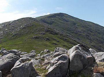
Beinn nan Aighenan is a tall mountain in the Grampian Mountains of Scotland. It stands about 960 meters (or 3,150 feet) high. This makes it a very impressive peak! You can find it in Argyll and Bute, which is a beautiful area in Scotland. The mountain is located north of a small village called Taynuilt.
Contents
About Beinn nan Aighenan
Beinn nan Aighenan is known as an "isolated" mountain. This means it stands mostly by itself, not directly connected to a long chain of other mountains. This makes it look even more grand and special.
What is a Munro?
Beinn nan Aighenan is a special type of mountain called a Munro. In Scotland, a Munro is a mountain that is over 3,000 feet (about 914 meters) tall. There are 282 Munros in Scotland, and climbing them all is a popular challenge for hikers!
What is a Marilyn?
The mountain is also a Marilyn. This is another way to classify hills and mountains. A Marilyn is any hill in the British Isles that has a "prominence" of at least 150 meters (about 492 feet). Prominence means how much a mountain rises above the land around it. So, Beinn nan Aighenan really stands out!
Climbing the Mountain
Even though Beinn nan Aighenan is quite isolated, it is a popular spot for hikers. People enjoy the challenge of reaching its summit.
Popular Routes
The most common ways to climb Beinn nan Aighenan are from two different glens (valleys). One popular path starts from Glen Kinglass. Another way is to climb along the ridge from Glen Etive. Both routes offer amazing views of the Scottish landscape.
 | Claudette Colvin |
 | Myrlie Evers-Williams |
 | Alberta Odell Jones |

