
Belle Haven, Fairfax County, Virginia facts for kids
Quick facts for kids
Belle Haven, Fairfax County, Virginia
|
|
|---|---|

Belleview Branch Post Office
|
|

Location within Fairfax County
|
|

Belle Haven, Fairfax County, Virginia
Location in Northern Virginia

Belle Haven, Fairfax County, Virginia
Location in Virginia

Belle Haven, Fairfax County, Virginia
Location in the United States
|
|
| Country | United States |
| State | Virginia |
| County | Fairfax |
| Area | |
| • Total | 2.9 sq mi (7.4 km2) |
| • Land | 2.0 sq mi (5.1 km2) |
| • Water | 0.9 sq mi (2.3 km2) |
| Elevation | 15 ft (5 m) |
| Population
(2020)
|
|
| • Total | 6,851 |
| • Density | 3,425.5/sq mi (1,343.3/km2) |
| Time zone | UTC−5 (Eastern (EST)) |
| • Summer (DST) | UTC−4 (EDT) |
| ZIP code |
22307 (Alexandria/Belleview)
|
| FIPS code | 51-05928 |
| GNIS feature ID | 2389195 |

Belle Haven is a community in Fairfax County, Virginia, United States. It is a "census-designated place" (CDP), which means it's a special area defined for gathering population data.
Belle Haven is located just south of Old Town Alexandria. It is bordered by Richmond Highway (U.S. 1) to the west and the Potomac River to the east. The community includes the original Belle Haven area, which started in the 1920s, and other nearby neighborhoods.
Some parts of Belle Haven, like New Alexandria and Belle View, are low-lying. This means they can get flooded during big storms. For example, Hurricane Isabel in 2003 and Hurricane Agnes in 1972 caused a lot of flood damage here. The Belleview branch of the Post Office is located in Belle Haven. It serves the 22307 ZIP code area.
Contents
History of Belle Haven
The name "Belle Haven" comes from Scottish settlers who arrived in the early 1700s. They named their settlement after a Scottish nobleman, the Earl of Belhaven. This early settlement grew into a busy port along the Potomac River. It was later renamed "Alexandria."
The land where Belle Haven is now became part of the West Grove Plantation. Hugh West built this plantation around 1748. It was in a good spot near the growing town of Alexandria.
The West family was important in Virginia and Fairfax County government in the 1700s. Hugh West was a burgess (a representative in the colonial government). He was also a trustee for the town of Alexandria. His son, John, continued to work in public service until he passed away in 1777.
In 1814, the West family sold the home to Colonel Augustine J. Smith. He made the plantation much larger, from about 155 acres to over 1,800 acres. He did this by draining swamps near the Potomac River and building a dike (a wall to hold back water). After his death, these walls were not kept up. Colonel Smith also built many new buildings on the plantation. These included larger living areas for the enslaved people who worked there.
Colonel Smith died in 1830. After some years, Dennis Johnston bought the plantation. He mostly worked on fixing the buildings that Smith had added. Johnston passed away before the Civil War. His wife then managed the plantation. In 1862, during the Civil War, soldiers from the 39th New York Volunteer Infantry Regiment took over the plantation. They later burned it down because the owner's sons were officers for General Robert E. Lee. No house was built on this land again until 1928. This was when the first house in the modern Belle Haven community was built.
The Belle Haven community we know today began in the 1920s. David Howell, a civil engineer from Alexandria, bought the land. He created two companies. One company built a golf course and club, which became the Belle Haven Country Club. The other company developed the residential area where people now live.
Geography
Belle Haven is in the eastern part of Fairfax County. Its exact location is 38°46′44″N 77°3′39″W / 38.77889°N 77.06083°W.
The eastern edge of Belle Haven is the Potomac River. This river also forms the border with Maryland. To the north, the community borders the city of Alexandria along Hunting Creek.
The community covers about 7.4 square kilometers (2.9 square miles). About 5.1 square kilometers (2.0 square miles) of this is land. The rest, about 2.3 square kilometers (0.9 square miles), is water.
Belle Haven is located about 20 minutes away from Washington, D.C..
Population Information
2020 Census
In 2020, about 6,851 people lived in Belle Haven. The community had about 3,263 homes.
Most people in Belle Haven were White (about 71%). Other groups included African American, Asian, and Native American people. About 16% of the population was of Hispanic or Latino background.
The average age of people in Belle Haven was about 41.5 years old. About 24% of the people were under 18 years old. About 16% were 65 years old or older. Many people (about 28%) had Irish ancestry. About 18% spoke a language other than English at home.
The average income for a household in Belle Haven was around $129,495. For families, the average income was about $190,469. Many adults (about 71%) had a college degree or higher.
Population History
Here's how the population of Belle Haven has changed over the years:
- 1980: 6,520 people
- 1990: 6,427 people
- 2000: 6,269 people
- 2010: 6,518 people
- 2020: 6,851 people
Gallery
-
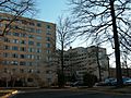
River Towers condominium complex
-
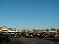
Belle View Shopping Center
-

Belle View Condominium Association Management Office
-
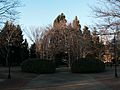
Bower which forms the centerpiece of the Belle View Town Square
-
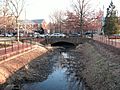
Creek which runs through Belle View
-

Along the George Washington Memorial Parkway in Belle View
-
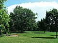
Belle Haven Park, along the river
-
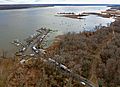
Aerial view of Bell Haven Marina
-
The Belle Haven Marina
-
Belle View Condominiums


See also
 In Spanish: Belle Haven (condado de Fairfax) para niños
