Bellingham, Tasmania facts for kids
Quick facts for kids BellinghamTasmania |
|||||||||||||||
|---|---|---|---|---|---|---|---|---|---|---|---|---|---|---|---|

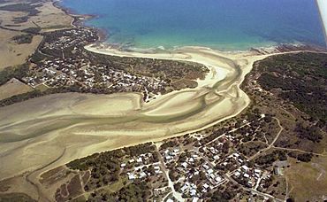
Aerial photo of Bellingham (right) and Weymouth (left)
|
|||||||||||||||
| Population | 60 (2016 census) | ||||||||||||||
| Postcode(s) | 7254 | ||||||||||||||
| Location |
|
||||||||||||||
| LGA(s) | George Town | ||||||||||||||
| Region | Launceston | ||||||||||||||
| State electorate(s) | Bass | ||||||||||||||
| Federal Division(s) | Bass | ||||||||||||||
|
|||||||||||||||
Bellingham is a small, quiet place in Tasmania, Australia. It is located in the George Town area. This area is part of the Launceston region.
Bellingham is about 39 kilometers (24 miles) northeast of George Town. In 2016, a count showed that about 60 people lived here. It is a tiny coastal village. It sits at the mouth of the Pipers River. Right across the river is the town of Weymouth. Bellingham is 62 kilometers (38 miles) from Launceston. It is also 20 kilometers (12 miles) from Bridport.
Contents
About Bellingham
Bellingham is mostly known for its holiday homes. These are often called "shacks." Many people use them during the summer. Only about 25 people live there all year round.
The local council, George Town Council, has made improvements. They have fixed many roads in the area. This includes paving the main Bellingham Road. They also added gravel to Gees Marsh Road. These changes make it easier to get around.
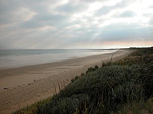
In the center of Bellingham, you can find a camping ground. There is also a tennis court for playing games. A small boat ramp is available for launching boats. The Marine and Safety Board of Tasmania (MAST) plans to upgrade this ramp soon. You can easily reach the Pipers River from town. There are also large beaches next to Bass Strait.
Exploring the Coast
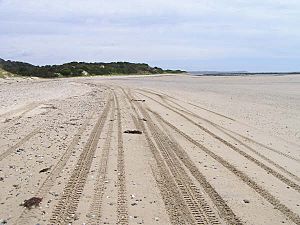
You can get to Miller's Beach by a four-wheel drive vehicle. This beach is the start of a special 4WD route. This route goes along the beaches and sand dunes. It passes through Noland Bay and St. Albans Bay. Eventually, it leads to Bridport.
Bellingham's Past
Bellingham was first known as Pipers Heads. It was a lookout point for ships. These ships would sail up the Pipers River to Weymouth. The old wharf in Weymouth burned down many years ago. You can still see the burnt wooden posts in the river sand today. Bellingham officially became a recognized place in 1964.
Where is Bellingham?
The northern edge of Bellingham is bordered by the waters of Bass Strait. The Pipers Brook forms the western boundary. Part of the eastern boundary is made by the Little Pipers River.
Getting Around by Road
Route C852, also called Bellingham Road, comes into the area from the south. It goes all the way to the village in the northwest. This is where the road ends.
Changes in the Area
Sometimes, changes happen in how land is used. In the nearby Gees Marsh area, some land rules were updated. This allowed some shack owners to buy the land their shacks were on. However, some older shacks were found to be unsafe. They had to be taken down. This caused some sadness among people who had used these shacks for many years.
The George Town Council has also made decisions about public buildings. Some community halls were old and needed repairs. The council decided to remove them. This was due to their condition and the cost of insurance. Local people and summer visitors have asked the council to keep these facilities. They hope the council will help upgrade them. They have suggested adding new toilets and ramps for disabled access.
 | John T. Biggers |
 | Thomas Blackshear |
 | Mark Bradford |
 | Beverly Buchanan |


