Bethel, Washington facts for kids
Quick facts for kids
Bethel, Washington
|
|
|---|---|
| Country | United States |
| State | Washington |
| County | Kitsap |
| Area | |
| • Total | 3.31 sq mi (8.57 km2) |
| • Land | 3.31 sq mi (8.57 km2) |
| • Water | 0 sq mi (0.0 km2) |
| Elevation | 310 ft (90 m) |
| Population
(2020)
|
|
| • Total | 4,073 |
| • Density | 1,122/sq mi (433.2/km2) |
| Time zone | UTC-8 (Pacific (PST)) |
| • Summer (DST) | UTC-7 (PDT) |
| ZIP code |
98387
|
| Area code(s) | 360 |
| FIPS code | 53-05735 |
| GNIS feature ID | 1512005 |
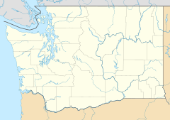
Bethel is a community in Kitsap County, Washington, United States. It is known as a census-designated place (CDP). This means it's an area that the government counts as a community. However, it does not have its own city government.
Bethel is a quiet, wooded area. It is located just a few miles south of the city of Port Orchard. Many people who live in Bethel travel to Port Orchard or other nearby cities for work.
The first time Bethel was counted as a CDP was in the 2010 census. At that time, its population was 3,713 people. By the 2020 census, the number of people living in Bethel grew to 4,073.
| Historical population | |||
|---|---|---|---|
| Census | Pop. | %± | |
| 2010 | 3,713 | — | |
| 2020 | 4,073 | 9.7% | |
| Sources: | |||
Where is Bethel Located?
Bethel is in the southern part of Kitsap County. It shares its borders with several other areas. To the northwest, it is next to Port Orchard. To the north, you'll find an area called East Port Orchard. This area is "unincorporated," meaning it's not part of an official city.
To the northeast, Bethel is next to another unincorporated area called Parkwood.
Traveling Around Bethel
Washington State Route 16 runs along the western edge of Bethel. This highway can take you to other towns. If you go northwest about 5 miles, you'll reach Gorst. If you travel south about 23 miles, you will arrive in Tacoma.
The city of Bremerton is about 9 miles north of Bethel. You can get there by taking State Routes 16 and 3. Another road, State Route 160, forms the northern border of Bethel. This road goes east about 5 miles to Southworth.
Size of Bethel
The U.S. Census Bureau has measured the size of Bethel. The entire area of Bethel is about 8.6 square kilometers. All of this area is land, with no large bodies of water inside its borders.
More Information

- In Spanish: Bethel (Washington) para niños
 | Emma Amos |
 | Edward Mitchell Bannister |
 | Larry D. Alexander |
 | Ernie Barnes |


