Southworth, Washington facts for kids
Quick facts for kids
Southworth, Washington
|
|
|---|---|
| Country | United States |
| State | Washington |
| County | Kitsap |
| Area | |
| • Total | 3.39 sq mi (8.77 km2) |
| • Land | 3.37 sq mi (8.74 km2) |
| • Water | 0.008 sq mi (0.02 km2) |
| Elevation | 49 ft (15 m) |
| Population
(2010)
|
|
| • Total | 2,185 |
| • Density | 647/sq mi (250.0/km2) |
| Time zone | UTC-8 (Pacific (PST)) |
| • Summer (DST) | UTC-7 (PDT) |
| ZIP code |
98386
|
| FIPS code | 53-66220 |
| GNIS feature ID | 1512679 |
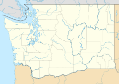
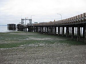
Southworth is a small community in Kitsap County, Washington, United States. It is located right on the beautiful Puget Sound. Southworth is well-known as the western end of a busy ferry route. This route connects Southworth to Vashon Island and Fauntleroy in Seattle.
The area has a few local spots like Southworth Grocery and a US Post Office. The ferry terminal is a major landmark. You can also find clay cliffs and a private beach nearby. Many people enjoy launching kayaks from the area next to the ferry terminal. They paddle to Blake Island, which is a popular destination. In 2010, about 2,185 people lived in the Southworth area.
Geography of Southworth
Southworth is located in the southeastern part of Kitsap County. It sits right on the shore of Puget Sound. The community stretches along Colvos Passage and extends towards Yukon Harbor.
The Southworth area includes smaller communities like Harper and South Colby. Washington State Route 160 forms the southern border of the community. This road leads west to State Route 16, near Port Orchard.
Point Southworth, a key spot in the area, was named a long time ago. It was named by Charles Wilkes during an important exploration trip between 1838 and 1842. He named it after Edward Southworth, who was a quartermaster on his expedition.
The total land area of Southworth is about 8.77 square kilometers (3.39 square miles). Only a very small part of this area, about 0.02 square kilometers (0.01 square miles), is water.
See also
 In Spanish: Southworth (Washington) para niños
 | Sharif Bey |
 | Hale Woodruff |
 | Richmond Barthé |
 | Purvis Young |


