Bethel (CDP), Vermont facts for kids
Quick facts for kids
Bethel, Vermont
|
|
|---|---|

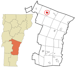
Location in Windsor County and the state of Vermont.
|
|
| Country | United States |
| State | Vermont |
| County | Windsor |
| Area | |
| • Total | 1.6 sq mi (4.2 km2) |
| • Land | 1.6 sq mi (4.1 km2) |
| • Water | 0.04 sq mi (0.1 km2) |
| Elevation | 573 ft (175 m) |
| Population
(2010)
|
|
| • Total | 569 |
| • Density | 351/sq mi (135.5/km2) |
| Time zone | UTC-5 (Eastern (EST)) |
| • Summer (DST) | UTC-4 (EDT) |
| ZIP code |
05032
|
| Area code(s) | 802 |
| FIPS code | 50-05725 |
| GNIS feature ID | 1456042 |
Bethel is a small community in Windsor County, Vermont, United States. It's known as a census-designated place (CDP), which means it's a specific area identified by the U.S. Census Bureau for statistical purposes. Think of it as the main village area within the larger town of Bethel.
In 2010, about 569 people lived in the Bethel CDP. The entire town of Bethel, which includes the CDP and surrounding areas, had a population of 2,030 people at that time.
Exploring Bethel's Location
Bethel is nestled in a beautiful part of Vermont, right where two rivers meet.
River Junction
The village of Bethel is located along the Third Branch of the White River. This is where the Third Branch flows into the larger White River. Rivers are important for towns because they often provide water, transportation routes, and fertile land.
Roads and Travel
Two main roads, Vermont Route 12 and Vermont Route 107, meet and then separate in Bethel.
- Route 12 heads north from Bethel. It follows the Third Branch valley towards the town of Randolph.
- Route 107 goes southwest from Bethel. It travels up the White River Valley towards Stockbridge.
After diverging, these two routes then join up again and travel east together. They follow the White River valley into the nearby town of Royalton. These roads help connect Bethel to other communities in Vermont.
See also
 In Spanish: Bethel (condado de Windsor) para niños
 | Kyle Baker |
 | Joseph Yoakum |
 | Laura Wheeler Waring |
 | Henry Ossawa Tanner |

