Black Cap Mountain facts for kids
Quick facts for kids Black Cap Mountain |
|
|---|---|
| Highest point | |
| Elevation | 1,020 ft (310 m) |
| Prominence | 570 ft (170 m) |
| Geography | |
| Location | Penobscot County, Maine, U.S. |
| Climbing | |
| Easiest route | Hiking, class 1 |

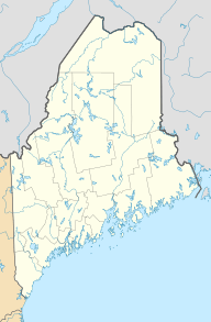
Black Cap Mountain is a mountain in Penobscot County, Maine, USA. It's about 1,020 feet (311 meters) tall. The mountain is located about 5 miles (8 km) southeast of Eddington, Maine, and the Penobscot River. You can reach it from Maine Route 46.
The mountain gets its name from its top, which looks like a "black cap." This is because its granite peak is mostly bare rock with only a few small trees. From the top, you can see amazing views of western Maine, including the Western Maine Mountains and part of the White Mountain National Forest.
About Black Cap Mountain
Black Cap Mountain is part of a range of hills. This range is about 1.5 miles (2.4 km) long and about 0.5 miles (0.8 km) wide. At the bottom of the mountain, you'll find Boy Scout Camp Roosevelt and Fitts Pond.
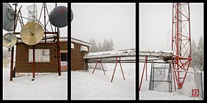
The very top of Black Cap Mountain is home to several antennas. These antennas are used for sending out microwave, radio, and television signals. For example, WMEH, a station for Maine Public Radio, has an antenna there.
The mountain stands out in the area. You can easily see it from Bangor and even from Penobscot Bay and the sea.
Nature and History
The area around Black Cap Mountain has seen some big changes over time. In 1938, a large hurricane hit New England. This storm knocked down many trees in the forest around the mountain. After the hurricane, a new spruce forest was planted in its place.
You can also find beech trees and blueberry bushes on the mountain. The blueberry bushes started growing after several forest fires happened in the 1800s. These fires cleared out the older forests, making space for the blueberries to grow.
Most of Black Cap Mountain is owned by the Katahdin Area Council. They own about two-thirds of the mountain, which is part of their 1,800-acre Camp Roosevelt. The rest of the land belongs to private owners. An energy company named Emera owns one acre at the very top for a radio tower.
Hiking and Fun
Black Cap Mountain is a popular spot for hiking. There is a well-known hiking trail that starts right next to the parking lot for Camp Roosevelt. It's a great place to explore nature and enjoy the outdoors.
 | Janet Taylor Pickett |
 | Synthia Saint James |
 | Howardena Pindell |
 | Faith Ringgold |


