
Black Forest, South Australia facts for kids
Quick facts for kids Black ForestAdelaide, South Australia |
|||||||||||||||
|---|---|---|---|---|---|---|---|---|---|---|---|---|---|---|---|

Forest Avenue Reserve
|
|||||||||||||||
| Established | 1850 | ||||||||||||||
| Postcode(s) | 5035 | ||||||||||||||
| Area | 1.63 km2 (0.6 sq mi) | ||||||||||||||
| Location | 4.7 km (3 mi) SW of Adelaide city centre | ||||||||||||||
| LGA(s) | City of Unley | ||||||||||||||
| State electorate(s) | Badcoe | ||||||||||||||
| Federal Division(s) | Boothby | ||||||||||||||
|
|||||||||||||||


Black Forest is a suburb located in the southern part of Adelaide, South Australia. It's part of the City of Unley. The suburb is bordered by the Glenelg tram line to the north-west and the Seaford railway line to the south-east. South Road is on its western side, and East Avenue is on its eastern side.
Contents
Discovering Black Forest's Past
The area around Black Forest was once covered by a thick woodland. This forest was known as the "Black Forest" by early settlers. The local Aboriginal people, the Kaurna, called it Kertaweeta.
This ancient forest had many types of trees. These included grey-box, blue gum, and red gum trees. There were also native pines and sheoak trees. The ground was covered with grass trees, native grasses, and beautiful orchids. These plants helped keep the soil healthy and strong.
In the early days of European settlement, the Black Forest was a wild place. It was sometimes visited by people who stole cattle.
The area has had three Post Offices named Black Forest over time. The first opened in 1899 and was later renamed Glandore. The second opened in 1947 and became Clarence Park West. The current Post Office opened in 1996 on South Road.
Who Lives in Black Forest?
In 2006, the Australian Bureau of Statistics counted 1,846 people living in Black Forest. About 47% were male and 53% were female.
Most residents (79%) were born in Australia. Other people living here came from countries like England and Greece.
Exploring Local Spots and Activities
Black Forest has several places for learning and fun.
Schools in the Area
Black Forest Primary School first opened its doors in 1919. You can find it off South Road and School Avenue. The school grounds are next to the Forest Avenue Reserve.
Parks and Playgrounds
The Forest Avenue Reserve is a lovely park in the middle of the suburb. It's a great place to relax outdoors. There's also a smaller park called the Princess Margaret Playground. This playground is located at the eastern end of Byron Road.
Community Hubs
The Uniting Church History Centre is based in an old church building on East Avenue. It helps preserve the history of the Uniting Church.
The Clarence Park Community Centre is a busy place for local residents. It has a childcare facility for younger kids. There's also a "men's shed" where people can work on projects and connect.
Getting Around Black Forest
It's easy to travel in and out of Black Forest.
Main Roads
The suburb is mainly served by South Road. East Avenue also helps people get around.
Public Transport Options
Black Forest has good public transport links. You can catch a tram from three different stops. There are also two train stations nearby. Buses run along East Avenue and South Road. All these services are managed by Adelaide Metro.
| Preceding station | Adelaide Metro | Following station | ||
|---|---|---|---|---|
| Forestville
towards Adelaide Entertainment Centre
|
Glenelg tram line | South Road
towards Moseley Square, Glenelg
|
||
Images for kids
-
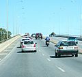
South Road overpass over Cross Road,
looking south -
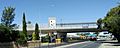
South Road overpass over Cross Road,
looking west -
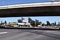
South Road Tram Overpass
-
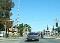
South Road Tram level crossing - prior to the overpass
-
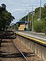
Clarence Park railway station
-
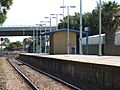
Emerson railway station


