Blue Creek (Gunnison River tributary) facts for kids
Quick facts for kids Blue Creek |
|
|---|---|

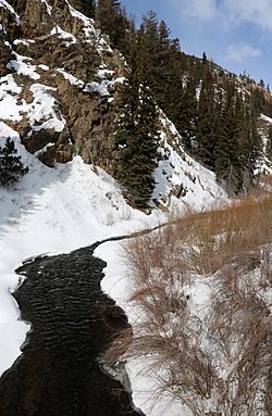
The headwaters of Blue Creek in Blue Creek Canyon along U.S. Highway 50 in Gunnison County, Colorado
|
|
|
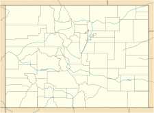
The creek's location in Colorado
|
|
| Physical characteristics | |
| Main source | Blue Creek Canyon 38°02′31″N 107°24′16″W / 38.04194°N 107.40444°W |
| River mouth | Morrow Point Reservoir (Gunnison River) 7,949 feet (2,423 meters) 38°27′02″N 107°27′16″W / 38.45056°N 107.45444°W |
| Length | 3.5 miles (5.6 kilometers) long. |
| Basin features | |
| Progression | Gunnison River—Colorado River |
Blue Creek is a beautiful stream located in Gunnison County, Colorado. It's a smaller river that flows into the larger Gunnison River. This creek begins where two smaller streams, Little Blue Creek and Big Blue Creek, join together. This meeting point is near U.S. Highway 50 and Alpine Plateau Road, right inside Blue Creek Canyon.
Where Does Blue Creek Flow?
Blue Creek starts when Little Blue Creek and Big Blue Creek meet. After forming, the creek flows under a bridge on Highway 50. It then travels north, staying close to the west side of the highway for a while. Eventually, it turns away from the highway and continues its journey north. Blue Creek is about 3.5 miles (5.6 kilometers) long. It finally empties into the Morrow Point Reservoir, near a famous rock formation called the Curecanti Needle.
What's Special About Blue Creek?
Blue Creek is very important to the Morrow Point Reservoir. It's one of the two main streams that feed water into this reservoir. The other important stream is Curecanti Creek. The end of Blue Creek, where it flows into the reservoir, is part of the Curecanti National Recreation Area. This area is a great place for outdoor activities.
If you enjoy fishing, the part of Blue Creek inside the recreation area is known for good fly fishing. This means you can catch fish there, but you can only get to this part of the creek by boat. It's a fun spot for anglers looking for a peaceful fishing experience.
 | Bayard Rustin |
 | Jeannette Carter |
 | Jeremiah A. Brown |


