Blue Hawk Mine facts for kids

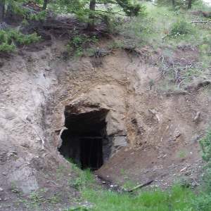
Entrance to Blue Hawk Mine
|
|
| Location | |
|---|---|
| Location | Kelowna |
| Province | BC/BCE |
| Country | |
| Coordinates | 49°59′2″N 119°30′59″W / 49.98389°N 119.51639°W |
| Production | |
| Products | Gold |
| History | |
| Opened | 1934 |
| Closed | 1934 |
The Blue Hawk Mine is a historic mine located on the east side of Blue Grouse Mountain, near Okanagan Lake. It's only a few kilometers from Downtown Kelowna in the Canadian province of British Columbia.
This mine has several adits, which are like tunnels that go into the side of a mountain. It was only worked for one year, in 1934, and has been mostly empty ever since. The government of British Columbia calls this mine "082ENW002". Records show that about 5 metric tonnes (that's 5,000 kilograms!) of ore were dug up. From this ore, miners found 560 grams of silver and 156 grams of gold. The tunnels inside the mine stretch for about 90 meters in total.
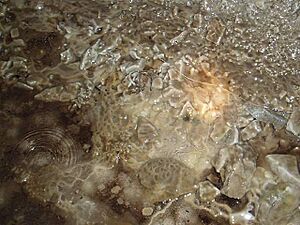
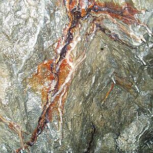
Many people who live in Kelowna know about the Blue Hawk Mine. There's a gravel road that leads right past it, and it's kept in good condition. Sometimes, the entrance to the mine has water pooled inside, but the tunnels themselves are usually dry. Inside, you can see many cool rock formations that haven't been disturbed.
The official location of the mine, according to the government, is 49°59′2″N 119°31′6″W / 49.98389°N 119.51833°W. However, some local people in Kelowna say the entrance is actually at 49°59′2″N 119°30′59″W / 49.98389°N 119.51639°W, which is about 965 meters high.
What is the history of the Blue Hawk Mine?
The Blue Hawk Mine has an interesting history, even though it was only active for a short time.
- 1930s: This is when the Blue Hawk Mine first started with some surface digging and pits.
- 1965 to 1980: A company called Dawood Mines Ltd. explored the area. They did things like digging trenches on the surface, cutting lines to mark areas, and taking soil samples. They also used a special tool called a magnetometer to study the ground. A report from this time also mentions that the main tunnel walls and roof were made safer, but we don't know the exact year this happened.
- 1980 to 1986: A person named Neall Curtis Lenard did some more searching, mapping, and sampling in the area.
- 1986 and later: Pinewood Resources did more drilling, digging, and soil sampling to look for gold. They also drilled 5 holes near the existing tunnel.
It's not completely clear who owns the property now. The most recent owner seems to have been Armac Investments Ltd. from Vancouver, BC. It's possible that Armac sold the rights to an area of 3 square kilometers (which includes the Blue Hawk Mine) to Southern Pacific Development Corp. in 2004 or 2005.
Can you see a map of the mine tunnels?
Yes, there is a detailed map of the area around the mine, including the main tunnel (adit). This map is found on page 13 of F. Marshall Smith's Assessment Report, which was written on December 18, 1994.
However, recent visits to the mine have shown that part of the ceiling inside the tunnel has fallen down. This means you can't go past that point anymore, especially in the tunnel section below "Trench 5". There's a special copy of the map that shows where this collapse happened, marked in red.
 | Shirley Ann Jackson |
 | Garett Morgan |
 | J. Ernest Wilkins Jr. |
 | Elijah McCoy |


