
Boa Vista facts for kids
Quick facts for kids
Boa Vista
|
|||
|---|---|---|---|
|
Municipality
|
|||
| The Municipality of Boa Vista | |||
 |
|||
|
|||
| Motto(s):
"Segurança, Desenvolvimento, Integração" ("Security, Development, Integration")
|
|||

Location of Boa Vista in the State of Roraima
|
|||

Boa Vista
Location in Brazil
|
|||
| Country | |||
| Region | North | ||
| State | |||
| Founded | July 9, 1890 | ||
| Area | |||
| • Total | 5,687.022 km2 (2,195.771 sq mi) | ||
| Elevation | 90 m (300 ft) | ||
| Population
(2018 est.)
|
|||
| • Total | 375,374 | ||
| • Density | 66.00537/km2 (170.95313/sq mi) | ||
| Time zone | UTC-4 | ||
| Postal Code |
69300-000
|
||
| Area code(s) | (+55) 95 | ||
| Climate | Aw | ||
| Website | Boa Vista, Roraima | ||


Boa Vista is the capital city of Roraima, a state in Brazil. It sits on the western side of the Branco River. The city is about 220 kilometers (137 miles) from Brazil's border with Venezuela. It's special because it's the only Brazilian state capital located entirely north of the Equator.
Boa Vista is the largest city in Roraima by population. About half of everyone living in the state lives here. The city mostly trades with Manaus, which is the capital of the State of Amazonas. Boa Vista also does business with Lethem in Guyana and Santa Elena de Uairén in Venezuela. These two foreign cities are the main ones you can reach by road from Boa Vista. To get to other parts of Brazil, people usually travel by airplane.
Boa Vista is a modern city. It stands out among other capitals in the North Region of Brazil. This is because it's a planned city. Its design is similar to Paris, France. An architect named Darci Aleixo Derenusson planned the city. Captain Ene Garcez, Roraima's first governor, oversaw its construction.
History of Boa Vista
The city of Boa Vista was the first major town in the state of Roraima. An old fort called São Joaquim do Rio Branco was built in 1775. It's located about 32 kilometers (20 miles) from the capital on the banks of the Uraricoera River. This fort was very important for the region's early history.
Boa Vista was officially created on July 9, 1890. It was first named Boa Vista do Rio Branco. Augusto Villeroy, who was the governor of Amazonas at the time, founded the city. The first mayor was João Capistrano da Silva Mota, also known as Coronel Mota. Two councillors, José Francisco Coelho and José Gonzaga de Souza Junior, were also appointed.
In 1943, during World War II, Boa Vista became the capital of a new area. This area was called the Federal Territory of Rio Branco. The territory grew because of mining activities. Later, the Federal Territory of Rio Branco became a state and was renamed "Roraima". After some time, large-scale machine mining was stopped. This was because it caused damage to the environment. This change affected the economy of the state and the city.
In the 2010s, many people from Venezuela moved to Boa Vista. This happened because of problems in their home country. The city's population grew by about 50,000 Venezuelan immigrants during this time.
Images for kids
-
Boa Vista, Brazil
-
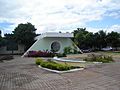
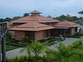
Federal University of Roraima.
-
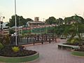
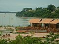
Orla Taumanan Park
-
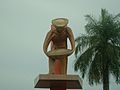
Praça dos Garimpeiros - Miners' monument.
-
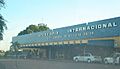
José Amador de Oliveira International Bus Station.
-
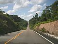
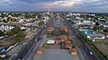
BR-174, a road connecting Boa Vista to Manaus and Venezuela.
-
Taumanam, Boa Vista, Brazil
-
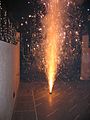
Fireworks in Boa Vista's Saint John Festival.
-
Velia Coutinho in Boa Vista, Roraima
-
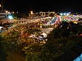
Festa Junina of Boa Vista, Brazil


